How to get to Jsventes by bus?
Click on the bus route to see step by step directions with maps, line arrival times and updated time schedules.
From Bois D'Arcy, Versailles
169 minFrom Osny, Osny
202 minFrom Hôpital de Poissy, Poissy
211 minFrom IKEA, Plaisir
335 minFrom Centre Commercial Grand Plaisir, Plaisir
332 minFrom Orgeval, Orgeval
104 minFrom Fête des Loges, Saint-Germain-En-Laye
104 minFrom Les Pyramides Le Port Marly, Le Port-Marly
157 minFrom Camp militaire de Frileuse, Beynes
324 minFrom Chambourcy, Chambourcy
225 min
Bus stops near Jsventes in Longnes
Bus lines to Jsventes in Longnes
What are the closest stations to Jsventes?
The closest stations to Jsventes are:
- Versailles is 389 meters away, 6 min walk.
- Mairie is 595 meters away, 8 min walk.
- Eglise is 681 meters away, 9 min walk.
Which bus lines stop near Jsventes?
These bus lines stop near Jsventes: 5438, 5489, 5491.
What’s the nearest bus station to Jsventes in Longnes?
The nearest bus station to Jsventes in Longnes is Versailles. It’s a 6 min walk away.
What time is the first bus to Jsventes in Longnes?
The 5438 is the first bus that goes to Jsventes in Longnes. It stops nearby at 4:16 AM.
What time is the last bus to Jsventes in Longnes?
The 5438 is the last bus that goes to Jsventes in Longnes. It stops nearby at 11:16 PM.
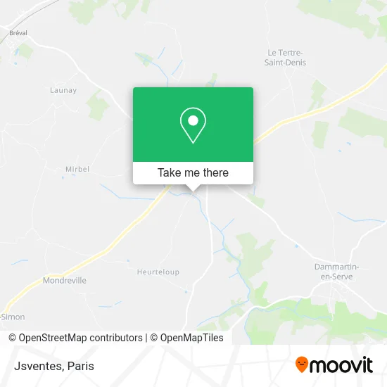
See Jsventes, Longnes, on the map
Public Transit to Jsventes in Longnes
Wondering how to get to Jsventes in Longnes? Moovit helps you find the best way to get to Jsventes with step-by-step directions from the nearest public transit station.
Moovit provides free maps and live directions to help you navigate through your city. View schedules, routes, timetables, and find out how long does it take to get to Jsventes in real time.
Looking for the nearest stop or station to Jsventes? Check out this list of stops closest to your destination: Versailles; Mairie; Eglise.
Bus: 5438, 5489, 5491, 7825, 5490.
Want to see if there’s another route that gets you there at an earlier time? Moovit helps you find alternative routes or times. Get directions from and directions to Jsventes easily from the Moovit App or Website.
We make riding to Jsventes easy, which is why over 1.5 million users, including users in Longnes, trust Moovit as the best app for public transit. You don’t need to download an individual bus app or train app, Moovit is your all-in-one transit app that helps you find the best bus time or train time available.
For information on prices of bus, train and RER, costs and ride fares to Jsventes, please check the Moovit app.
Use the app to navigate to popular places including to the airport, hospital, stadium, grocery store, mall, coffee shop, school, college, and university.
Jsventes Address: 22 Rue du Heurteloup 78980 Longnes street in Longnes
- 28 Rue de Houdan,
- Amv Fermetures,
- 78980,
- Pizza Land Longnes,
- La Pirogue,
- Le Pigeonnier,
- Erine - Esthéticienne à Domicile - Wecasa Beauté,
- Jardin d'Hiver Crêperie,
- Huang Julien,
- Geoffroy Lukasz,
- Merdrignac Joel,
- Lmc,
- Thom'Elec78,
- Paysagiste Harmand,
- Soprano,
- FRINGARD JEAN LOU,
- Totalenergies,
- Rue de Bréval,
- Rue de Mantes,
- Entreprise Clerice
Places Near Jsventes (Longnes)
- Hopital Foch, Suresnes,
- Hôpital Beaujon, Clichy,
- Hôpital Pitié Salpêtrière, Paris,
- Créteil Soleil, Creteil,
- Hôpital Saint-Joseph, Paris,
- Hôpital Henri Mondor, Creteil,
- Atelier Des Lumieres, Paris,
- Hôpital Cochin, Paris,
- Théâtre Mogador, Paris,
- Galeries Lafayette Haussmann, Paris,
- 29 Rue Manin, Paris,
- Gare Routière Flixbus, Paris,
- Hôpital de la Pitié-Salpêtrière, Paris,
- Galeries Lafayette, Paris,
- Marché Saint-Pierre, Paris,
- Fondation Louis Vuitton, Paris,
- Hopital Lariboisière, Paris,
- Centre Hospitalier des 15/20, Paris,
- Hôpital Necker, Paris,
- Institut Curie, Paris
How to get to popular places in Paris with public transit
Get around Longnes by public transit!
Traveling around Longnes has never been so easy. See step by step directions as you travel to any attraction, street or major public transit station. View bus and train schedules, arrival times, service alerts and detailed routes on a map, so you know exactly how to get to anywhere in Longnes.
When traveling to any destination around Longnes use Moovit's Live Directions with Get Off Notifications to know exactly where and how far to walk, how long to wait for your line, and how many stops are left. Moovit will alert you when it's time to get off — no need to constantly re-check whether yours is the next stop.
Wondering how to use public transit in Longnes or how to pay for public transit in Longnes? Moovit public transit app can help you navigate your way with public transit easily, and at minimum cost. It includes public transit fees, ticket prices, and costs. Looking for a map of Longnes public transit lines? Moovit public transit app shows all public transit maps in Longnes with all Bus, Train, Metro, Light Rail, RER, Funicular and Gondola routes and stops on an interactive map.
Paris has 7 transit type(s), including: Bus, Train, Metro, Light Rail, RER, Funicular and Gondola, operated by several transit agencies, including RATP, RER, RER Bus de remplacement, Train, Train Bus de remplacement, Tramway Bus de remplacement, TER, ADP, Magical Shuttle, Argenteuil - Boucles de Seine, Autocars Dominique, Bièvre, Brie et 2 Morin, Le Bus - C.C. du Clermontois and Cœur d’Essonne