How to get to Jtool by bus?
Click on the bus route to see step by step directions with maps, line arrival times and updated time schedules.
Bus stops near Jtool in Brandon
Bus lines to Jtool in Brandon
What are the closest stations to Jtool?
The closest stations to Jtool are:
- Victoria Avenue @ 26th Street is 508 meters away, 7 min walk.
- Princess Avenue @ 20th Street is 553 meters away, 8 min walk.
Which bus line stops near Jtool?
22 (Downtown Terminal (Return)→Downtown Terminal (Return))
What’s the nearest bus station to Jtool in Brandon?
The nearest bus station to Jtool in Brandon is Victoria Avenue @ 26th Street. It’s a 7 min walk away.
What time is the first bus to Jtool in Brandon?
The 8 is the first bus that goes to Jtool in Brandon. It stops nearby at 9:03 AM.
What time is the last bus to Jtool in Brandon?
The 14 is the last bus that goes to Jtool in Brandon. It stops nearby at 6:46 PM.
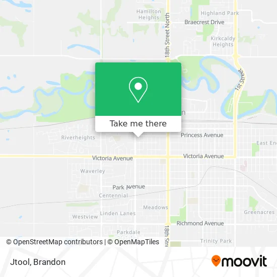
See Jtool, Brandon, on the map
Public Transit to Jtool in Brandon
Wondering how to get to Jtool in Brandon? Moovit helps you find the best way to get to Jtool with step-by-step directions from the nearest public transit station.
Moovit provides free maps and live directions to help you navigate through your city. View schedules, routes, timetables, and find out how long does it take to get to Jtool in real time.
Looking for the nearest stop or station to Jtool? Check out this list of stops closest to your destination: Victoria Avenue @ 26th Street; Princess Avenue @ 20th Street.
Bus: 22, 14, 1001, 1004, 8.
Want to see if there’s another route that gets you there at an earlier time? Moovit helps you find alternative routes or times. Get directions from and directions to Jtool easily from the Moovit App or Website.
We make riding to Jtool easy, which is why over 1.5 million users, including users in Brandon, trust Moovit as the best app for public transit. You don’t need to download an individual bus app or train app, Moovit is your all-in-one transit app that helps you find the best bus time or train time available.
For information on prices of bus, costs and ride fares to Jtool, please check the Moovit app.
Use the app to navigate to popular places including to the airport, hospital, stadium, grocery store, mall, coffee shop, school, college, and university.
Jtool Address: 228 25th St Brandon, MB R7B street in Brandon
- Pristine Clean,
- Foreign Empire,
- Westman Mobile Hotwash,
- Shop on the Corner,
- Coronation Park,
- Howpark Farms,
- Ward's Tattoo Shop,
- Dakota Tiwahe Services,
- Financement Agricole Canada Fac,
- Optimal Care Chiropractic Centre,
- Andrews Agencies LTD,
- Golden Touch Massage Therapy,
- Brandon Nails Salon,
- Hairtakers,
- Mitchell Electric,
- Nature's Own Therapeutic Massage Clinic,
- Diamond Water Express,
- Shawarmaqueenbrandon,
- The Town Centre,
- Kelswiz
Places Near Jtool (Brandon)
- Keystone Centre, Brandon,
- Labatt's Manitoba Brewery LTD, Brandon,
- Neelin High School, Brandon,
- Real Canadian Superstore, Brandon,
- CFB Shilo,
- Maple Leaf Foods, Brandon,
- Evans Theatre, Brandon,
- Giant Tiger, Brandon,
- Keystone Centre Ampitheatre, Brandon,
- Betty Gibson School, Brandon,
- Shoppers Mall, Brandon,
- Assiniboine Community College, Brandon,
- Helix Hearing Inc Dba, Brandon,
- Sturgeon Tire, Brandon,
- Amazon Counter-Living Delight (Pudo), Brandon,
- Crocus Plains Regional Secondary School, Brandon,
- Microtech Service Systems, Brandon,
- ACC North Hill Campus, Brandon,
- Vincent Massey High School, Brandon,
- Co-op, Brandon
How to get to popular places in Brandon with public transit
Get around Brandon by public transit!
Traveling around Brandon has never been so easy. See step by step directions as you travel to any attraction, street or major public transit station. View bus and train schedules, arrival times, service alerts and detailed routes on a map, so you know exactly how to get to anywhere in Brandon.
When traveling to any destination around Brandon use Moovit's Live Directions with Get Off Notifications to know exactly where and how far to walk, how long to wait for your line, and how many stops are left. Moovit will alert you when it's time to get off — no need to constantly re-check whether yours is the next stop.
Wondering how to use public transit in Brandon or how to pay for public transit in Brandon? Moovit public transit app can help you navigate your way with public transit easily, and at minimum cost. It includes public transit fees, ticket prices, and costs. Looking for a map of Brandon public transit lines? Moovit public transit app shows all public transit maps in Brandon with all bus routes and stops on an interactive map.
Brandon has 1 transit type(s), including: bus, operated by several transit agencies, including Brandon Transit