How to get to Juan Carlos Chacaltana by bus?
Click on the bus route to see step by step directions with maps, line arrival times and updated time schedules.
From Plaza de Armas Arequipa, Miraflores
49 minFrom Avenida Guillermo Prescott, San Isidro
45 minFrom Santa Clara, Ate
30 minFrom EsSalud Policlínico Chincha, Lima
35 minFrom Ministerio de Transportes y Comunicaciones - MTC, Lima
48 minFrom Malecón Miraflores, Miraflores
49 minFrom Universidad Peruana Cayetano Heredia - Campo Central, San Martin
41 minFrom METRO PERSHING, Jesus maria, Jesus Mari
50 minFrom ALT CUADRA 9 DE AV BRASIL, Jesus Mari
36 minFrom AVENIDA CANTA CALLAO CON AV BERTELLO, Lima
38 min
Bus stops near Juan Carlos Chacaltana in Santa Anit
Metro station near Juan Carlos Chacaltana in Santa Anit
- Estación Evitamiento, 23 min walk,VIEW
Bus lines to Juan Carlos Chacaltana in Santa Anit
- 1043, La Molina - S.J.L.,VIEW
- 1177, Torre Blanca (Carabayllo) - Metropolitana (Ate),VIEW
- 1272, Minka (Callao) - Santa Marta (Santa Anita),VIEW
- 1279, Ceres,VIEW
- 1343, Pachacamac - S.J.L.,VIEW
- 1344, Pachacamac - S.J.L.,VIEW
- 1345, Manchay (Pachacamac) - Portón (San Juan De Lurigancho),VIEW
- 1355, Los Eucaliptos (Santa Anita( - La Planicie (La Molina),VIEW
- 1356, Chaclacayo - La Molina,VIEW
- 1359, Ate - Santa Anita,VIEW
- 1360, Av. Huarochirí (Cieneguilla) - Santa Clara (Ate),VIEW
- 1395, Santa Clara (Ate) - Manchay (Pachacamac),VIEW
- 4206, Santa Anita - Lince,VIEW
- ICR14, Lince - Santa Anita,VIEW
- IM04, Ceres Medio (Ate) - Óvalo Santa Anita (Santa Anita) ,VIEW
- 4205, Surge (Ate) - San Marcos (Lima),VIEW
- 1205, San Miguel - El Agustino,VIEW
- 1227, Tagore (Ate) - Tiwinza (Callao),VIEW
- 1194, Los Virreyes (Ate) - Chuquitanta (San Martin De Porres),VIEW
- 1221, Ramiro Priale (Ate) - Mexico (Lince) ,VIEW
What are the closest stations to Juan Carlos Chacaltana?
The closest stations to Juan Carlos Chacaltana are:
- Torcazas & Ruiseñores is 18 meters away, 1 min walk.
- Los Ruiseñores, 682 is 84 meters away, 2 min walk.
- De La Torre Ugarte is 361 meters away, 5 min walk.
- Moore is 503 meters away, 7 min walk.
- Justo Arias is 520 meters away, 7 min walk.
- Estación Evitamiento is 1718 meters away, 23 min walk.
Which bus lines stop near Juan Carlos Chacaltana?
These bus lines stop near Juan Carlos Chacaltana: 1043, 1177, 1279, 1355, 1359.
What’s the nearest metro station to Juan Carlos Chacaltana in Santa Anit?
The nearest metro station to Juan Carlos Chacaltana in Santa Anit is Estación Evitamiento. It’s a 23 min walk away.
What’s the nearest bus station to Juan Carlos Chacaltana in Santa Anit?
The nearest bus station to Juan Carlos Chacaltana in Santa Anit is Torcazas & Ruiseñores. It’s a 1 min walk away.
What time is the first metro to Juan Carlos Chacaltana in Santa Anit?
The LINEA 2 is the first metro that goes to Juan Carlos Chacaltana in Santa Anit. It stops nearby at 6:00 AM.
What time is the last metro to Juan Carlos Chacaltana in Santa Anit?
The LINEA 2 is the last metro that goes to Juan Carlos Chacaltana in Santa Anit. It stops nearby at 11:02 PM.
What time is the first bus to Juan Carlos Chacaltana in Santa Anit?
The 1177 is the first bus that goes to Juan Carlos Chacaltana in Santa Anit. It stops nearby at 4:10 AM.
What time is the last bus to Juan Carlos Chacaltana in Santa Anit?
The 1272 is the last bus that goes to Juan Carlos Chacaltana in Santa Anit. It stops nearby at 1:07 AM.
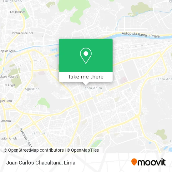
See Juan Carlos Chacaltana, Santa Anit, on the map
Public Transit to Juan Carlos Chacaltana in Santa Anit
Wondering how to get to Juan Carlos Chacaltana in Santa Anit? Moovit helps you find the best way to get to Juan Carlos Chacaltana with step-by-step directions from the nearest public transit station.
Moovit provides free maps and live directions to help you navigate through your city. View schedules, routes, timetables, and find out how long does it take to get to Juan Carlos Chacaltana in real time.
Looking for the nearest stop or station to Juan Carlos Chacaltana? Check out this list of stops closest to your destination: Torcazas & Ruiseñores; Los Ruiseñores; De La Torre Ugarte; Moore; Justo Arias; Estación Evitamiento.
Bus: 1043, 1177, 1279, 1355, 1359, 1272, 1343, 4205, 1205, 1227, 1194, 1221, 1341, 1476.Metro: LINEA 2.
Want to see if there’s another route that gets you there at an earlier time? Moovit helps you find alternative routes or times. Get directions from and directions to Juan Carlos Chacaltana easily from the Moovit App or Website.
We make riding to Juan Carlos Chacaltana easy, which is why over 1.5 million users, including users in Santa Anit, trust Moovit as the best app for public transit. You don’t need to download an individual bus app or train app, Moovit is your all-in-one transit app that helps you find the best bus time or train time available.
For information on prices of bus, costs and ride fares to Juan Carlos Chacaltana, please check the Moovit app.
Use the app to navigate to popular places including to the airport, hospital, stadium, grocery store, mall, coffee shop, school, college, and university.
Juan Carlos Chacaltana Address: Calle Las Torcazas 187 Santa Anita Segundo Sector, 15008 Santa Anita street in Santa Anit
- Laboratorio Otarvasq,
- El Chino,
- Herboristeria Nueva Vida,
- Calle Las Torcazas,
- Imprimec - Alquiler de Gruas, camión de Gruas.,
- Polideportivo Municipal Santa Anita,
- Sopranos Santa Anita,
- El Puerquito-Chicharroneria-Santa Anita,
- Car Wash Rapidos y Brillosos,
- Pq. de la Virgen del Carmen,
- Polideportivo Santa Anita,
- Gastroenterólogo-Hector Ricardo Shibao Miyasato,
- Parque Virgen de Fatima,
- Jilgueros 391,
- Gastroinox Steel - Acero Inoxidable,
- Polideportivo Ruiseñores Santa Anita,
- Institución Educativa Inicial 056 Virgen De Fatima,
- CALLE LOS PAUJILES 108,
- JR LOS TUCANES SANTA ANITA,
- Jr. Antunez de Mayolo
Places Near Juan Carlos Chacaltana (Santa Anit)
- Av. La Marina, San Miguel,
- Real Plaza Puruchuco, Ate,
- Paradero Av.Brasil,
- Pontificia Universidad Católica del Perú - PUCP, San Miguel,
- av arequipa, Lima,
- Parque Kennedy, Miraflores,
- Centro Comercial Plaza Norte, Independen,
- Circuito Mágico Del Agua, Lima,
- Mall Del Sur,
- Larcomar, Miraflores,
- Jockey Plaza, Santiago D,
- Av. Abancay, Lima,
- Hospital Edgardo Rebagliati Martins, Jesus Mari,
- Barranco, Barranco,
- Gamarra,
- Plaza San Miguel, San Miguel,
- Av. Salaverry, Jesus Mari,
- Aeropuerto Internacional Jorge Chávez, Ventanilla,
- Parque de las Leyendas, San Miguel,
- Miraflores, Miraflores
How to get to popular places in Lima with public transit
Get around Santa Anit by public transit!
Traveling around Santa Anit has never been so easy. See step by step directions as you travel to any attraction, street or major public transit station. View bus and train schedules, arrival times, service alerts and detailed routes on a map, so you know exactly how to get to anywhere in Santa Anit.
When traveling to any destination around Santa Anit use Moovit's Live Directions with Get Off Notifications to know exactly where and how far to walk, how long to wait for your line, and how many stops are left. Moovit will alert you when it's time to get off — no need to constantly re-check whether yours is the next stop.
Wondering how to use public transit in Santa Anit or how to pay for public transit in Santa Anit? Moovit public transit app can help you navigate your way with public transit easily, and at minimum cost. It includes public transit fees, ticket prices, and costs. Looking for a map of Santa Anit public transit lines? Moovit public transit app shows all public transit maps in Santa Anit with all Bus, Metro and Ferry routes and stops on an interactive map.
Lima has 3 transit type(s), including: Bus, Metro and Ferry, operated by several transit agencies, including Metro de Lima Línea 2 , Metro de Lima, Corredor Rojo, Metropolitano, Metropolitano - Alimentadores, Corredor Morado, Corredor Azul, Rutas Tradicionales, Transportes y Servicios La Esperanza S.A., Las Flores S.A., Virgen de la Asunción S.A., Consorcio HAM, Transportes y Service Canadá S.A., ETUL4SA and ETUCHISA