How to get to Just Food For Dogs by bus?
Click on the bus route to see step by step directions with maps, line arrival times and updated time schedules.
From Nutley, NJ, Nutley
99 minFrom Paterson, NJ, Paterson
89 minFrom Mountainside Hospital, Glen Ridge
55 minFrom Bloomfield, NJ, Bloomfield
64 minFrom Clifton, NJ, Clifton
76 minFrom Wayne, NJ, Wayne
58 minFrom Lakeland Bus Stop, Parsippany-Troy Hills
34 minFrom BAPS Shri Swaminarayan Mandir, Clifton
95 minFrom Community Coach Bus 77, West Orange
87 minFrom West Orange, NJ, West Orange
54 min
Bus stop near Just Food For Dogs in Fairfield
- New Dutch Lane at Elderidge Rd, 9 min walk,VIEW
Train station near Just Food For Dogs in Fairfield
- Mountain View, 21 min walk,VIEW
Bus lines to Just Food For Dogs in Fairfield
- 71, Fairfield Loop Via Henderson,VIEW
What are the closest stations to Just Food For Dogs?
The closest stations to Just Food For Dogs are:
- New Dutch Lane at Elderidge Rd is 689 yards away, 9 min walk.
- Mountain View is 1774 yards away, 21 min walk.
Which bus lines stop near Just Food For Dogs?
These bus lines stop near Just Food For Dogs: 197, 198, 705, 71, 748.
What’s the nearest train station to Just Food For Dogs in Fairfield?
The nearest train station to Just Food For Dogs in Fairfield is Mountain View. It’s a 21 min walk away.
What’s the nearest bus station to Just Food For Dogs in Fairfield?
The nearest bus station to Just Food For Dogs in Fairfield is New Dutch Lane at Elderidge Rd. It’s a 9 min walk away.
What time is the first train to Just Food For Dogs in Fairfield?
The ML is the first train that goes to Just Food For Dogs in Fairfield. It stops nearby at 6:06 AM.
What time is the last train to Just Food For Dogs in Fairfield?
The ML is the last train that goes to Just Food For Dogs in Fairfield. It stops nearby at 11:05 PM.
What time is the first bus to Just Food For Dogs in Fairfield?
The 71 is the first bus that goes to Just Food For Dogs in Fairfield. It stops nearby at 6:31 AM.
What time is the last bus to Just Food For Dogs in Fairfield?
The 71 is the last bus that goes to Just Food For Dogs in Fairfield. It stops nearby at 5:35 PM.
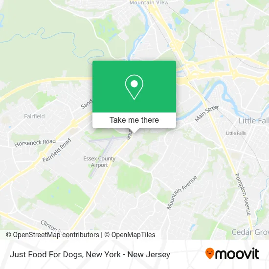
See Just Food For Dogs, Fairfield, on the map
Public Transit to Just Food For Dogs in Fairfield
Wondering how to get to Just Food For Dogs in Fairfield? Moovit helps you find the best way to get to Just Food For Dogs with step-by-step directions from the nearest public transit station.
Moovit provides free maps and live directions to help you navigate through your city. View schedules, routes, timetables, and find out how long does it take to get to Just Food For Dogs in real time.
Looking for the nearest stop or station to Just Food For Dogs? Check out this list of stops closest to your destination: New Dutch Lane at Elderidge Rd; Mountain View.
Bus: 197, 198, 705, 71, 748.Train: ML.
Want to see if there’s another route that gets you there at an earlier time? Moovit helps you find alternative routes or times. Get directions from and directions to Just Food For Dogs easily from the Moovit App or Website.
We make riding to Just Food For Dogs easy, which is why over 1.5 million users, including users in Fairfield, trust Moovit as the best app for public transit. You don’t need to download an individual bus app or train app, Moovit is your all-in-one transit app that helps you find the best bus time or train time available.
For information on prices of bus, costs and ride fares to Just Food For Dogs, please check the Moovit app.
Use the app to navigate to popular places including to the airport, hospital, stadium, grocery store, mall, coffee shop, school, college, and university.
Just Food For Dogs Address: 7 Sherwood Lane, All Creatures Great and Small Animal Hospital street in Fairfield
- Sneeze It,
- Agencysmart,
- Acrisure Fairfield, NJ (Stratford Financial Group),
- Stratus Building Solutions Of Northern New Jersey,
- Fabre Tech,
- Essential Procurement Services,
- Zeiser Inc.,
- The View at Fairfield,
- Dmw&H,
- K Dojo,
- Blink,
- New York Skyline,
- Independence Home Mortgage Corporation,
- Sommer Law Firm,
- Ryder Relocations,
- Bean Kings Corp,
- Four3 Rehab & Performance - Fairfield,
- International Tool & Manufacturing Inc.,
- Nptc,
- Puffcity Marketplace Distributors
Places Near Just Food For Dogs (Fairfield)
- Katz's Deli, Manhattan,
- 911 Memorial, Manhattan,
- San Gennaro Feast, Manhattan,
- Hudson Yards, Manhattan,
- Bellevue Hospital, Manhattan,
- Queens Center Mall, Queens,
- Rockefeller Center, Manhattan,
- Times Square, Manhattan,
- 111 Centre New York City Supreme Court, Manhattan,
- 376 Hudson Street, Manhattan,
- 3 Stone St, Manhattan,
- Wall Street, Manhattan,
- 1 Police Plaza, Manhattan,
- Pier 83, Manhattan,
- Mountainside Hospital, Glen Ridge,
- 26 Federal Plaza, Manhattan,
- Chinatown, Manhattan,
- qqqq, Manhattan,
- 66 John Street, Manhattan,
- SoHo, Manhattan
How to get to popular places in New York - New Jersey with public transit
Get around Fairfield by public transit!
Traveling around Fairfield has never been so easy. See step by step directions as you travel to any attraction, street or major public transit station. View bus and train schedules, arrival times, service alerts and detailed routes on a map, so you know exactly how to get to anywhere in Fairfield.
When traveling to any destination around Fairfield use Moovit's Live Directions with Get Off Notifications to know exactly where and how far to walk, how long to wait for your line, and how many stops are left. Moovit will alert you when it's time to get off — no need to constantly re-check whether yours is the next stop.
Wondering how to use public transit in Fairfield or how to pay for public transit in Fairfield? Moovit public transit app can help you navigate your way with public transit easily, and at minimum cost. It includes public transit fees, ticket prices, and costs. Looking for a map of Fairfield public transit lines? Moovit public transit app shows all public transit maps in Fairfield with all Bus, Train, Subway, Light Rail, Ferry and Cable Car routes and stops on an interactive map.
New York - New Jersey has 6 transit type(s), including: Bus, Train, Subway, Light Rail, Ferry and Cable Car, operated by several transit agencies, including MTA Subway, Metro-North Railroad, LIRR, PATH, MTA New York City Transit - Express routes, MTA Bus, NJ Transit, NYC Ferry, NICE bus, Bee-Line Bus, NJ Transit Rail, Norwalk Transit District, Hartford Line, River Valley Transit and HART