Directions to Just For Pets (Merrick) with public transportation
The following transit lines have routes that pass near Just For Pets
 Bus: N19, N19X.
- Train: BABYLON BRANCH.
How to get to Just For Pets by bus?
Click on the bus route to see step by step directions with maps, line arrival times and updated time schedules.
From Westbury, NY, Westbury
66 minFrom Mercy Hospital, Rockville Centre
84 minFrom East Meadow, NY, East Meadow
65 minFrom Valley Stream, NY, Valley Stream
67 minFrom Roosevelt Field Mall Bus Terminal, East Garden City
63 minFrom Plattduetsche Park, Franklin Square
77 minFrom Uniondale, NY, Uniondale
39 minFrom Garden City, NY, Garden City
51 minFrom Green Acres Mall, South Valley Stream
78 minFrom Walmart, Valley Stream
74 min
How to get to Just For Pets by train?
Click on the train route to see step by step directions with maps, line arrival times and updated time schedules.
From Westbury, NY, Westbury
69 minFrom Valley Stream, NY, Valley Stream
63 minFrom Roosevelt Field Mall Bus Terminal, East Garden City
86 minFrom Plattduetsche Park, Franklin Square
81 minFrom Garden City, NY, Garden City
74 minFrom Green Acres Mall, South Valley Stream
71 minFrom Walmart, Valley Stream
64 min
Bus stops near Just For Pets in Merrick
Train station near Just For Pets in Merrick
- Baldwin, 30 min walk,VIEW
What are the closest stations to Just For Pets?
The closest stations to Just For Pets are:
- Merrick Ave / Merrick is 37 yards away, 1 min walk.
- Hewlett Av / Sunrise is 1063 yards away, 13 min walk.
- Baldwin is 2543 yards away, 30 min walk.
Which bus line stops near Just For Pets?
N19 (Hicksville Rd)
Which train line stops near Just For Pets?
BABYLON BRANCH (Babylon)
What’s the nearest train station to Just For Pets in Merrick?
The nearest train station to Just For Pets in Merrick is Baldwin. It’s a 30 min walk away.
What’s the nearest bus station to Just For Pets in Merrick?
The nearest bus station to Just For Pets in Merrick is Merrick Ave / Merrick. It’s a 1 min walk away.
What time is the first train to Just For Pets in Merrick?
The BABYLON BRANCH is the first train that goes to Just For Pets in Merrick. It stops nearby at 3:26 AM.
What time is the last train to Just For Pets in Merrick?
The BABYLON BRANCH is the last train that goes to Just For Pets in Merrick. It stops nearby at 3:38 AM.
What time is the first bus to Just For Pets in Merrick?
The N19 is the first bus that goes to Just For Pets in Merrick. It stops nearby at 6:06 AM.
What time is the last bus to Just For Pets in Merrick?
The N19 is the last bus that goes to Just For Pets in Merrick. It stops nearby at 7:43 PM.
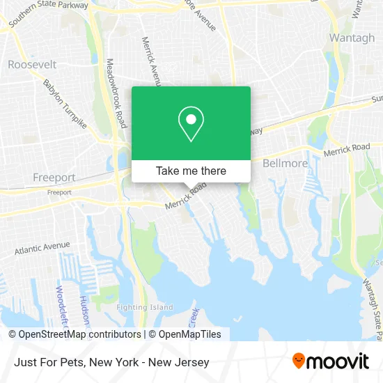
See Just For Pets, Merrick, on the map
Public Transit to Just For Pets in Merrick
Wondering how to get to Just For Pets in Merrick? Moovit helps you find the best way to get to Just For Pets with step-by-step directions from the nearest public transit station.
Moovit provides free maps and live directions to help you navigate through your city. View schedules, routes, timetables, and find out how long does it take to get to Just For Pets in real time.
Looking for the nearest stop or station to Just For Pets? Check out this list of stops closest to your destination: Merrick Ave / Merrick; Hewlett Av / Sunrise; Baldwin.
Bus: N19, N19X.Train: BABYLON BRANCH.
Want to see if there’s another route that gets you there at an earlier time? Moovit helps you find alternative routes or times. Get directions from and directions to Just For Pets easily from the Moovit App or Website.
We make riding to Just For Pets easy, which is why over 1.5 million users, including users in Merrick, trust Moovit as the best app for public transit. You don’t need to download an individual bus app or train app, Moovit is your all-in-one transit app that helps you find the best bus time or train time available.
For information on prices of bus and train, costs and ride fares to Just For Pets, please check the Moovit app.
Use the app to navigate to popular places including to the airport, hospital, stadium, grocery store, mall, coffee shop, school, college, and university.
Just For Pets Address: 2005 Merrick Rd Apt 126 street in Merrick
- Merrick, NY,
- Jovia Financial Credit Union,
- Chip City,
- The Lynne Experience- Model & Casting Agency,
- Tony & Luigi’S,
- Asurion Phone & Tech Repair (Formerly Ubreakifix),
- 6 Elements Sushi Asian Cuisine and Bar,
- Laura J. Lowenstein & Associates Llc,
- Jovia Financial Fcu,
- Jam Mix Productions,
- Merrick Bakery,
- T-Mobile,
- Cobs Bread,
- Orangetheory Fitness,
- Staged Long Island,
- Bank Of America Atm,
- Bank Of America Financial Center,
- Bank Of America Financial Center & Drive-Thru Atm | South Merrick,
- Tino Photography,
- Cards & Gifts
Places Near Just For Pets (Merrick)
- Chinatown, Manhattan,
- 3 Stone St, Manhattan,
- Katz's Deli, Manhattan,
- Hudson Yards, Manhattan,
- Bellevue Hospital, Manhattan,
- 26 Federal Plaza, Manhattan,
- 66 John Street, Manhattan,
- Mountainside Hospital, Glen Ridge,
- SoHo, Manhattan,
- Pier 83, Manhattan,
- Times Square, Manhattan,
- 911 Memorial, Manhattan,
- San Gennaro Feast, Manhattan,
- Queens Center Mall, Queens,
- 376 Hudson Street, Manhattan,
- 1 Police Plaza, Manhattan,
- 111 Centre New York City Supreme Court, Manhattan,
- Wall Street, Manhattan,
- Rockefeller Center, Manhattan,
- qqqq, Manhattan
How to get to popular places in New York - New Jersey with public transit
Get around Merrick by public transit!
Traveling around Merrick has never been so easy. See step by step directions as you travel to any attraction, street or major public transit station. View bus and train schedules, arrival times, service alerts and detailed routes on a map, so you know exactly how to get to anywhere in Merrick.
When traveling to any destination around Merrick use Moovit's Live Directions with Get Off Notifications to know exactly where and how far to walk, how long to wait for your line, and how many stops are left. Moovit will alert you when it's time to get off — no need to constantly re-check whether yours is the next stop.
Wondering how to use public transit in Merrick or how to pay for public transit in Merrick? Moovit public transit app can help you navigate your way with public transit easily, and at minimum cost. It includes public transit fees, ticket prices, and costs. Looking for a map of Merrick public transit lines? Moovit public transit app shows all public transit maps in Merrick with all Bus, Train, Subway, Light Rail, Ferry and Cable Car routes and stops on an interactive map.
New York - New Jersey has 6 transit type(s), including: Bus, Train, Subway, Light Rail, Ferry and Cable Car, operated by several transit agencies, including MTA Subway, Metro-North Railroad, LIRR, PATH, MTA New York City Transit - Express routes, MTA Bus, NJ Transit, NYC Ferry, NICE bus, Bee-Line Bus, NJ Transit Rail, Norwalk Transit District, Hartford Line, River Valley Transit and HART