Køge St. stop - Sunday schedule
| Line | Direction | Time |
|---|---|---|
| 241 | Køge St. | 7:59 AM |
Directions to Køge St. stop with public transit
The following transit lines have routes that pass near Køge St.
 Bus: 102A, 109, 121, 260R, 101A.
- Train: 210R, A, E, RE, 110R.
How to get to Køge St. stop by bus?
Click on the bus route to see step by step directions with maps, line arrival times and updated time schedules.
How to get to Køge St. stop by train?
Click on the train route to see step by step directions with maps, line arrival times and updated time schedules.
Bus stops near Køge St. stop
- Bjerggade (Niels Juels Gade), 5 min walk,
- Carlsensvej (Toldbodvej), 7 min walk,
- Fændediget (Bag Haverne), 8 min walk,
- Bornholmerfærgen (Sandvej), 10 min walk,
- Køge St., Østre Banevej (Østre Banevej), 12 min walk,
Train stations near Køge St. station
- Ølby St., 25 min walk,
- Køge St., 58 min walk,
Bus lines to Køge St. stop
- 101A, Ølby St.,
- 108, Køge St. Østre Banevej (Østre Banevej) - Køge St. Østre Banevej (Østre Banevej),
- 109, Strøby Strandvejen (Strøby Bygade) - Køge St. Østre Banevej (Østre Banevej),
- 251, Køge St. Østre Banevej (Østre Banevej) - Mandehoved,
- 254, Køge St. Østre Banevej (Østre Banevej) - Hårlev St.,
- 971N, Faxe Ladeplads (Postvej) - Køge St. Østre Banevej (Østre Banevej),
- 972N, Køge St. Østre Banevej (Østre Banevej) - Rødvig Stevns Friskole (Vemmetoftevej),
- 102A, Præstø St.,
- 245R, Borup St.,
- 260R, Slimminge,
- 241, Køge St.,
- 106, Bornholmerfærgen Bornholmerfærgen,
- 121, Køge St. Østre Banevej,
- 970N, Roskilde St.,
What are the closest stations to Køge St.?
The closest stations to Køge St. are:
- Bjerggade (Niels Juels Gade) stop is 358 meters away, 5 min walk.
- Carlsensvej (Toldbodvej) stop is 479 meters away, 7 min walk.
- Fændediget (Bag Haverne) stop is 559 meters away, 8 min walk.
- Bornholmerfærgen (Sandvej) stop is 744 meters away, 10 min walk.
- Køge St., Østre Banevej (Østre Banevej) stop is 894 meters away, 12 min walk.
- Ølby St. station is 1948 meters away, 25 min walk.
- Køge St. station is 4606 meters away, 58 min walk.
Which bus lines stop near Køge St.?
These bus lines stop near Køge St.: 102A, 109, 121, 260R.
Which train lines stop near Køge St.?
These train lines stop near Køge St.: 210R, A.
What’s the nearest train station to Køge St.?
The nearest train station to Køge St. is Ølby St.. It’s a 25 min walk away.
What’s the nearest bus station to Køge St.?
The nearest bus station to Køge St. is Bjerggade (Niels Juels Gade). It’s a 5 min walk away.
What time is the first train to Køge St.?
The A is the first train that goes to Køge St.. It stops nearby at 3:05 AM.
What time is the last train to Køge St.?
The A is the last train that goes to Køge St.. It stops nearby at 12:58 AM.
What time is the first bus to Køge St.?
The 972N is the first bus that goes to Køge St.. It stops nearby at 3:00 AM.
What time is the last bus to Køge St.?
The 102A is the last bus that goes to Køge St.. It stops nearby at 12:52 AM.
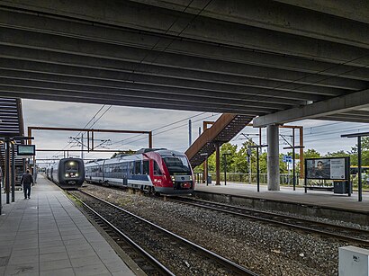
See Køge St. stop on the map
Public transit to Køge St. stop
Looking for directions to Køge St. in Køge, Denmark?
Download the Moovit App to find the current schedule and step-by-step directions for Bus or Train routes that pass through Køge St..
Looking for the nearest stops closest to Køge St. ? Check out this list of closest stops to your destination: Bjerggade (Niels Juels Gade); Carlsensvej (Toldbodvej); Fændediget (Bag Haverne); Bornholmerfærgen (Sandvej); Køge St.; Ølby St.; Køge St..
Bus: 102A, 109, 121, 260R, 101A, 108, 251, 254, 971N, 245R, 241.Train: 210R, A, E, RE, 110R.
We make riding on public transit to Køge St. easy, which is why over 1.7 billion users, including users in Køge trust Moovit as the best app for public transit.
Use the app to navigate to popular places including to the airport, hospital, stadium, grocery store, mall, coffee shop, school, college, and university.
The first line to this stop is 241, at 7:59 AM, and the last line is 241 at 7:59 AM.
Rådhusstræde 8G, Køge, Denmark
This stop serves Movia’s lines
Popular routes from Køge St. stop
- Bjerggade (Niels Juels Gade),
- Carlsensvej (Toldbodvej),
- Fændediget (Bag Haverne),
- Bornholmerfærgen (Sandvej),
- Køge St., Østre Banevej (Østre Banevej)
Bus stops near Køge St. stop
- Virum St.,
- Valby St.,
- Vibenshus Runddel St. (Metro),
- Nr. Uttrup Kirke (Hjørringvej / Nørresundby),
- Ballerup Borupvang (Lautrupparken),
- Næstved St.,
- Ørestad St.,
- Margretheholm (Refshalevej),
- Juni Allé (Mørkhøjvej),
- Strandboulevarden (Nordre Frihavnsgade),
- Herlev Hospital,
- Ejboparken (Ringstedvej),
- Vejlands Allé (Artillerivej),
- Fynshav Færgehavn,
- Gravsholtvej (Vestvej / Langholt),
- Jægersborg St.,
- Frederiks Brygge (Vasbygade),
- Åbyhøj Torv/Silkeborgvej (Aarhus Kom),
- Færgehavnsvej (Baltikavej),
- Kongens Nytorv St. (Metro)
Popular public transit stations in Køge
Get around Køge by public transit!
Traveling around Køge has never been so easy. See step by step directions as you travel to any attraction, street or major public transit station. View bus and train schedules, arrival times, service alerts and detailed routes on a map, so you know exactly how to get to anywhere in Køge.
When traveling to any destination around Køge use Moovit's Live Directions with Get Off Notifications to know exactly where and how far to walk, how long to wait for your line, and how many stops are left. Moovit will alert you when it's time to get off — no need to constantly re-check whether yours is the next stop.
Wondering how to use public transit in Køge or how to pay for public transit in Køge? Moovit public transit app can help you navigate your way with public transit easily, and at minimum cost. It includes public transit fees, ticket prices, and costs. Looking for a map of Køge public transit lines? Moovit public transit app shows all public transit maps in Køge with all Bus, Train, Metro, Light Rail and Ferry routes and stops on an interactive map.
Denmark has 5 transit type(s), including: Bus, Train, Metro, Light Rail and Ferry, operated by several transit agencies, including Metroselskabet, DSB S-tog, Lokaltog A/S, Midttrafik, Odense Letbane, DSB, NT, GoCollective, Skånetrafiken, Movia, FYNBUS, Sydtrafik, Bornholms Trafik, Samsø Bus and Citybus