How to get to KERNELS by bus?
Click on the bus route to see step by step directions with maps, line arrival times and updated time schedules.
From Al Mustafa Academy, Edmonton
47 minFrom South Park Centre, Edmonton
60 minFrom Garneau, Edmonton
26 minFrom Uline Shipping Supplies, St. Albert
45 minFrom Bhartiya Cultural Society Of Alberta, Edmonton
51 minFrom Costco Wholesale, Edmonton
32 minFrom 3803 Calgary Trail Northwest, Edmonton
59 minFrom Burnco Landscape Centre, Edmonton
54 minFrom Malhotra Wholesale, Edmonton
52 minFrom Abbotsfield, Edmonton
34 min
Bus stops near KERNELS in Edmonton
Light Rail stations near KERNELS in Edmonton
Bus lines to KERNELS in Edmonton
- 008, University Transit Centre,VIEW
- 110X, 102 Street & Macdonald Drive,VIEW
- 111, Stadium Transit Centre,VIEW
- 560, 560 Spruce Grove,VIEW
- 902, 106 Street & 118 Avenue Loop,VIEW
- 202, St Albert Via Nait,VIEW
- 140X, Kingsway Rah Transit Centre,VIEW
- 201, St Albert Via 118 Ave,VIEW
- 903, Jasper Place Transit Centre,VIEW
- 691, Kingsway Rah Transit Centre,VIEW
- 102, Abbottsfield Transit Centre,VIEW
- 003, Westmount Transit Centre,VIEW
What are the closest stations to KERNELS?
The closest stations to KERNELS are:
- 109 Street & 113 Avenue is 112 meters away, 2 min walk.
- 109 Street & Princess Elizabeth Avenue is 284 meters away, 4 min walk.
- 109 Street & Kingsway is 309 meters away, 5 min walk.
- 106 Street & 114 Avenue is 430 meters away, 6 min walk.
- Kingsway & 111 Avenue is 598 meters away, 8 min walk.
- 102 St Stop is 2017 meters away, 27 min walk.
- Kingsway Rah Station is 2424 meters away, 32 min walk.
- Churchill Station Underground is 2782 meters away, 37 min walk.
Which bus lines stop near KERNELS?
These bus lines stop near KERNELS: 008, 201, 903.
Which light rail line stops near KERNELS?
METRO (Nait Blatchford Market)
What’s the nearest light rail station to KERNELS in Edmonton?
The nearest light rail station to KERNELS in Edmonton is 102 St Stop. It’s a 27 min walk away.
What’s the nearest bus station to KERNELS in Edmonton?
The nearest bus station to KERNELS in Edmonton is 109 Street & 113 Avenue. It’s a 2 min walk away.
What time is the first light rail to KERNELS in Edmonton?
The VALLEY is the first light rail that goes to KERNELS in Edmonton. It stops nearby at 5:15 AM.
What time is the last light rail to KERNELS in Edmonton?
The VALLEY is the last light rail that goes to KERNELS in Edmonton. It stops nearby at 1:12 AM.
What time is the first bus to KERNELS in Edmonton?
The 008 is the first bus that goes to KERNELS in Edmonton. It stops nearby at 3:09 AM.
What time is the last bus to KERNELS in Edmonton?
The 008 is the last bus that goes to KERNELS in Edmonton. It stops nearby at 3:12 AM.
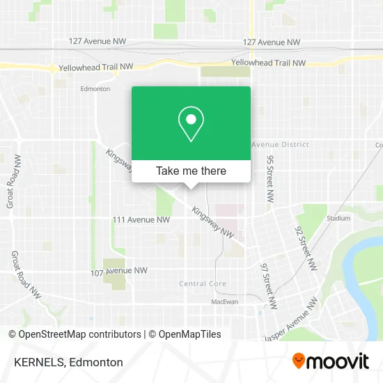
See KERNELS, Edmonton, on the map
Public Transit to KERNELS in Edmonton
Wondering how to get to KERNELS in Edmonton? Moovit helps you find the best way to get to KERNELS with step-by-step directions from the nearest public transit station.
Moovit provides free maps and live directions to help you navigate through your city. View schedules, routes, timetables, and find out how long does it take to get to KERNELS in real time.
Looking for the nearest stop or station to KERNELS? Check out this list of stops closest to your destination: 109 Street & 113 Avenue; 109 Street & Princess Elizabeth Avenue; 109 Street & Kingsway; 106 Street & 114 Avenue; Kingsway & 111 Avenue; 102 St Stop; Kingsway Rah Station; Churchill Station Underground.
Bus: 008, 201, 903, 110X, 111, 560, 902, 202, 140X, 691, 102, 003.Light Rail: METRO.
Want to see if there’s another route that gets you there at an earlier time? Moovit helps you find alternative routes or times. Get directions from and directions to KERNELS easily from the Moovit App or Website.
We make riding to KERNELS easy, which is why over 1.5 million users, including users in Edmonton, trust Moovit as the best app for public transit. You don’t need to download an individual bus app or train app, Moovit is your all-in-one transit app that helps you find the best bus time or train time available.
For information on prices of bus and light rail, costs and ride fares to KERNELS, please check the Moovit app.
Use the app to navigate to popular places including to the airport, hospital, stadium, grocery store, mall, coffee shop, school, college, and university.
KERNELS Address: 109 St NW Edmonton, AB T5G 3A6 street in Edmonton
- Marlin Travel,
- Fossil,
- AMERICAN EAGLE OUTFITTERS,
- Kingsway Mall Guest Services,
- Allstate Insurance,
- VICTORIA'S SECRET PINK,
- Evolve Pmu Studio Academy,
- Kingsway Mall,
- Ben Moss,
- Zellers,
- Kingsway Garden Mall,
- Fit4less,
- BMO Bank of Montreal,
- Flurries,
- Cellxpress Kiosk,
- STARBUCKS,
- SKECHERS,
- Society,
- G by Glam,
- Skin High Facial + Wellness Bar
Places Near KERNELS (Edmonton)
- Fort Edmonton Park, Edmonton,
- Canada Place Service Canada Centre, Edmonton,
- Edmonton EXPO Centre, Edmonton,
- Londonderry Mall, Edmonton,
- Grey Nuns Community Hospital, Edmonton,
- Borden Park, Edmonton,
- Northgate Centre, Edmonton,
- West Edmonton Mall, Edmonton,
- Edmonton Valley Zoo, Edmonton,
- Royal Alexandra Hospital, Edmonton,
- Kaye Edmonton Clinic, Edmonton,
- Edmonton Commonwealth Stadium, Edmonton,
- University of Alberta, Edmonton,
- Kingsway Mall, Edmonton,
- Alberta Legislature Building, Edmonton,
- Whyte Avenue, Edmonton,
- Cross Cancer Institute, Edmonton,
- Edmonton VIA Rail Station, Edmonton,
- Rogers Place, Edmonton,
- MacEwan University, Edmonton
How to get to popular places in Edmonton with public transit
Get around Edmonton by public transit!
Traveling around Edmonton has never been so easy. See step by step directions as you travel to any attraction, street or major public transit station. View bus and train schedules, arrival times, service alerts and detailed routes on a map, so you know exactly how to get to anywhere in Edmonton.
When traveling to any destination around Edmonton use Moovit's Live Directions with Get Off Notifications to know exactly where and how far to walk, how long to wait for your line, and how many stops are left. Moovit will alert you when it's time to get off — no need to constantly re-check whether yours is the next stop.
Wondering how to use public transit in Edmonton or how to pay for public transit in Edmonton? Moovit public transit app can help you navigate your way with public transit easily, and at minimum cost. It includes public transit fees, ticket prices, and costs. Looking for a map of Edmonton public transit lines? Moovit public transit app shows all public transit maps in Edmonton with all Bus and Light Rail routes and stops on an interactive map.
Edmonton has 2 transit type(s), including: Bus and Light Rail, operated by several transit agencies, including ETS LRT, ETS, Strathcona County Transit, St. Albert Transit, Spruce Grove Transit, Fort Saskatchewan Transit, Beaumont Transit and Leduc Transit