How to get to KMP Trunojoyo by bus?
Click on the bus route to see step by step directions with maps, line arrival times and updated time schedules.
From SPBU Utama Raya, Embong Kaliasin
34 minFrom Universitas Katolik Widya Mandala ( Kampus Pakuwon City ), Surabaya
56 minFrom Galaxy Mall Surabaya, Mulyorejo
50 minFrom Galaxy Mall, Mulyorejo
50 minFrom POLTEKES Surabaya, Kertajaya
62 minFrom Politeknik Kesehatan Kementerian Kesehatan Surabaya, Kertajaya
62 minFrom SMAK St Louis 1 Surabaya, Keputran
43 minFrom Genteng, Genteng
31 minFrom Pasar Blauran, Sawahan
29 min
Bus stops near KMP Trunojoyo in Perak Utara
Bus lines to KMP Trunojoyo in Perak Utara
What are the closest stations to KMP Trunojoyo?
The closest stations to KMP Trunojoyo are:
- Terminal Tanjung Perak is 205 meters away, 3 min walk.
- Pelabuhan Tanjung Perak is 495 meters away, 7 min walk.
Which bus lines stop near KMP Trunojoyo?
These bus lines stop near KMP Trunojoyo: K, R1, USP.
What’s the nearest bus station to KMP Trunojoyo in Perak Utara?
The nearest bus station to KMP Trunojoyo in Perak Utara is Terminal Tanjung Perak. It’s a 3 min walk away.
What time is the first bus to KMP Trunojoyo in Perak Utara?
The Z1 is the first bus that goes to KMP Trunojoyo in Perak Utara. It stops nearby at 5:00 AM.
What time is the last bus to KMP Trunojoyo in Perak Utara?
The Z1 is the last bus that goes to KMP Trunojoyo in Perak Utara. It stops nearby at 10:29 PM.
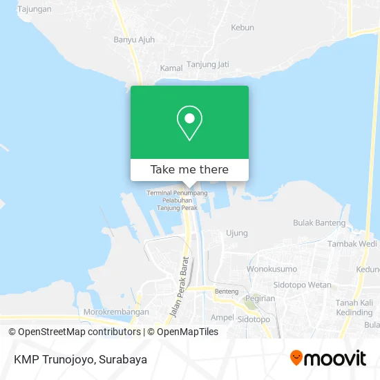
See KMP Trunojoyo, Perak Utara, on the map
Public Transit to KMP Trunojoyo in Perak Utara
Wondering how to get to KMP Trunojoyo in Perak Utara? Moovit helps you find the best way to get to KMP Trunojoyo with step-by-step directions from the nearest public transit station.
Moovit provides free maps and live directions to help you navigate through your city. View schedules, routes, timetables, and find out how long does it take to get to KMP Trunojoyo in real time.
Looking for the nearest stop or station to KMP Trunojoyo? Check out this list of stops closest to your destination: Terminal Tanjung Perak; Pelabuhan Tanjung Perak.
Bus: K, R1, USP, L, Z1.
Want to see if there’s another route that gets you there at an earlier time? Moovit helps you find alternative routes or times. Get directions from and directions to KMP Trunojoyo easily from the Moovit App or Website.
We make riding to KMP Trunojoyo easy, which is why over 1.5 million users, including users in Perak Utara, trust Moovit as the best app for public transit. You don’t need to download an individual bus app or train app, Moovit is your all-in-one transit app that helps you find the best bus time or train time available.
For information on prices of bus, costs and ride fares to KMP Trunojoyo, please check the Moovit app.
Use the app to navigate to popular places including to the airport, hospital, stadium, grocery store, mall, coffee shop, school, college, and university.
KMP Trunojoyo Address: Selat Madura street in Perak Utara
- Tanjung Perak (Surabaya) - Larantuka,
- Pelabuhan Penyeberangan Ujung-Kamal,
- Pelabuhan Perak Dermaga I,
- Terminal Perak,
- RKB D202 Universitas Trunojoyo,
- Main,
- Warung Sogol,
- terminal penumpang pelabuhan gresik,
- Warung Masturi,
- Nasi Bebek Mba Wati,
- PT. ASDP Indonesia Ferry (Persero) Cabang Surabaya,
- Surya Mas PT,
- Dwi Karya Sakti. CV,
- Giras Kang Hardy,
- Sinar Electro,
- Cuci Mobil Motor Ud. Wapo Perak,
- Toko Mandiri Utama,
- Tahu Walik Crispyyy,
- Gudang Puskopad,
- Tina
Places Near KMP Trunojoyo (Perak Utara)
- BG Junction Mall, Bubutan,
- Taman Harmoni, Keputih,
- Pakuwon Mall, Lontar,
- Galaxy Mall Surabaya, Mulyorejo,
- Pakuwon City Mall, Keputih,
- Stadion gelora bung tomo(surabaya,jawa timur), Surabaya,
- Graha Pena, Ketintang,
- Kebun Binatang Surabaya, Darmo,
- PTC, Surabaya,
- Smoking Room Terminal Domestik Juanda International Airport, Sidoarjo,
- Bis Damri P1 (Perak-Bungurasih PP), Krembangan Selatan,
- Masjid Al-Akbar, Surabaya,
- Grand City Mall, Surabaya, Gubeng,
- Kantor Regional II BKN Surabaya, Sidoarjo,
- Bg Junction, Bubutan,
- UPN Veteran Jawa Timur, Gunung Anyar,
- Pelabuhan Tanjung Perak,
- GBT (Gelora Bung Tomo) Surabaya, Benowo,
- Universitas Negeri Surabaya (UNESA), Lidah Wetan,
- Halte Bis Royal Plaza, Wonokromo
How to get to popular places in Surabaya with public transit
Get around Perak Utara by public transit!
Traveling around Perak Utara has never been so easy. See step by step directions as you travel to any attraction, street or major public transit station. View bus and train schedules, arrival times, service alerts and detailed routes on a map, so you know exactly how to get to anywhere in Perak Utara.
When traveling to any destination around Perak Utara use Moovit's Live Directions with Get Off Notifications to know exactly where and how far to walk, how long to wait for your line, and how many stops are left. Moovit will alert you when it's time to get off — no need to constantly re-check whether yours is the next stop.
Wondering how to use public transit in Perak Utara or how to pay for public transit in Perak Utara? Moovit public transit app can help you navigate your way with public transit easily, and at minimum cost. It includes public transit fees, ticket prices, and costs. Looking for a map of Perak Utara public transit lines? Moovit public transit app shows all public transit maps in Perak Utara with all Bus and Train routes and stops on an interactive map.
Surabaya has 2 transit type(s), including: Bus and Train, operated by several transit agencies, including KAI Commuter, Angkutan Surabaya, Trans Semanggi Suroboyo, Suroboyo Bus, Feeder Wira Wiri Suroboyo, Trans Jatim and DAMRI