Directions to KTHR (Wichita) with public transportation
The following transit lines have routes that pass near KTHR
 Bus: ROUTE201: ROCK R, ROUTE21: DOUGLAS.
How to get to KTHR by bus?
Click on the bus route to see step by step directions with maps, line arrival times and updated time schedules.
From Miller Mark, Wichita
57 minFrom Dr Vending, Wichita
45 minFrom Tacos los 3 Potrillos, Wichita
87 minFrom Palmer Bud Auction, Wichita
90 minFrom Prairie Vistas Gallery, Wichita
64 minFrom Aerospace Products, Wichita
46 minFrom Mt Gilead Apostolic Faith Church, Wichita
49 minFrom Roo Grayson LLC, Wichita
55 minFrom Kimberly Molik, MD, Wichita
37 min
Bus lines to KTHR in Wichita
What are the closest stations to KTHR?
The closest stations to KTHR are:
- Vatterott is 624 yards away, 8 min walk.
- 35th And Webb is 638 yards away, 8 min walk.
Which bus lines stop near KTHR?
These bus lines stop near KTHR: ROUTE201: ROCK R, ROUTE21: DOUGLAS.
What’s the nearest bus station to KTHR in Wichita?
The nearest bus stations to KTHR in Wichita are Vatterott and 35th And Webb. The closest one is a 8 min walk away.
What time is the first bus to KTHR in Wichita?
The ROUTE21: DOUGLAS is the first bus that goes to KTHR in Wichita. It stops nearby at 5:14 AM.
What time is the last bus to KTHR in Wichita?
The ROUTE21: DOUGLAS is the last bus that goes to KTHR in Wichita. It stops nearby at 7:52 PM.
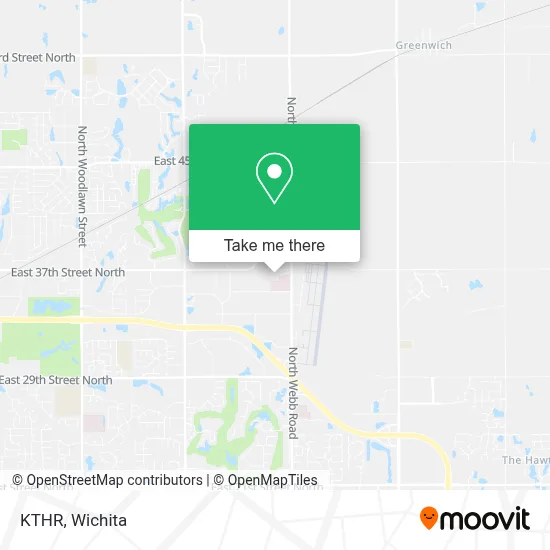
See KTHR, Wichita, on the map
Public Transit to KTHR in Wichita
Wondering how to get to KTHR in Wichita? Moovit helps you find the best way to get to KTHR with step-by-step directions from the nearest public transit station.
Moovit provides free maps and live directions to help you navigate through your city. View schedules, routes, timetables, and find out how long does it take to get to KTHR in real time.
Looking for the nearest stop or station to KTHR? Check out this list of stops closest to your destination: Vatterott; 35th And Webb.
Bus: ROUTE201: ROCK R, ROUTE21: DOUGLAS.
Want to see if there’s another route that gets you there at an earlier time? Moovit helps you find alternative routes or times. Get directions from and directions to KTHR easily from the Moovit App or Website.
We make riding to KTHR easy, which is why over 1.5 million users, including users in Wichita, trust Moovit as the best app for public transit. You don’t need to download an individual bus app or train app, Moovit is your all-in-one transit app that helps you find the best bus time or train time available.
For information on prices of bus, costs and ride fares to KTHR, please check the Moovit app.
Use the app to navigate to popular places including to the airport, hospital, stadium, grocery store, mall, coffee shop, school, college, and university.
KTHR Address: 9323 E 37th St N Wichita, KS 67226 street in Wichita
- B98,
- Anderson Management Company,
- Kitchen Tune-Up,
- The Vascular Institute of Kansas,
- Richard Steckle MD Pa,
- Kansas Cardiology Consultants,
- Wichita Eaa Chapter 88,
- Maruka USA,
- N Webb Rd,
- Health Street,
- Landvest,
- Viking,
- Figeac Aero North America,
- Ewing Irrigation & Landscape Supply,
- Colonel James Jabara Airport,
- Clemens Aviation,
- Amazon Hub Locker+ (Bel Aire),
- Bennett Packaging,
- Evergy,
- Momentum Dance Collective
Places Near KTHR (Wichita)
- Spirit AeroSystems, Bldg 2-280J (Section 9),
- Ascencion Via Christi Hospital St Francis, Wichita,
- Total Card Solutions, Wichita,
- 21st & Maize, Wichita,
- Lopez Services, Wichita,
- East 21st Street North and Webb Road, Wichita,
- Sena African Hair Braiding LLC, Wichita,
- Towne East Mall, Wichita,
- Afghan Halal Market, Wichita,
- North High School, Wichita,
- Four Corners Cafe @ Wesley Medical Center, Wichita,
- Spirit Aerosystems,
- Wichita Dwight D. Eisenhower National Airport (ICT) (Wichita Eisenhower National Airport), Wichita,
- Spirit Aerosystems Inc, Building 1-198D,
- Westside Athletic Field (Friends University Baseball Field), Wichita,
- McConnell Air Force Base, Mcconnell Afb,
- Hubb's glory hole, Wichita,
- Bmer Tech Automotive, Wichita,
- Paige Place Apartments, Wichita,
- Ratcliff Auto and Truck Repair, Wichita
How to get to popular places in Wichita with public transit
Get around Wichita by public transit!
Traveling around Wichita has never been so easy. See step by step directions as you travel to any attraction, street or major public transit station. View bus and train schedules, arrival times, service alerts and detailed routes on a map, so you know exactly how to get to anywhere in Wichita.
When traveling to any destination around Wichita use Moovit's Live Directions with Get Off Notifications to know exactly where and how far to walk, how long to wait for your line, and how many stops are left. Moovit will alert you when it's time to get off — no need to constantly re-check whether yours is the next stop.
Wondering how to use public transit in Wichita or how to pay for public transit in Wichita? Moovit public transit app can help you navigate your way with public transit easily, and at minimum cost. It includes public transit fees, ticket prices, and costs. Looking for a map of Wichita public transit lines? Moovit public transit app shows all public transit maps in Wichita with all bus routes and stops on an interactive map.
Wichita has 1 transit type(s), including: bus, operated by several transit agencies, including Wichita Transit, Greyhound-us and FlixBus-us