Directions to Ka Modas (Fazendinha) with public transportation
The following transit lines have routes that pass near Ka Modas
How to get to Ka Modas by bus?
Click on the bus route to see step by step directions with maps, line arrival times and updated time schedules.
From Afonso Pena/Terminal Boqueirão (Sentido Afonso Pena), Boqueirão
74 minFrom Centro Médico Comunitário Bairro Novo, Sítio Cercado
59 minFrom Juvevê, Juvevê
59 minFrom Rua José Izidoro Biazetto 158, Orleans
47 minFrom Avenida Cândido Hartmann 570, Bigorrilho
36 minFrom Rua Vicente de Carvalho 113, Cajuru
55 minFrom Rua Emílio de Menezes, São Francisco
53 minFrom Rua Doutor Faivre 141, Centro
48 minFrom Avenida Marechal Floriano Peixoto, Boqueirão
71 minFrom Rua Doutor Bley Zornig, Boqueirão
78 min
Bus stops near Ka Modas in Fazendinha
Bus lines to Ka Modas in Fazendinha
- 670 SÃO JORGE, Praça Rui Barbosa → São Jorge,VIEW
- 040 INTERBAIRROS IV, Terminal Pinheirinho → Terminal Santa Felicidade,VIEW
- 789 MAD. CAIUÁ, Praça Rui Barbosa ↺ Caiuá (Circular),VIEW
- 828 CAMPO COMPRIDO / CAPÃO RASO, Terminal Campo Comprido → Terminal Capão Raso,VIEW
- 831 FAZENDINHA / CAPÃO RASO, Terminal Fazendinha → Terminal Capão Raso,VIEW
- 050 INTERBAIRROS V, Terminal Oficinas → Terminal Fazendinha,VIEW
- 611 FAZENDINHA / PORTÃO, Terminal Fazendinha → Terminal Portão,VIEW
- 614 FAZENDINHA / PUC, PUC-PR → Terminal Fazendinha ,VIEW
- 701 FAZENDINHA, Praça Rui Barbosa → Terminal Fazendinha,VIEW
- 703 CAIUÁ, Terminal Caiuá → Praça Rui Barbosa,VIEW
- 706 CAIUÁ - FAZENDINHA / CENTRO, Praça Rui Barbosa → Terminal Caiuá,VIEW
- 545 TRABALHADOR, Terminal Boqueirão → Terminal Fazendinha,VIEW
- 710 SANTA AMÉLIA / PORTO BELO, Santa Amélia → Terminal Fazendinha,VIEW
- 713 SANTA AMÉLIA, Terminal Fazendinha → Santa Amélia,VIEW
What are the closest stations to Ka Modas?
The closest stations to Ka Modas are:
- Rua Edvino Antônio Deboni, 1-55 is 114 meters away, 2 min walk.
- R. General Potiguara, 2429 is 364 meters away, 5 min walk.
- R. Carlos Klemtz, 1360 is 399 meters away, 6 min walk.
- R. General Potiguara, 2780 is 403 meters away, 6 min walk.
Which bus lines stop near Ka Modas?
These bus lines stop near Ka Modas: 040 INTERBAIRROS IV, 050 INTERBAIRROS V, 545 TRABALHADOR, 670 SÃO JORGE, 831 FAZENDINHA / CAPÃO RASO.
What’s the nearest bus station to Ka Modas in Fazendinha?
The nearest bus station to Ka Modas in Fazendinha is Rua Edvino Antônio Deboni, 1-55. It’s a 2 min walk away.
What time is the first bus to Ka Modas in Fazendinha?
The 789 MAD. CAIUÁ is the first bus that goes to Ka Modas in Fazendinha. It stops nearby at 3:03 AM.
What time is the last bus to Ka Modas in Fazendinha?
The 789 MAD. CAIUÁ is the last bus that goes to Ka Modas in Fazendinha. It stops nearby at 3:05 AM.
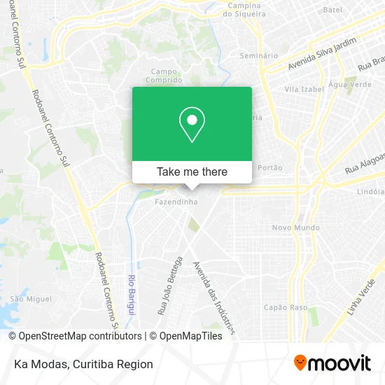
See Ka Modas, Fazendinha, on the map
Public Transit to Ka Modas in Fazendinha
Wondering how to get to Ka Modas in Fazendinha? Moovit helps you find the best way to get to Ka Modas with step-by-step directions from the nearest public transit station.
Moovit provides free maps and live directions to help you navigate through your city. View schedules, routes, timetables, and find out how long does it take to get to Ka Modas in real time.
Looking for the nearest stop or station to Ka Modas? Check out this list of stops closest to your destination: Rua Edvino Antônio Deboni; R. General Potiguara; R. Carlos Klemtz; R. General Potiguara.
Bus: 040 INTERBAIRROS IV, 050 INTERBAIRROS V, 545 TRABALHADOR, 670 SÃO JORGE, 831 FAZENDINHA / CAPÃO RASO, 789 MAD. CAIUÁ, 828 CAMPO COMPRIDO / CAPÃO RASO, 611 FAZENDINHA / PORTÃO, 614 FAZENDINHA / PUC, 701 FAZENDINHA, 703 CAIUÁ, 710 SANTA AMÉLIA / PORTO BELO, 713 SANTA AMÉLIA.
Want to see if there’s another route that gets you there at an earlier time? Moovit helps you find alternative routes or times. Get directions from and directions to Ka Modas easily from the Moovit App or Website.
We make riding to Ka Modas easy, which is why over 1.5 million users, including users in Fazendinha, trust Moovit as the best app for public transit. You don’t need to download an individual bus app or train app, Moovit is your all-in-one transit app that helps you find the best bus time or train time available.
For information on prices of bus, costs and ride fares to Ka Modas, please check the Moovit app.
Use the app to navigate to popular places including to the airport, hospital, stadium, grocery store, mall, coffee shop, school, college, and university.
Ka Modas Address: Rua Angelina Ançai, 162 Fazendinha Curitiba-PR 81320-110 street in Fazendinha
- Treviso Pizzaria,
- Textura,
- Castelete Servicos e Comercio de Material Eletrico,
- Condomínio Residencial Moradas do Campo,
- Hhhhh,
- Janete Modas,
- Vila Estrela São Jorge,
- Eletro Magayver Me,
- Lourenco Construcoes,
- Escola Pequeno Einstein,
- Valentini Promotora de Eventos Empresariais,
- Ebs Operacoes de Distribuicao de Cargas,
- Mayer Modas Story,
- Mestre do Tabaco,
- Marciarocha Representacoes,
- Rua Edvino Antônio Deboni 333,
- Prela Comercio de Motopecas,
- Luna Estética e Beleza,
- Usina 80 American Hot Dog,
- Depile Depilação
Places Near Ka Modas (Fazendinha)
- Hospital Madalena Sofia, Bairro Alto,
- Hospital Da Cruz Vermelha, Batel,
- Hospital Universitário Evangélico de Curitiba, Bigorrilho,
- Hhhhh, Fazendinha,
- Hospital de Clínicas (HC - UFPR), Centro,
- Shopping Estação, Rebouças,
- Hospital do Rocio, Campo,
- Hospital Nossa Senhora Das Graças, Mercês,
- Jardim Botânico de Curitiba PR, Centro,
- Jockey Plaza Shopping Center, Tarumã,
- Rua General Mário Tourinho, Campina Do Siqueira,
- Pontifícia Universidade Católica do Paraná (PUCPR), Prado Velho,
- Shopping Palladium, Portão,
- Campo Largo, Campo,
- Parque Barigui, Mercês,
- Park Shopping Barigüi, Mossunguê,
- Arena Da Baixada - Curitiba,
- Hospital Erasto Gaertner, Jardim Das Américas,
- Rua Martim Afonso 558, Mercês,
- Hospital Angelina Caron, Campina Grande Do Sul
How to get to popular places in Curitiba Region with public transit
Get around Fazendinha by public transit!
Traveling around Fazendinha has never been so easy. See step by step directions as you travel to any attraction, street or major public transit station. View bus and train schedules, arrival times, service alerts and detailed routes on a map, so you know exactly how to get to anywhere in Fazendinha.
When traveling to any destination around Fazendinha use Moovit's Live Directions with Get Off Notifications to know exactly where and how far to walk, how long to wait for your line, and how many stops are left. Moovit will alert you when it's time to get off — no need to constantly re-check whether yours is the next stop.
Wondering how to use public transit in Fazendinha or how to pay for public transit in Fazendinha? Moovit public transit app can help you navigate your way with public transit easily, and at minimum cost. It includes public transit fees, ticket prices, and costs. Looking for a map of Fazendinha public transit lines? Moovit public transit app shows all public transit maps in Fazendinha with all Bus and Cable Car routes and stops on an interactive map.
Curitiba Region has 2 transit type(s), including: Bus and Cable Car, operated by several transit agencies, including Sistema Integrado de Mobilidade (URBS), Sistema Integrado de Mobilidade (AMEP), URBS (Cartões bancários e Dinheiro), URBS (Cartões bancários / Cartão URBS), AMEP (Cartões bancários / Cartão MetroCard), AMEP (Cartões bancários / Cartão MetroCard / Dinheiro), Viação Colombo (Dinheiro), TRIAR (Cartão TRIAR / Dinheiro), Empresa Curitiba Cerro Azul (Dinheiro), Expresso Nossa Senhora da Penha (Dinheiro), Empresa Campo Alto Tijucas (Dinheiro), Auto Viação São José (Cartão VEM / Dinheiro), BRT S/A (Cartão VEM / Dinheiro), TransPiedade (Cartão Cidadão / Dinheiro) and Oceânica Sul (Cartão Transporte / Dinheiro)