Kalinas stop - Thursday schedule
| Line | Direction | Time |
|---|---|---|
| 26 | Didieji Gulbinai | 6:11 AM |
| 26 | Didieji Gulbinai | 6:46 AM |
| 26 | Didieji Gulbinai | 7:52 AM |
| 26 | Didieji Gulbinai | 8:30 AM |
| 26 | Didieji Gulbinai | 9:57 AM |
| 26 | Didieji Gulbinai | 10:33 AM |
| 26 | Didieji Gulbinai | 11:34 AM |
| 26 | Didieji Gulbinai | 12:07 PM |
| 26 | Didieji Gulbinai | 1:10 PM |
| 26 | Didieji Gulbinai | 1:52 PM |
| 26 | Didieji Gulbinai | 2:50 PM |
| 26 | Didieji Gulbinai | 3:36 PM |
| 26 | Didieji Gulbinai | 4:29 PM |
| 26 | Didieji Gulbinai | 5:26 PM |
| 26 | Didieji Gulbinai | 6:18 PM |
| 26 | Didieji Gulbinai | 7:13 PM |
| 26 | Didieji Gulbinai | 8:19 PM |
| 26 | Didieji Gulbinai | 9:09 PM |
| 26 | Didieji Gulbinai | 9:53 PM |
| 26 | Didieji Gulbinai | 10:38 PM |
Directions to Kalinas stop (Vilnius) with public transit
The following transit lines have routes that pass near Kalinas
 Bus: 144, 26, 130, 132, 133.
How to get to Kalinas stop by bus?
Click on the bus route to see step by step directions with maps, line arrival times and updated time schedules.
Bus stops near Kalinas stop in Vilnius
- Kalinas, 4 min walk,
- Riešė, 11 min walk,
Bus lines to Kalinas stop in Vilnius
- 26, Ozo G.,
- 130, Vilnius (Pramogų arenos stotelė) – Giedraičiai per Pikeliškes,
- 132, Vilnius (Pramogų arenos stotelė) – Paberžė per Vyžulionis,
- 133, Vilnius (Pramogų arenos stotelė) – Adomaičiai per Pociūnus,
- 135, Vilnius (Pramogų arena) - Maišiagala,
- 137, Vilnius (Pramogų arenos stotelė) – Barskūnai per Pikeliškes,
- M-141, Anykščiai-Vilnius,
- 144, Vilnius (Žalgirio stotelė) – Nemenčinė per Pikeliškes,
- 145, "Vilnius (Žalgirio st.) - Raudondvaris per Vanaginę",
- M-889, Vilnius-Balninkai,
- 133-2, Vilnius - Adomaičiai per Pociūnus null,
- 135-2, Vilnius (Pramogų arenos stotelė) – Maišiagala per Pikeliškes null,
- 144-2, Vilnius (Žalgirio stotelė) – Nemenčinė per Pikeliškes null,
What are the closest stations to Kalinas?
The closest stations to Kalinas are:
- Kalinas stop is 246 meters away, 4 min walk.
- Riešė stop is 764 meters away, 11 min walk.
Which bus lines stop near Kalinas?
These bus lines stop near Kalinas: 144, 26.
What’s the nearest bus station to Kalinas in Vilnius?
The nearest bus station to Kalinas in Vilnius is Kalinas. It’s a 4 min walk away.
What time is the first bus to Kalinas in Vilnius?
The 130 is the first bus that goes to Kalinas in Vilnius. It stops nearby at 6:01 AM.
What time is the last bus to Kalinas in Vilnius?
The 26 is the last bus that goes to Kalinas in Vilnius. It stops nearby at 10:06 PM.
See Kalinas stop, Vilnius, on the map
Public transit to Kalinas stop (ID: 5148) in Vilnius
Looking for directions to Kalinas in Vilnius, Lithuania?
Download the Moovit App to find the current schedule and step-by-step directions for Bus or Trolleybus routes that pass through Kalinas.
Looking for the nearest stops closest to Kalinas ? Check out this list of closest stops to your destination: Kalinas; Riešė.
Bus: 144, 26, 130, 132, 133, 135, 137.
We make riding on public transit to Kalinas easy, which is why over 1.7 billion users, including users in Vilnius trust Moovit as the best app for public transit.
Use the app to navigate to popular places including to the airport, hospital, stadium, grocery store, mall, coffee shop, school, college, and university.
Kalinas stop’s code is 5148
The first line to this stop is 26, at 6:11 AM, and the last line is 26 at 10:38 PM.
7 Medikiškių g, Lithuania
This stop serves SĮ "Susisiekimo paslaugos"-Bus’s lines
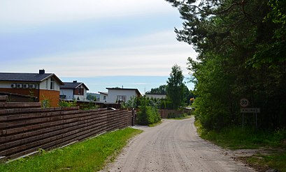
Kalinas (Polish: Kalin) is a village in Vilnius District Municipality, Riešė Eldership. It is located 2 kilometers northeast of Didžioji Riešė, by the Riešė river.Wiki
Popular routes from Kalinas stop, Vilnius
- Studentų St.,
- Karoliniškės,
- Jono Kairiūkščio St.,
- Pagubės Sodai,
- Paukščių Takas,
- Sodybų St.,
- Stotis,
- Stepono Batoro St.,
- Kirtimų Geležinkelio Stotis,
- Lukiškės,
- Vėtrungių St.,
- Zuikių St.,
- Šiltnamių St.,
- Palydovo St.,
- Didlaukio St.,
- Dunojaus St.,
- Pajautos St.,
- Draugystės St.,
- Vytauto St.,
- Kunigiškių St.
Popular public transit stations in Vilnius
Get around Vilnius by public transit!
Traveling around Vilnius has never been so easy. See step by step directions as you travel to any attraction, street or major public transit station. View bus and train schedules, arrival times, service alerts and detailed routes on a map, so you know exactly how to get to anywhere in Vilnius.
When traveling to any destination around Vilnius use Moovit's Live Directions with Get Off Notifications to know exactly where and how far to walk, how long to wait for your line, and how many stops are left. Moovit will alert you when it's time to get off — no need to constantly re-check whether yours is the next stop.
Wondering how to use public transit in Vilnius or how to pay for public transit in Vilnius? Moovit public transit app can help you navigate your way with public transit easily, and at minimum cost. It includes public transit fees, ticket prices, and costs. Looking for a map of Vilnius public transit lines? Moovit public transit app shows all public transit maps in Vilnius with all Bus, Ferry and Trolleybus routes and stops on an interactive map.
Vilnius has 3 transit type(s), including: Bus, Ferry and Trolleybus, operated by several transit agencies, including SĮ "Susisiekimo paslaugos"-Bus, SĮ "Susisiekimo paslaugos"-Cable, Klaipėdos keleivinis transportas, Kauno r. sav., Palangos m. sav., Prienų r. sav. administracija, Druskininkų sav., Kauno m. sav., Kupiškio r. sav., Neringos sav., Biržų r. sav., Šalčininkų r. sav., Trakų r. sav., Anykščių r. sav. and Vilniaus r. sav.