How to get to Kalunga - Kalunga.Com by bus?
Click on the bus route to see step by step directions with maps, line arrival times and updated time schedules.
From Jardim da Luz, U.T.P. Parque Das Laranjeiras E Jardim Da Luz
57 minFrom Fazendinha do Quartel, U.T.P. Jd. Guanabara
74 minFrom Jardim Atlântico, U.T.P. Jardim Atlantico
54 minFrom Avenida New York, U.T.P. Jardim Novo Mundo
40 minFrom Conjunto Riviera, U.T.P. Riviera/Agua Branca
56 minFrom Varjão - GO, Nova Brazilia
71 minFrom Avenida C-171, U.T.P. Jardim America
49 minFrom Cartório Silva, U.T.P. Marista
29 minFrom Linha 015 - T. Pç. A / Flamboyant - Via T. Isidória, U.T.P. Pedro Ludovico/Bela Vista/Jardim Das Esmeraldas
35 minFrom Setor Serrinha, U.T.P. Jardim Atlantico
47 min
Bus stops near Kalunga - Kalunga.Com in U.T.P. Aeroviarios
Bus lines to Kalunga - Kalunga.Com in U.T.P. Aeroviarios
- 164, Vera Cruz ⇆ Praça Cívica,VIEW
- 305, T. Praça A,VIEW
- 605, Rodoviária - Via Campinas,VIEW
- 935, T. Vera Cruz - Via Leste-Oeste,VIEW
- 009, T. Pe. Pelágio,VIEW
- 110, BRT Oeste | T. Pe. Pelágio,VIEW
- 112, BRT Leste | Pça. da Bíblia - Via T. Vera Cruz,VIEW
- 113, BRT Oeste | T. Goianira,VIEW
- 115, BRT Oeste | Direto | T. Vera Cruz,VIEW
- 116, BRT Oeste | T. Vera Cruz,VIEW
- 117, BRT Leste | T. Novo Mundo,VIEW
- 118, BRT Oeste | Rodovia Go-070,VIEW
- 307, Carolina Park - Via T. Gyn Viva,VIEW
- 702, T. Dergo ⇆ Res. Portinari,VIEW
- 710, T. Dergo → T. Gyn Viva → Serra Azul,VIEW
- 052, Vera Cruz ⇆ Centro - Via Campinas,VIEW
- 167, T. Pq. Oeste ⇆ Universitário - Via T. Dergo,VIEW
- 598, Maysa,VIEW
- 341, T. Dergo → Buena Vista → Jd. Botânico,VIEW
What are the closest stations to Kalunga - Kalunga.Com?
The closest stations to Kalunga - Kalunga.Com are:
- Av. 24 De Outubro is 47 meters away, 1 min walk.
- Avenida Leste-Oeste is 598 meters away, 8 min walk.
- Av. Castelo Branco is 606 meters away, 8 min walk.
- Est. Anicuns | Oeste is 627 meters away, 9 min walk.
- T. Dergo | Sentido: B. Goiá / T. Goiânia Viva is 725 meters away, 10 min walk.
- Rua Café is 743 meters away, 11 min walk.
- Av. Santana is 763 meters away, 11 min walk.
Which bus lines stop near Kalunga - Kalunga.Com?
These bus lines stop near Kalunga - Kalunga.Com: 009, 113, 117, 305.
What’s the nearest bus station to Kalunga - Kalunga.Com in U.T.P. Aeroviarios?
The nearest bus station to Kalunga - Kalunga.Com in U.T.P. Aeroviarios is Av. 24 De Outubro. It’s a 1 min walk away.
What time is the first bus to Kalunga - Kalunga.Com in U.T.P. Aeroviarios?
The 118 is the first bus that goes to Kalunga - Kalunga.Com in U.T.P. Aeroviarios. It stops nearby at 4:27 AM.
What time is the last bus to Kalunga - Kalunga.Com in U.T.P. Aeroviarios?
The 110 is the last bus that goes to Kalunga - Kalunga.Com in U.T.P. Aeroviarios. It stops nearby at 12:51 AM.
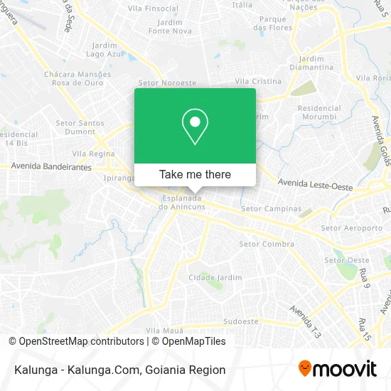
See Kalunga - Kalunga.Com, U.T.P. Aeroviarios, on the map
Public Transit to Kalunga - Kalunga.Com in U.T.P. Aeroviarios
Wondering how to get to Kalunga - Kalunga.Com in U.T.P. Aeroviarios? Moovit helps you find the best way to get to Kalunga - Kalunga.Com with step-by-step directions from the nearest public transit station.
Moovit provides free maps and live directions to help you navigate through your city. View schedules, routes, timetables, and find out how long does it take to get to Kalunga - Kalunga.Com in real time.
Looking for the nearest stop or station to Kalunga - Kalunga.Com? Check out this list of stops closest to your destination: Av. 24 De Outubro; Avenida Leste-Oeste; Av. Castelo Branco; Est. Anicuns | Oeste; T. Dergo | Sentido: B. Goiá / T. Goiânia Viva; Rua Café; Av. Santana.
Bus: 009, 113, 117, 305, 164, 605, 935, 110, 112, 115, 116, 307, 702, 710, 052, 167, 598.
Want to see if there’s another route that gets you there at an earlier time? Moovit helps you find alternative routes or times. Get directions from and directions to Kalunga - Kalunga.Com easily from the Moovit App or Website.
We make riding to Kalunga - Kalunga.Com easy, which is why over 1.5 million users, including users in U.T.P. Aeroviarios, trust Moovit as the best app for public transit. You don’t need to download an individual bus app or train app, Moovit is your all-in-one transit app that helps you find the best bus time or train time available.
For information on prices of bus, costs and ride fares to Kalunga - Kalunga.Com, please check the Moovit app.
Use the app to navigate to popular places including to the airport, hospital, stadium, grocery store, mall, coffee shop, school, college, and university.
Kalunga - Kalunga.Com Address: Avenida Anhanguera, Cidade Jardim Goiânia-GO 74435-300 street in U.T.P. Aeroviarios
- Hope Lingerie,
- Allê Esfihas,
- Icebar,
- Le Biscuit,
- Fastomelet Cerrado,
- Mebelisca Alimentos Ltda,
- Shopping Cerrado,
- Komiketo,
- Escape Moove,
- Café Fest,
- Bbk - Bubblekill,
- Pirralhos,
- Spuntini Café,
- Mix Sorvetes E Açaí,
- Lojas Milano,
- Salpiquê Restaurante,
- Banco 24horas,
- Magic Games,
- Big Lar,
- C&A
Places Near Kalunga - Kalunga.Com (U.T.P. Aeroviarios)
- Avenida T-2, U.T.P. Bueno,
- Parque Das Nacoes, Aparecida De Goiânia,
- Hospital de Urgências de Goiânia (HUGO), U.T.P. Pedro Ludovico/Bela Vista/Jardim Das Esmeraldas,
- Hospital Santa Casa de Misericórdia de Goiânia, U.T.P. Bueno,
- Aeroporto de Goiânia / Santa Genoveva (GYN), U.T.P. Aeroporto Internacional,
- Terminal Recanto do Bosque, Goiania,
- Shopping Flamboyant, U.T.P. Jardim Goias,
- Terminal Praça A, U.T.P. Campinas,
- Senador Canedo, Senador Canedo,
- Terminal Araguaia, Aparecida De Goiânia,
- Hospital e Maternidade São Judas Tadeu, U.T.P. Jardim Europa,
- Rodovia BR - 153, Aparecida De Goiânia,
- Rodeio Show de Aparecida, Aparecida De Goiânia,
- ICF Instituto de Ciências Farmacêuticas Unidade Clinica, U.T.P. Novo Horizonte/Faicalville,
- Avenida 44, Goiania,
- Buriti Shopping, Aparecida De Goiânia,
- HUGOL - Hospital De Urgências Governador Octávio Lage, U.T.P. V. Regina/Pq. Ind. Paulista/Santos Dumont,
- Terminal Rodoviário De Goiânia, U.T.P. Central,
- Avenida Rio Verde, Aparecida De Goiânia,
- Setor Expansul, Aparecida De Goiânia
How to get to popular places in Goiania Region with public transit
Get around U.T.P. Aeroviarios by public transit!
Traveling around U.T.P. Aeroviarios has never been so easy. See step by step directions as you travel to any attraction, street or major public transit station. View bus and train schedules, arrival times, service alerts and detailed routes on a map, so you know exactly how to get to anywhere in U.T.P. Aeroviarios.
When traveling to any destination around U.T.P. Aeroviarios use Moovit's Live Directions with Get Off Notifications to know exactly where and how far to walk, how long to wait for your line, and how many stops are left. Moovit will alert you when it's time to get off — no need to constantly re-check whether yours is the next stop.
Wondering how to use public transit in U.T.P. Aeroviarios or how to pay for public transit in U.T.P. Aeroviarios? Moovit public transit app can help you navigate your way with public transit easily, and at minimum cost. It includes public transit fees, ticket prices, and costs. Looking for a map of U.T.P. Aeroviarios public transit lines? Moovit public transit app shows all public transit maps in U.T.P. Aeroviarios with all bus routes and stops on an interactive map.
Goiania Region has 1 transit type(s), including: bus, operated by several transit agencies, including Redemob Consórcio - CMTC