Directions to Kalvebod Brygge (København) with public transportation
The following transit lines have routes that pass near Kalvebod Brygge
 Bus: 17, 250S, 7A, 11.
- Train: A, B, C, BX, E.
- Metro: M4, M3.
- Ferry: 991, 992.
How to get to Kalvebod Brygge by bus?
Click on the bus route to see step by step directions with maps, line arrival times and updated time schedules.
How to get to Kalvebod Brygge by train?
Click on the train route to see step by step directions with maps, line arrival times and updated time schedules.
How to get to Kalvebod Brygge by metro?
Click on the metro route to see step by step directions with maps, line arrival times and updated time schedules.
Bus stops near Kalvebod Brygge in København
- Tivoli Hotel (Kalvebod Brygge), 1 min walk,
- Dybbølsbro St. (Ingerslevsgade), 9 min walk,
- Polititorvet, 9 min walk,
- Copenhagen Busterminal, 15 min walk,
Metro station near Kalvebod Brygge in København
- København H, 2 min walk,
Train stations near Kalvebod Brygge in København
- Dybbølsbro St., 14 min walk,
- København H, 18 min walk,
Ferry station near Kalvebod Brygge in København
- Bryggebroen (Islands Brygge), 19 min walk,
Bus lines to Kalvebod Brygge in København
- 17, Vesterport St.,
- 11, Vigerslevvej,
- 5C, Københavns Lufthavn,
- 68, Lyngby St. Via Mellemvangen,
- FLIXBUS N05, Copenhagen - Munich,
- FLIXBUS 032, Malmö - Berlin,
- FLIXBUS N32, Arlanda - Berlin/Prague,
- FLIXBUS N73, Ljubljana - Lund,
- FLIXBUS N74, Copenhagen - Cologne - Paris,
- FLIXBUS N110, Copenhagen - Frankurt - Ulm,
- FLIXBUS N132, Oslo - Prague,
- FLIXBUS N160, Berlin - Trieste,
- FLIXBUS 173, Gothenburg - Copenhagen - Oldenburg,
- FLIXBUS N232, Copenhagen - Vienna,
- FLIXBUS 602, Stockholm - Copenhagen,
- FLIXBUS N602, Stockholm - Hamburg,
- FLIXBUS 613, Oslo - Copenhagen,
- FLIXBUS N613, Oslo - Hamburg,
- FLIXBUS 620, Aarhus - Copenhagen,
- FLIXBUS 620C, Aarhus - Copenhagen - Malmö,
What are the closest stations to Kalvebod Brygge?
The closest stations to Kalvebod Brygge are:
- Tivoli Hotel (Kalvebod Brygge) is 17 meters away, 1 min walk.
- København H is 31 meters away, 2 min walk.
- Dybbølsbro St. (Ingerslevsgade) is 623 meters away, 9 min walk.
- Polititorvet is 672 meters away, 9 min walk.
- Dybbølsbro St. is 883 meters away, 14 min walk.
- Copenhagen Busterminal is 1129 meters away, 15 min walk.
- Bryggebroen (Islands Brygge) is 1434 meters away, 19 min walk.
Which bus lines stop near Kalvebod Brygge?
These bus lines stop near Kalvebod Brygge: 17, 250S, 7A.
Which train lines stop near Kalvebod Brygge?
These train lines stop near Kalvebod Brygge: A, B, C.
Which metro line stops near Kalvebod Brygge?
M4 (København Syd St. (Metro))
What’s the nearest metro station to Kalvebod Brygge in København?
The nearest metro station to Kalvebod Brygge in København is København H. It’s a 2 min walk away.
What’s the nearest train station to Kalvebod Brygge in København?
The nearest train station to Kalvebod Brygge in København is Dybbølsbro St.. It’s a 14 min walk away.
What’s the nearest bus station to Kalvebod Brygge in København?
The nearest bus station to Kalvebod Brygge in København is Tivoli Hotel (Kalvebod Brygge). It’s a 1 min walk away.
What’s the nearest ferry station to Kalvebod Brygge in København?
The nearest ferry station to Kalvebod Brygge in København is Bryggebroen (Islands Brygge). It’s a 19 min walk away.
What time is the first metro to Kalvebod Brygge in København?
The M3 is the first metro that goes to Kalvebod Brygge in København. It stops nearby at 3:00 AM.
What time is the last metro to Kalvebod Brygge in København?
The M3 is the last metro that goes to Kalvebod Brygge in København. It stops nearby at 3:17 AM.
What time is the first train to Kalvebod Brygge in København?
The A is the first train that goes to Kalvebod Brygge in København. It stops nearby at 3:03 AM.
What time is the last train to Kalvebod Brygge in København?
The IC is the last train that goes to Kalvebod Brygge in København. It stops nearby at 4:26 AM.
What time is the first bus to Kalvebod Brygge in København?
The 5C is the first bus that goes to Kalvebod Brygge in København. It stops nearby at 3:01 AM.
What time is the last bus to Kalvebod Brygge in København?
The FLIXBUS N160 is the last bus that goes to Kalvebod Brygge in København. It stops nearby at 8:55 PM.
What time is the first ferry to Kalvebod Brygge in København?
The 992 is the first ferry that goes to Kalvebod Brygge in København. It stops nearby at 10:33 AM.
What time is the last ferry to Kalvebod Brygge in København?
The 991 is the last ferry that goes to Kalvebod Brygge in København. It stops nearby at 9:02 PM.
See Kalvebod Brygge, København, on the map
Public Transit to Kalvebod Brygge in København
Wondering how to get to Kalvebod Brygge in København? Moovit helps you find the best way to get to Kalvebod Brygge with step-by-step directions from the nearest public transit station.
Moovit provides free maps and live directions to help you navigate through your city. View schedules, routes, timetables, and find out how long does it take to get to Kalvebod Brygge in real time.
Looking for the nearest stop or station to Kalvebod Brygge? Check out this list of stops closest to your destination: Tivoli Hotel (Kalvebod Brygge); København H; Dybbølsbro St. (Ingerslevsgade); Polititorvet; Dybbølsbro St.; Copenhagen Busterminal; Bryggebroen (Islands Brygge).
Bus: 17, 250S, 7A, 11.Train: A, B, C, BX, E, ECE, IC, ICL, RE, RE.Metro: M4, M3.Ferry: 991, 992.
Want to see if there’s another route that gets you there at an earlier time? Moovit helps you find alternative routes or times. Get directions from and directions to Kalvebod Brygge easily from the Moovit App or Website.
We make riding to Kalvebod Brygge easy, which is why over 1.5 million users, including users in København, trust Moovit as the best app for public transit. You don’t need to download an individual bus app or train app, Moovit is your all-in-one transit app that helps you find the best bus time or train time available.
For information on prices of bus, train, metro and light rail, costs and ride fares to Kalvebod Brygge, please check the Moovit app.
Use the app to navigate to popular places including to the airport, hospital, stadium, grocery store, mall, coffee shop, school, college, and university.
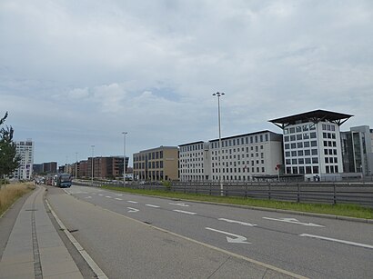
Kalvebod Brygge Address: Kalvebod Brygge, København V, Danmark street in København
- Hotel Tivoli Congress Center Kongres Køkken,
- Tivoli Hotel Og Tivoli Congress Center Restaurant Tivoli Vie,
- Tivoli Hotel & Congress Center,
- Georgiens Ambassade,
- Pizza-Hut,
- Cabinn Copenhagen,
- Hjulfabrikken,
- Cabinn Hotel,
- Kopenhagen Parken-Stadion,
- Wakeup Copenhagen Carsten Niebuhrs Gade,
- Wakeup Copenhagen,
- Carsten Niebuhrs Gade 11,
- Kort & Godt,
- Ikea,
- Copenhagen Island,
- Copenhagen Boat House,
- Ls Copenhagen Fisktor,
- The Harbour,
- Aller Media,
- CPH Hotel Copenhagen
Places Near Kalvebod Brygge (København)
- Christiania, København,
- Nyhavn, København,
- Refshaleøen, København,
- Eventyrpigerne, Sorø,
- Royal Arena, København,
- Copenhagen Street Food - Reffen, København,
- Bella Center, København,
- Ikea, Århus,
- Rigshospitalet, København,
- Fisketorvet, København,
- Bispebjerg Hospital, København,
- Seduction Girls, Rødovre,
- Operaen, København,
- Field's, København,
- Bakken, København,
- Carlsberg Byen, København,
- Reffen, København,
- Dr Koncerthuset, København,
- Havnebus 993 (Nyhavn - Operaen),
- Den Sorte Diamant, København
How to get to popular places in Denmark with public transit
Get around København by public transit!
Traveling around København has never been so easy. See step by step directions as you travel to any attraction, street or major public transit station. View bus and train schedules, arrival times, service alerts and detailed routes on a map, so you know exactly how to get to anywhere in København.
When traveling to any destination around København use Moovit's Live Directions with Get Off Notifications to know exactly where and how far to walk, how long to wait for your line, and how many stops are left. Moovit will alert you when it's time to get off — no need to constantly re-check whether yours is the next stop.
Wondering how to use public transit in København or how to pay for public transit in København? Moovit public transit app can help you navigate your way with public transit easily, and at minimum cost. It includes public transit fees, ticket prices, and costs. Looking for a map of København public transit lines? Moovit public transit app shows all public transit maps in København with all Bus, Train, Metro, Light Rail and Ferry routes and stops on an interactive map.
Denmark has 5 transit type(s), including: Bus, Train, Metro, Light Rail and Ferry, operated by several transit agencies, including Metroselskabet, DSB S-tog, Lokaltog A/S, Midttrafik, Odense Letbane, DSB, NT, GoCollective, Skånetrafiken, Movia, FYNBUS, Sydtrafik, Bornholms Trafik, Citybus and Ærø Kommune