How to get to Kane Group by bus?
Click on the bus route to see step by step directions with maps, line arrival times and updated time schedules.
From Fells Point, Baltimore
49 minFrom Randallstown, MD, Baltimore County
38 minFrom Guinness Open Gate Brewery & Barrel House, Baltimore County
86 minFrom Oriole Park at Camden Yards, Baltimore
47 minFrom Johns Hopkins Medicine at Green Spring Station, Baltimore County
63 minFrom Eastern Ave (eastern avenue and dundalk av), Baltimore
64 minFrom B&O Railroad Museum, Baltimore
30 minFrom Johns Hopkins Bayview Medical Center, Baltimore
63 minFrom Baltimore VA Medical Center, Baltimore
31 minFrom I-695 @ Exit 18 (Liberty Rd/MD 26), Baltimore County
30 min
How to get to Kane Group by metro?
Click on the metro route to see step by step directions with maps, line arrival times and updated time schedules.
Bus stops near Kane Group in Baltimore
Train station near Kane Group in Baltimore
- West Baltimore Marc Nb, 35 min walk,VIEW
Metro station near Kane Group in Baltimore
- Mondawmin Metro, 36 min walk,VIEW
Bus lines to Kane Group in Baltimore
What are the closest stations to Kane Group?
The closest stations to Kane Group are:
- Clifton Ave & Edgewood St is 70 yards away, 1 min walk.
- Garrison Blvd & Gwynns Falls Pkwy Sb is 101 yards away, 2 min walk.
- Clifton Ave & Garrison Blvd FS Wb is 188 yards away, 3 min walk.
- Hilton St & Troy St Opp Nb is 548 yards away, 7 min walk.
- West Baltimore Marc Nb is 2953 yards away, 35 min walk.
- Mondawmin Metro is 2992 yards away, 36 min walk.
Which bus line stops near Kane Group?
80 (Rogers Ave Metro)
Which metro line stops near Kane Group?
METRO (Towards Owing Mills)
What’s the nearest bus station to Kane Group in Baltimore?
The nearest bus station to Kane Group in Baltimore is Clifton Ave & Edgewood St. It’s a 1 min walk away.
What time is the first metro to Kane Group in Baltimore?
The METRO is the first metro that goes to Kane Group in Baltimore. It stops nearby at 4:58 AM.
What time is the last metro to Kane Group in Baltimore?
The METRO is the last metro that goes to Kane Group in Baltimore. It stops nearby at 12:18 AM.
What time is the first train to Kane Group in Baltimore?
The MARC is the first train that goes to Kane Group in Baltimore. It stops nearby at 4:39 AM.
What time is the last train to Kane Group in Baltimore?
The MARC is the last train that goes to Kane Group in Baltimore. It stops nearby at 10:53 PM.
What time is the first bus to Kane Group in Baltimore?
The 80 is the first bus that goes to Kane Group in Baltimore. It stops nearby at 3:08 AM.
What time is the last bus to Kane Group in Baltimore?
The 80 is the last bus that goes to Kane Group in Baltimore. It stops nearby at 3:13 AM.
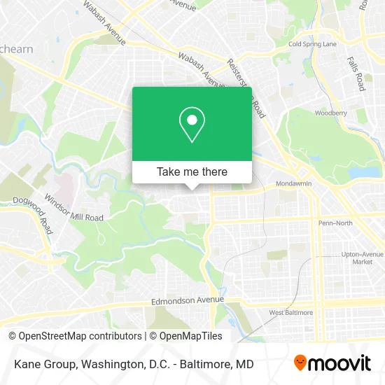
See Kane Group, Baltimore, on the map
Public Transit to Kane Group in Baltimore
Wondering how to get to Kane Group in Baltimore? Moovit helps you find the best way to get to Kane Group with step-by-step directions from the nearest public transit station.
Moovit provides free maps and live directions to help you navigate through your city. View schedules, routes, timetables, and find out how long does it take to get to Kane Group in real time.
Looking for the nearest stop or station to Kane Group? Check out this list of stops closest to your destination: Clifton Ave & Edgewood St; Garrison Blvd & Gwynns Falls Pkwy Sb; Clifton Ave & Garrison Blvd FS Wb; Hilton St & Troy St Opp Nb; West Baltimore Marc Nb; Mondawmin Metro.
Bus: 80, CITYLINK GOLD, 79, 38, 82.Train: MARC.Metro: METRO.
Want to see if there’s another route that gets you there at an earlier time? Moovit helps you find alternative routes or times. Get directions from and directions to Kane Group easily from the Moovit App or Website.
We make riding to Kane Group easy, which is why over 1.5 million users, including users in Baltimore, trust Moovit as the best app for public transit. You don’t need to download an individual bus app or train app, Moovit is your all-in-one transit app that helps you find the best bus time or train time available.
For information on prices of bus, metro and train, costs and ride fares to Kane Group, please check the Moovit app.
Use the app to navigate to popular places including to the airport, hospital, stadium, grocery store, mall, coffee shop, school, college, and university.
Kane Group Address: 2300 Garrison Blvd street in Baltimore
- Covid-19 Testing Site: Quest Diagnostics - Garwyn Medical,
- Garwyn Medical Building,
- Garwyn Pharmacy,
- Taylor Integrated Health,
- Same Day STD Testing,
- Care RX Pharmacy,
- Quest Diagnostics,
- Garwyn. Oaks. Community,
- Children's Garden Day Nursery,
- Garrison Blvd Gwynns,
- Davis Memorial,
- Mt Washington Swim Club,
- Freestate Grand Lodge,
- No Doubt,
- James Tabernacle Apostolic Holiness Church,
- LLDM Baltimore MD,
- Mount Holly,
- Relaxin with B,
- Garrison Blvd,
- Fifteen Minute Locksmith
Places Near Kane Group (Baltimore)
- The Anthem, Washington,
- Westfield Montgomery Mall, Montgomery County,
- Amazon Hq2, Arlington County,
- Pennsylvania Ave NW (3rd st and pennsylvania), Washington,
- Museum Of The Bible, Washington,
- Camden Yards, Baltimore,
- Sibley Memorial Hospital, Washington,
- Capital One Arena, Washington,
- Washington National Cathedral, Washington,
- Georgetown, Washington,
- Washington DC VA Medical Center, Washington,
- National Museum of African American History and Culture, Washington,
- M&T Bank Stadium, Baltimore,
- National Theatre, Washington,
- Basilica of the National Shrine, Washington,
- National Zoo, Washington,
- PG Mall, Prince George's County,
- Warner Theatre, Washington,
- Rock Creek Tennis Center, Washington,
- Marriott Marquis Washington, DC, Washington
How to get to popular places in Washington, D.C. - Baltimore, MD with public transit
Get around Baltimore by public transit!
Traveling around Baltimore has never been so easy. See step by step directions as you travel to any attraction, street or major public transit station. View bus and train schedules, arrival times, service alerts and detailed routes on a map, so you know exactly how to get to anywhere in Baltimore.
When traveling to any destination around Baltimore use Moovit's Live Directions with Get Off Notifications to know exactly where and how far to walk, how long to wait for your line, and how many stops are left. Moovit will alert you when it's time to get off — no need to constantly re-check whether yours is the next stop.
Wondering how to use public transit in Baltimore or how to pay for public transit in Baltimore? Moovit public transit app can help you navigate your way with public transit easily, and at minimum cost. It includes public transit fees, ticket prices, and costs. Looking for a map of Baltimore public transit lines? Moovit public transit app shows all public transit maps in Baltimore with all Bus, Train, Metro, Light Rail and Ferry routes and stops on an interactive map.
Washington, D.C. - Baltimore, MD has 5 transit type(s), including: Bus, Train, Metro, Light Rail and Ferry, operated by several transit agencies, including WMATA, Montgomery County Ride On, Fairfax Connector, TheBus, PRTC, DASH - Alexandria, Arlington Transit (ART), RTA of Central Maryland, MDOT MTA, MDOT MTA Light RailLink, MDOT MTA Commuter Bus, MDOT MTA Local Bus, FXBGO!, Virginia Railway Express (VRE) and MARC