How to get to Karate by bus?
Click on the bus route to see step by step directions with maps, line arrival times and updated time schedules.
From Real Plaza Centro Cívico, Lima
42 minFrom Centro Comercial Risso, Lince
49 minFrom Profuturo AFP, San Isidro
58 minFrom Av. Las Begonias, San Isidro
56 minFrom Avenida España 734, Breña
40 minFrom Av Rivera Navarrete, San Isidro
58 minFrom El Agustino, El Agustin
27 minFrom Avenida Angamos Este, Surquillo
45 minFrom TRC Express - Lima, Surquillo
50 minFrom Av. Alameda del Corregidor - La molina, La Molina
33 min
Bus stops near Karate in Santa Anit
Metro station near Karate in Santa Anit
- Estacion Ovalo Santa Anita, 12 min walk,VIEW
Bus lines to Karate in Santa Anit
- 1075, Cajamrquilla (Lurigancho) - Gamarra (La Victoria) ,VIEW
- 1223, Sarita Colonia (Callao) - Ceres (Ate),VIEW
- 1279, Ceres,VIEW
- 1285, Callao - Ate ,VIEW
- 1359, Ate - Santa Anita,VIEW
- 4205, Surge (Ate) - San Marcos (Lima),VIEW
- ICR14, Lince - Santa Anita,VIEW
- IM04, Ceres Medio (Ate) - Óvalo Santa Anita (Santa Anita) ,VIEW
- 1065, Valdiviezo (Ate) - Ceres (Ate),VIEW
- 1078, Ate - La Victoria - Ate,VIEW
- 1084, Ceres (Ate) - La Campiña (Chorrillos),VIEW
- 1177, Torre Blanca (Carabayllo) - Metropolitana (Ate),VIEW
- 1194, Los Virreyes (Ate) - Chuquitanta (San Martin De Porres),VIEW
- 1214, Las Gardenias (Ate) - Canta Callao (San Martin De Porres),VIEW
- 1221, Ramiro Priale (Ate) - Mexico (Lince) ,VIEW
- 1226, Ceres Medio (Ate) - Av. Perú (San Martin De Porres),VIEW
- 1227, Tiwinza (Callao) - Ceres (Ate),VIEW
- 1341, Santa Anita - Lurigancho ,VIEW
- 1360, Av. Huarochirí (Cieneguilla) - Santa Clara (Ate),VIEW
- 1395, Santa Clara (Ate) - Manchay (Pachacamac),VIEW
What are the closest stations to Karate?
The closest stations to Karate are:
- Huarochirí is 105 meters away, 2 min walk.
- Tortelin Metropolitana Santa Anita is 456 meters away, 6 min walk.
- Avenida Ferrocarril & Huarochirí is 757 meters away, 10 min walk.
- Estacion Ovalo Santa Anita is 887 meters away, 12 min walk.
Which bus lines stop near Karate?
These bus lines stop near Karate: 1075, 1279, 1285, ICR14.
What’s the nearest metro station to Karate in Santa Anit?
The nearest metro station to Karate in Santa Anit is Estacion Ovalo Santa Anita. It’s a 12 min walk away.
What’s the nearest bus station to Karate in Santa Anit?
The nearest bus station to Karate in Santa Anit is Huarochirí. It’s a 2 min walk away.
What time is the first metro to Karate in Santa Anit?
The LINEA 2 is the first metro that goes to Karate in Santa Anit. It stops nearby at 6:00 AM.
What time is the last metro to Karate in Santa Anit?
The LINEA 2 is the last metro that goes to Karate in Santa Anit. It stops nearby at 11:02 PM.
What time is the first bus to Karate in Santa Anit?
The 1272 is the first bus that goes to Karate in Santa Anit. It stops nearby at 4:05 AM.
What time is the last bus to Karate in Santa Anit?
The 1272 is the last bus that goes to Karate in Santa Anit. It stops nearby at 1:14 AM.
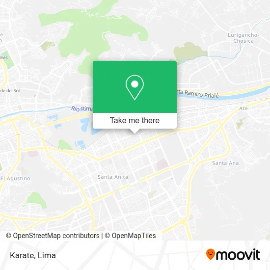
See Karate, Santa Anit, on the map
Public Transit to Karate in Santa Anit
Wondering how to get to Karate in Santa Anit? Moovit helps you find the best way to get to Karate with step-by-step directions from the nearest public transit station.
Moovit provides free maps and live directions to help you navigate through your city. View schedules, routes, timetables, and find out how long does it take to get to Karate in real time.
Looking for the nearest stop or station to Karate? Check out this list of stops closest to your destination: Huarochirí; Tortelin Metropolitana Santa Anita; Avenida Ferrocarril & Huarochirí; Estacion Ovalo Santa Anita.
Bus: 1075, 1279, 1285, ICR14, 1223, 1359, 1065, 1078, 1084, 1177, 1194, 1269, 1272, 1305, 1356.Metro: LINEA 2.
Want to see if there’s another route that gets you there at an earlier time? Moovit helps you find alternative routes or times. Get directions from and directions to Karate easily from the Moovit App or Website.
We make riding to Karate easy, which is why over 1.5 million users, including users in Santa Anit, trust Moovit as the best app for public transit. You don’t need to download an individual bus app or train app, Moovit is your all-in-one transit app that helps you find the best bus time or train time available.
For information on prices of bus, costs and ride fares to Karate, please check the Moovit app.
Use the app to navigate to popular places including to the airport, hospital, stadium, grocery store, mall, coffee shop, school, college, and university.
Karate Address: Avenida Los Chancas Residencial Los Pinos, 15009 Santa Anita street in Santa Anit
- Cisold,
- Mass Chancas 11,
- Cevicheria Isla Marina,
- El Encanto del Mar,
- Rg Calderas S.A.C.,
- Urbanización Los Pinos,
- Residencial Los Pinos,
- Grifo Los Pinos,
- Bodega La Cusqueñita,
- Huarochirí & Avenida Los Chancas,
- Comercial Virgen de Natividad,
- Avenida Huarochiri,
- Avenida Huarochiri & Avenida Los Chancas,
- Turismo Levita,
- I. E. P. Wonderful Stars,
- Melaminas Laurente,
- Calle Sol de Oro 184 Of. 2 Piso Coop. Chancas de Andahuaylas,
- Iei Semillas del Saber,
- Institución Educativa Inicial Semillitas Del Saber,
- Calle Vincent Van Gogh Cdra Uno
Places Near Karate (Santa Anit)
- Miraflores, Miraflores,
- Mall Del Sur,
- Barranco, Barranco,
- Circuito Mágico Del Agua, Lima,
- Hospital Edgardo Rebagliati Martins, Jesus Mari,
- Real Plaza Puruchuco, Ate,
- Pontificia Universidad Católica del Perú - PUCP, San Miguel,
- Jockey Plaza, Santiago D,
- Av. La Marina, San Miguel,
- Av. Abancay, Lima,
- Plaza San Miguel, San Miguel,
- av arequipa, Lima,
- Parque de las Leyendas, San Miguel,
- Gamarra,
- Paradero Av.Brasil,
- Parque Kennedy, Miraflores,
- Larcomar, Miraflores,
- Av. Salaverry, Jesus Mari,
- Centro Comercial Plaza Norte, Independen,
- Aeropuerto Internacional Jorge Chávez, Ventanilla
How to get to popular places in Lima with public transit
Get around Santa Anit by public transit!
Traveling around Santa Anit has never been so easy. See step by step directions as you travel to any attraction, street or major public transit station. View bus and train schedules, arrival times, service alerts and detailed routes on a map, so you know exactly how to get to anywhere in Santa Anit.
When traveling to any destination around Santa Anit use Moovit's Live Directions with Get Off Notifications to know exactly where and how far to walk, how long to wait for your line, and how many stops are left. Moovit will alert you when it's time to get off — no need to constantly re-check whether yours is the next stop.
Wondering how to use public transit in Santa Anit or how to pay for public transit in Santa Anit? Moovit public transit app can help you navigate your way with public transit easily, and at minimum cost. It includes public transit fees, ticket prices, and costs. Looking for a map of Santa Anit public transit lines? Moovit public transit app shows all public transit maps in Santa Anit with all Bus, Metro and Ferry routes and stops on an interactive map.
Lima has 3 transit type(s), including: Bus, Metro and Ferry, operated by several transit agencies, including Metro de Lima Línea 2 , Metro de Lima, Corredor Rojo, Metropolitano, Metropolitano - Alimentadores, Corredor Morado, Corredor Azul, Rutas Tradicionales, Transportes y Servicios La Esperanza S.A., Las Flores S.A., Virgen de la Asunción S.A., Consorcio HAM, Transportes y Service Canadá S.A., ETUL4SA and ETUCHISA