How to get to Kasapoglu by bus?
Click on the bus route to see step by step directions with maps, line arrival times and updated time schedules.
From Gaziosmanpaşa Eğitim Ve Araştırma Hastanesi, Gaziosmanpasa
127 minFrom 212 Outlet, Bagcilar
69 minFrom İstanbul Ulaşım, Esenler
93 minFrom Kuyumcukent, Bahçelievler
54 minFrom VEGA Avm İstanbul, Sultangazi
146 minFrom Sefaköy, Küçükçekmece
72 minFrom 303B Silivri Cezaevi Esenler Otogar iett hattı, Bayrampasa
107 minFrom Lolita Fatmanın Kerhanesi Ve Zevk Merkezi, Bagcilar
84 minFrom Tekstilkent Metro İstasyonu, Esenler
86 minFrom Sari sapkali minibusun 1 kilometrelik kuyrugu, Küçükçekmece
73 min
How to get to Kasapoglu by metro?
Click on the metro route to see step by step directions with maps, line arrival times and updated time schedules.
From Gaziosmanpaşa Eğitim Ve Araştırma Hastanesi, Gaziosmanpasa
48 minFrom 212 Outlet, Bagcilar
43 minFrom İstanbul Ulaşım, Esenler
49 minFrom Kuyumcukent, Bahçelievler
59 minFrom VEGA Avm İstanbul, Sultangazi
67 minFrom 303B Silivri Cezaevi Esenler Otogar iett hattı, Bayrampasa
52 minFrom Lolita Fatmanın Kerhanesi Ve Zevk Merkezi, Bagcilar
49 minFrom Tekstilkent Metro İstasyonu, Esenler
33 min
Bus stops near Kasapoglu in Basaksehir
Dolmus & Minibus station near Kasapoglu in Basaksehir
- Tümsan 1. Kısım Sanayi Sitesi, 9 min walk,VIEW
Metro station near Kasapoglu in Basaksehir
- Başak Konutları, 10 min walk,VIEW
Bus lines to Kasapoglu in Basaksehir
- A31, Şirinevler,VIEW
- A46, Başakşehir,VIEW
- 76O, Cihangir Mahallesi-Otogar,VIEW
- 78ZB, Fenertepe Peronlar-Zeytinburnu,VIEW
- 79Ş, Dolapdere Sanayi Sitesi-İgtot,VIEW
- 98, Bakırköy-Fenertepe Peronlar,VIEW
- 98KM, Fenertepe Peronlar-Fenertepe Yolu,VIEW
- 143, İstoç-Mehmet Akif İnan İmam Hatip Ortaokulu,VIEW
- 78E, Kayabaşı Kiptaş Peron-Fenertepe Peronlar,VIEW
- 78F, Başakşehir Metrokent-Fenertepe Peronlar,VIEW
- A47, Kayaşehir,VIEW
- 78C, Su Kemeri-Fenertepe Peronlar,VIEW
- 79E, Kayabaşı Kiptaş Peron-Eminönü,VIEW
- 146B, Başakşehir Metrokent-Eminönü,VIEW
- 146M, Birlik Mahallesi-Başakşehir Metrokent,VIEW
What are the closest stations to Kasapoglu?
The closest stations to Kasapoglu are:
- Başakşehir Yolu - İkitelli-Başakşehir Yönü is 53 meters away, 1 min walk.
- Yarenler Sokak - Fenertepe Yönü is 468 meters away, 7 min walk.
- Tümsan 1. Kısım Sanayi Sitesi is 678 meters away, 9 min walk.
- Dörtyol - İkitelli Garajı Yönü is 713 meters away, 10 min walk.
- Başak Konutları is 721 meters away, 10 min walk.
Which bus lines stop near Kasapoglu?
These bus lines stop near Kasapoglu: 79E, 98, 98KM.
Which metro line stops near Kasapoglu?
M3 (Bakırköy Sahil→Kayaşehir Merkez)
Which Dolmus & Minibus line stops near Kasapoglu?
A31 (Başakşehir Çam Sakura Şehir Hastanesi)
What’s the nearest metro station to Kasapoglu in Basaksehir?
The nearest metro station to Kasapoglu in Basaksehir is Başak Konutları. It’s a 10 min walk away.
What’s the nearest bus station to Kasapoglu in Basaksehir?
The nearest bus station to Kasapoglu in Basaksehir is Başakşehir Yolu - İkitelli-Başakşehir Yönü. It’s a 1 min walk away.
What’s the nearest Dolmus & Minibus station to Kasapoglu in Basaksehir?
The nearest Dolmus & Minibus station to Kasapoglu in Basaksehir is Tümsan 1. Kısım Sanayi Sitesi. It’s a 9 min walk away.
What time is the first metro to Kasapoglu in Basaksehir?
The M3 is the first metro that goes to Kasapoglu in Basaksehir. It stops nearby at 6:12 AM.
What time is the last metro to Kasapoglu in Basaksehir?
The M3 is the last metro that goes to Kasapoglu in Basaksehir. It stops nearby at 12:30 AM.
What time is the first bus to Kasapoglu in Basaksehir?
The 98 is the first bus that goes to Kasapoglu in Basaksehir. It stops nearby at 6:01 AM.
What time is the last bus to Kasapoglu in Basaksehir?
The 98 is the last bus that goes to Kasapoglu in Basaksehir. It stops nearby at 1:28 AM.
What time is the first Dolmus & Minibus to Kasapoglu in Basaksehir?
The A48 is the first Dolmus & Minibus that goes to Kasapoglu in Basaksehir. It stops nearby at 6:03 AM.
What time is the last Dolmus & Minibus to Kasapoglu in Basaksehir?
The A46 is the last Dolmus & Minibus that goes to Kasapoglu in Basaksehir. It stops nearby at 1:37 AM.
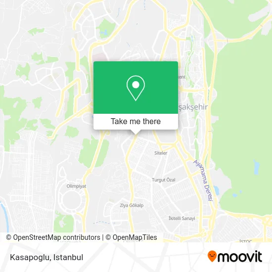
See Kasapoglu, Basaksehir, on the map
Public Transit to Kasapoglu in Basaksehir
Wondering how to get to Kasapoglu in Basaksehir? Moovit helps you find the best way to get to Kasapoglu with step-by-step directions from the nearest public transit station.
Moovit provides free maps and live directions to help you navigate through your city. View schedules, routes, timetables, and find out how long does it take to get to Kasapoglu in real time.
Looking for the nearest stop or station to Kasapoglu? Check out this list of stops closest to your destination: Başakşehir Yolu - İkitelli-Başakşehir Yönü; Yarenler Sokak - Fenertepe Yönü; Tümsan 1. Kısım Sanayi Sitesi; Dörtyol - İkitelli Garajı Yönü; Başak Konutları.
Bus: 79E, 98, 98KM, A31, A46, 76O, 78ZB, 79Ş, 78E, 78F, A47, 78C, 146B, 146M.Metro: M3.Dolmus & Minibus: A31, A47, A48.
Want to see if there’s another route that gets you there at an earlier time? Moovit helps you find alternative routes or times. Get directions from and directions to Kasapoglu easily from the Moovit App or Website.
We make riding to Kasapoglu easy, which is why over 1.5 million users, including users in Basaksehir, trust Moovit as the best app for public transit. You don’t need to download an individual bus app or train app, Moovit is your all-in-one transit app that helps you find the best bus time or train time available.
For information on prices of metro, bus, Dolmus & Minibus and Metrobus, costs and ride fares to Kasapoglu, please check the Moovit app.
Use the app to navigate to popular places including to the airport, hospital, stadium, grocery store, mall, coffee shop, school, college, and university.
Kasapoglu Address: Hürriyet Bulvarı, 34480 Başakşehir Mahallesi, Başakşehir street in Basaksehir
- Bodur Oto Boya,
- Inciajansreklam,
- Taş Ocağı Yolu,
- Mir Paslanmaz,
- Aydınplastik Limited Şti.,
- Taşoluk Yolu Sokak, 2,
- Telci Makina Sanayi Dış Ticaret Limited Şti.,
- Yüksel Torna L.S.,
- İkitelli OSB Tormak San. Sit.,
- Sancak Makina Sanayi Tic.Ltd.Şti.,
- Ena Agent,
- Özverler Resim Ve Çerçeve,
- Tormak Sanayi Sitesi Ustun Makina,
- basaksehir bulvari,
- Namık Sönmez Mescidi,
- Dora Sac Metal Oksijen Kesim Plazma Kesim Kalın Sac Satışı İkitelli,
- Adell Armatur ve Vana Fabrikalari A.S.,
- Başakşehir Yolu İETT Durağı,
- Kangaroo Kids - Alter Kalıp,
- Hürriyet Bulvarı
Places Near Kasapoglu (Basaksehir)
- Beylikdüzü - 4 Nolu Minibüs Hattı, Beylikduzu,
- Mall Of İstanbul, Basaksehir,
- 2 Nolu Minibüss, Beylikduzu,
- Şehit Prof. Dr. İlhan Varank Eğitim Ve Araştırma Hastanesi, Sancaktepe,
- İstanbul,
- VİALAND AVM, Eyüp,
- Bakırköy Sosyete Pazarı, Bakirköy,
- Karaköy Genelevi, Karaköy, Beyoğlu,
- 212 AVM, Bagcilar,
- Tersane İstanbul, Beyoğlu,
- METROPOL IsTaNBuL, Ataşehir,
- Gebze-Harem Minibüs Hattı, Gebze,
- İstinye Park, Sariyer,
- Topkule Kışlası 47.Komando Tugay Komutanlığı, Esenler,
- 41 Burda AVM, Kocaeli Merkezi,
- Gebze Koop Durağı, Gebze,
- Hz. Yuşa Tepesi, Beykoz,
- Hilltown AVM, Maltepe,
- Mehmet Emin Tokadî Hz. Türbesi, Fatih,
- Başakşehir Çam Ve Sakura Şehir Hastanesi, Basaksehir
How to get to popular places in Istanbul with public transit
Get around Basaksehir by public transit!
Traveling around Basaksehir has never been so easy. See step by step directions as you travel to any attraction, street or major public transit station. View bus and train schedules, arrival times, service alerts and detailed routes on a map, so you know exactly how to get to anywhere in Basaksehir.
When traveling to any destination around Basaksehir use Moovit's Live Directions with Get Off Notifications to know exactly where and how far to walk, how long to wait for your line, and how many stops are left. Moovit will alert you when it's time to get off — no need to constantly re-check whether yours is the next stop.
Wondering how to use public transit in Basaksehir or how to pay for public transit in Basaksehir? Moovit public transit app can help you navigate your way with public transit easily, and at minimum cost. It includes public transit fees, ticket prices, and costs. Looking for a map of Basaksehir public transit lines? Moovit public transit app shows all public transit maps in Basaksehir with all Bus, Train, Metro, Tram, Ferry, Metrobus and Dolmus & Minibus routes and stops on an interactive map.
Istanbul has 7 transit type(s), including: Bus, Train, Metro, Tram, Ferry, Metrobus and Dolmus & Minibus, operated by several transit agencies, including Marmaray, Metro İstanbul, Metrobüs, UAB, İETT, İETT ÇIFT KATLI HATLAR, İETT BÖLGESEL HATLAR, TCDD, Şehir Hatları, Dentur Avrasya, Beyden, Turyol, Mavi Marmara, Havaist and Prenstur
