How to get to Kaye S by bus?
Click on the bus route to see step by step directions with maps, line arrival times and updated time schedules.
From Millie’S, Washington
109 minFrom Embassy of France, Washington
82 minFrom Walmart, Fairfax County
44 minFrom Calvert St NW, Washington
94 minFrom The Westin Arlington Gateway, Arlington County
35 minFrom Georgetown University, Washington
62 minFrom Healy Lawn, Georgetown University, Washington
62 minFrom Glover Park, Washington
93 minFrom Hyatt Place-Arlington Courthouse Plaza (Hyatt Place Arlington/Courthouse Plaza), Arlington County
48 minFrom Deloitte, Arlington County
50 min
How to get to Kaye S by metro?
Click on the metro route to see step by step directions with maps, line arrival times and updated time schedules.
From Millie’S, Washington
75 minFrom Walmart, Fairfax County
35 minFrom The Westin Arlington Gateway, Arlington County
25 minFrom Georgetown University, Washington
48 minFrom Healy Lawn, Georgetown University, Washington
48 minFrom Hyatt Place-Arlington Courthouse Plaza (Hyatt Place Arlington/Courthouse Plaza), Arlington County
31 minFrom Deloitte, Arlington County
30 min
Bus stops near Kaye S in Falls Church
Metro stations near Kaye S in Falls Church
What are the closest stations to Kaye S?
The closest stations to Kaye S are:
- Haycock Rd+Mustang Aly is 174 yards away, 3 min walk.
- Metro West Falls Ch/Vt-Uva S Bay C is 762 yards away, 9 min walk.
- West Falls Church-Vt is 5044 yards away, 60 min walk.
- East Falls Church is 5130 yards away, 60 min walk.
Which bus line stops near Kaye S?
F20 (East To King St-Old Town)
Which metro line stops near Kaye S?
ORANGE (Vienna)
What’s the nearest bus station to Kaye S in Falls Church?
The nearest bus station to Kaye S in Falls Church is Haycock Rd+Mustang Aly. It’s a 3 min walk away.
What time is the first metro to Kaye S in Falls Church?
The ORANGE is the first metro that goes to Kaye S in Falls Church. It stops nearby at 5:04 AM.
What time is the last metro to Kaye S in Falls Church?
The SILVER is the last metro that goes to Kaye S in Falls Church. It stops nearby at 12:39 AM.
What time is the first bus to Kaye S in Falls Church?
The F20 is the first bus that goes to Kaye S in Falls Church. It stops nearby at 4:55 AM.
What time is the last bus to Kaye S in Falls Church?
The F20 is the last bus that goes to Kaye S in Falls Church. It stops nearby at 2:07 AM.
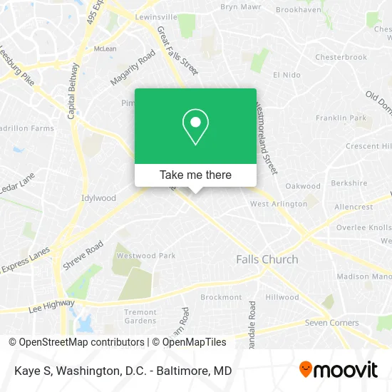
See Kaye S, Falls Church, on the map
Public Transit to Kaye S in Falls Church
Wondering how to get to Kaye S in Falls Church? Moovit helps you find the best way to get to Kaye S with step-by-step directions from the nearest public transit station.
Moovit provides free maps and live directions to help you navigate through your city. View schedules, routes, timetables, and find out how long does it take to get to Kaye S in real time.
Looking for the nearest stop or station to Kaye S? Check out this list of stops closest to your destination: Haycock Rd+Mustang Aly; Metro West Falls Ch/Vt-Uva S Bay C; West Falls Church-Vt; East Falls Church.
Bus: F20, 703.Metro: ORANGE, SILVER.
Want to see if there’s another route that gets you there at an earlier time? Moovit helps you find alternative routes or times. Get directions from and directions to Kaye S easily from the Moovit App or Website.
We make riding to Kaye S easy, which is why over 1.5 million users, including users in Falls Church, trust Moovit as the best app for public transit. You don’t need to download an individual bus app or train app, Moovit is your all-in-one transit app that helps you find the best bus time or train time available.
For information on prices of bus and metro, costs and ride fares to Kaye S, please check the Moovit app.
Use the app to navigate to popular places including to the airport, hospital, stadium, grocery store, mall, coffee shop, school, college, and university.
Kaye S Address: 124 Haycock Rd Falls Church, VA 22046 street in Falls Church
- Coinstar,
- Shell,
- Inova-Gohealth Urgent Care,
- Vineyard Voyages,
- US Wushu Academy,
- Birch & Broad Shopping Center,
- Prime Time Baseball,
- Board Hound,
- Occoquan Regional Park,
- Fairfax, VA / Broad St,
- Travel Horizons,
- Lovesac,
- Bad Girls Entertainment,
- Federal Armored Express,
- Kirchenbauer Financial Management & Consulting,
- Transport and Tours,
- Leonardo Sarli,
- Robbins Dustin,
- Chabad Luvavitch of Alexandria,
- Flippin Pizza
Places Near Kaye S (Falls Church)
- Washington National Cathedral, Washington,
- The Anthem, Washington,
- Warner Theatre, Washington,
- Westfield Montgomery Mall, Montgomery County,
- National Museum of African American History and Culture, Washington,
- PG Mall, Prince George's County,
- Museum Of The Bible, Washington,
- M&T Bank Stadium, Baltimore,
- Camden Yards, Baltimore,
- Rock Creek Tennis Center, Washington,
- Capital One Arena, Washington,
- National Mall, Washington,
- Marriott Marquis Washington, DC, Washington,
- Basilica of the National Shrine, Washington,
- Washington DC VA Medical Center, Washington,
- Sibley Memorial Hospital, Washington,
- Pennsylvania Ave NW (3rd st and pennsylvania), Washington,
- National Zoo, Washington,
- Amazon Hq2, Arlington County,
- Georgetown, Washington
How to get to popular places in Washington, D.C. - Baltimore, MD with public transit
Get around Falls Church by public transit!
Traveling around Falls Church has never been so easy. See step by step directions as you travel to any attraction, street or major public transit station. View bus and train schedules, arrival times, service alerts and detailed routes on a map, so you know exactly how to get to anywhere in Falls Church.
When traveling to any destination around Falls Church use Moovit's Live Directions with Get Off Notifications to know exactly where and how far to walk, how long to wait for your line, and how many stops are left. Moovit will alert you when it's time to get off — no need to constantly re-check whether yours is the next stop.
Wondering how to use public transit in Falls Church or how to pay for public transit in Falls Church? Moovit public transit app can help you navigate your way with public transit easily, and at minimum cost. It includes public transit fees, ticket prices, and costs. Looking for a map of Falls Church public transit lines? Moovit public transit app shows all public transit maps in Falls Church with all Bus, Train, Metro, Light Rail and Ferry routes and stops on an interactive map.
Washington, D.C. - Baltimore, MD has 5 transit type(s), including: Bus, Train, Metro, Light Rail and Ferry, operated by several transit agencies, including WMATA, Montgomery County Ride On, Fairfax Connector, TheBus, PRTC, DASH - Alexandria, Arlington Transit (ART), RTA of Central Maryland, MDOT MTA, MDOT MTA Light RailLink, MDOT MTA Commuter Bus, MDOT MTA Local Bus, FXBGO!, Virginia Railway Express (VRE) and MARC