Directions to Kaylane Modas (Sítio Cercado) with public transportation
The following transit lines have routes that pass near Kaylane Modas
How to get to Kaylane Modas by bus?
Click on the bus route to see step by step directions with maps, line arrival times and updated time schedules.
From Rua Arthur Martins Franco, Cic
66 minFrom Avenida das Torres, São José Dos Pinhais
50 minFrom Jardim das Américas, Jardim Das Américas
61 minFrom Rua Paulino de Siqueira Cortês, São José Dos Pinhais
51 minFrom Carrefour Hipermercado Parolim, Prado Velho
60 minFrom Rua João Bettega, Cic
52 minFrom Rua Engenheiro José B. Muniz de Queiroz, Cic
59 minFrom Hospital Vitória, Cic
51 minFrom Hospital e Maternidade São José, São José Dos Pinhais
63 minFrom Rua Castro 417, Água Verde
60 min
Bus stops near Kaylane Modas in Sítio Cercado
Bus lines to Kaylane Modas in Sítio Cercado
- 541 BAIRRO NOVO A, Terminal Sítio Cercado ↺ Bairro Novo A (Circular),VIEW
- Y95 FAZENDA / SÍTIO CERCADO, FAZENDA / SÍTIO CERCADO,VIEW
- 524 BAIRRO NOVO B / C, BAIRRO NOVO B / C,VIEW
- 528 BOQUEIRÃO / PINHEIRINHO, BOQUEIRÃO / PINHEIRINHO,VIEW
- 542 BAIRRO NOVO B, BAIRRO NOVO B,VIEW
- 548 OSTERNACK / SÍTIO CERCADO, OSTERNACK / SÍTIO CERCADO,VIEW
- 549 MAD. BAIRRO NOVO, MAD. BAIRRO NOVO,VIEW
- 552 SAMBAQUI, SAMBAQUI,VIEW
- 553 MORADIAS PARQUE IGUAÇU, MORADIAS PARQUE IGUAÇU,VIEW
- 506 BAIRRO NOVO, Osternack → Praça Rui Barbosa,VIEW
- 520 OSTERNACK / SÍTIO CERCADO (LD), Terminal Sítio Cercado → Osternack,VIEW
What are the closest stations to Kaylane Modas?
The closest stations to Kaylane Modas are:
- Rua São José Dos Pinhais, 1752 is 132 meters away, 2 min walk.
- R. Tijucas Do Sul, 378 is 445 meters away, 6 min walk.
- Centro Médico Comunitário Bairro Novo is 533 meters away, 7 min walk.
Which bus lines stop near Kaylane Modas?
These bus lines stop near Kaylane Modas: 506 BAIRRO NOVO, 528 BOQUEIRÃO / PINHEIRINHO, 541 BAIRRO NOVO A.
What’s the nearest bus station to Kaylane Modas in Sítio Cercado?
The nearest bus station to Kaylane Modas in Sítio Cercado is Rua São José Dos Pinhais, 1752. It’s a 2 min walk away.
What time is the first bus to Kaylane Modas in Sítio Cercado?
The 549 MAD. BAIRRO NOVO is the first bus that goes to Kaylane Modas in Sítio Cercado. It stops nearby at 3:56 AM.
What time is the last bus to Kaylane Modas in Sítio Cercado?
The 549 MAD. BAIRRO NOVO is the last bus that goes to Kaylane Modas in Sítio Cercado. It stops nearby at 2:53 AM.
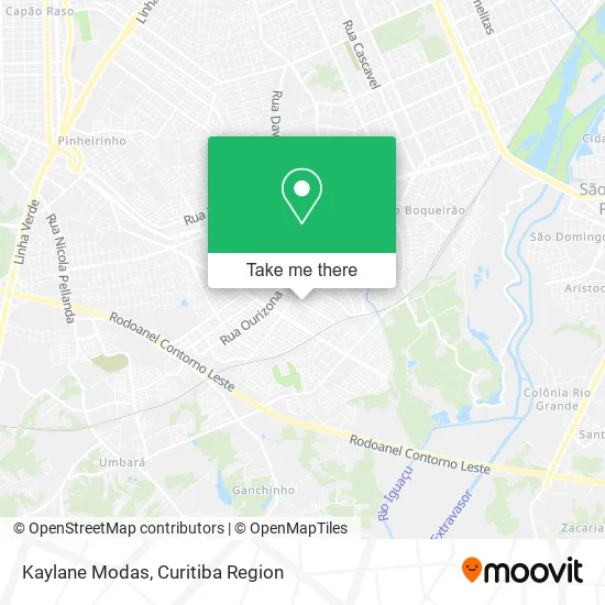
See Kaylane Modas, Sítio Cercado, on the map
Public Transit to Kaylane Modas in Sítio Cercado
Wondering how to get to Kaylane Modas in Sítio Cercado? Moovit helps you find the best way to get to Kaylane Modas with step-by-step directions from the nearest public transit station.
Moovit provides free maps and live directions to help you navigate through your city. View schedules, routes, timetables, and find out how long does it take to get to Kaylane Modas in real time.
Looking for the nearest stop or station to Kaylane Modas? Check out this list of stops closest to your destination: Rua São José Dos Pinhais; R. Tijucas Do Sul; Centro Médico Comunitário Bairro Novo.
Bus: 506 BAIRRO NOVO, 528 BOQUEIRÃO / PINHEIRINHO, 541 BAIRRO NOVO A, Y95 FAZENDA / SÍTIO CERCADO, 524 BAIRRO NOVO B / C, 542 BAIRRO NOVO B, 548 OSTERNACK / SÍTIO CERCADO, 520 OSTERNACK / SÍTIO CERCADO (LD).
Want to see if there’s another route that gets you there at an earlier time? Moovit helps you find alternative routes or times. Get directions from and directions to Kaylane Modas easily from the Moovit App or Website.
We make riding to Kaylane Modas easy, which is why over 1.5 million users, including users in Sítio Cercado, trust Moovit as the best app for public transit. You don’t need to download an individual bus app or train app, Moovit is your all-in-one transit app that helps you find the best bus time or train time available.
For information on prices of bus, costs and ride fares to Kaylane Modas, please check the Moovit app.
Use the app to navigate to popular places including to the airport, hospital, stadium, grocery store, mall, coffee shop, school, college, and university.
Kaylane Modas Address: Rua São José dos Pinhais, 1779 Sítio Cercado Curitiba-PR 81920-250 street in Sítio Cercado
- Teds Beer II,
- Casa do Ipi Curitiba,
- Restaurante Maxxgrill,
- Dom Henrique Sabores,
- Rangoo Comida de Boteco,
- Loja Guma Presentes,
- Brinkmix,
- d'Lanne Fashion,
- Zamban Tech,
- Lov'Dy,
- Camila Beauty Hair,
- Kv Restaurante,
- Casa Nordestina Comercio de Produtos Naturais,
- Locadora Play,
- Ótica Vimais,
- Senff *,
- Star PE Calçados,
- Vitoria,
- Moto Pecas Cislinski,
- Zero 41 Moto Parts
Places Near Kaylane Modas (Sítio Cercado)
- Campo Largo, Campo,
- Hospital Erasto Gaertner, Jardim Das Américas,
- Hospital do Rocio, Campo,
- Hhhhh, Fazendinha,
- Pontifícia Universidade Católica do Paraná (PUCPR), Prado Velho,
- Hospital de Clínicas (HC - UFPR), Centro,
- Park Shopping Barigüi, Mossunguê,
- Rua General Mário Tourinho, Campina Do Siqueira,
- Shopping Estação, Rebouças,
- Hospital Universitário Evangélico de Curitiba, Bigorrilho,
- Jockey Plaza Shopping Center, Tarumã,
- Parque Barigui, Mercês,
- Hospital Angelina Caron, Campina Grande Do Sul,
- Jardim Botânico de Curitiba PR, Centro,
- Hospital Da Cruz Vermelha, Batel,
- Rua Martim Afonso 558, Mercês,
- Hospital Madalena Sofia, Bairro Alto,
- Hospital Nossa Senhora Das Graças, Mercês,
- Arena Da Baixada - Curitiba,
- Shopping Palladium, Portão
How to get to popular places in Curitiba Region with public transit
Get around Sítio Cercado by public transit!
Traveling around Sítio Cercado has never been so easy. See step by step directions as you travel to any attraction, street or major public transit station. View bus and train schedules, arrival times, service alerts and detailed routes on a map, so you know exactly how to get to anywhere in Sítio Cercado.
When traveling to any destination around Sítio Cercado use Moovit's Live Directions with Get Off Notifications to know exactly where and how far to walk, how long to wait for your line, and how many stops are left. Moovit will alert you when it's time to get off — no need to constantly re-check whether yours is the next stop.
Wondering how to use public transit in Sítio Cercado or how to pay for public transit in Sítio Cercado? Moovit public transit app can help you navigate your way with public transit easily, and at minimum cost. It includes public transit fees, ticket prices, and costs. Looking for a map of Sítio Cercado public transit lines? Moovit public transit app shows all public transit maps in Sítio Cercado with all Bus and Cable Car routes and stops on an interactive map.
Curitiba Region has 2 transit type(s), including: Bus and Cable Car, operated by several transit agencies, including Sistema Integrado de Mobilidade (URBS), Sistema Integrado de Mobilidade (AMEP), URBS (Cartões bancários e Dinheiro), URBS (Cartões bancários / Cartão URBS), AMEP (Cartões bancários / Cartão MetroCard), AMEP (Cartões bancários / Cartão MetroCard / Dinheiro), Viação Colombo (Dinheiro), TRIAR (Cartão TRIAR / Dinheiro), Empresa Curitiba Cerro Azul (Dinheiro), Expresso Nossa Senhora da Penha (Dinheiro), Empresa Campo Alto Tijucas (Dinheiro), Auto Viação São José (Cartão VEM / Dinheiro), BRT S/A (Cartão VEM / Dinheiro), TransPiedade (Cartão Cidadão / Dinheiro) and Oceânica Sul (Cartão Transporte / Dinheiro)