How to get to Kelley Performance by bus?
Click on the bus route to see step by step directions with maps, line arrival times and updated time schedules.
From Florida Turnpike Sunrise Blvd. Toll Plaza, Plantation
64 minFrom Memorial Regional Hospital, Hollywood
62 minFrom Fort Lauderdale airport terminal 3 Jet Blue, Hollywood
46 minFrom Hollywood Beach-Broadwalk, Hollywood
91 minFrom DRV PNK Stadium, Fort Lauderdale
55 minFrom Joe Dimaggio Children's Hospital, Hollywood
60 minFrom The Red Light District, Fort Lauderdale
56 minFrom Hollywood, Florida, Hollywood
63 minFrom Inter Miami CF, Fort Lauderdale
56 minFrom Oakwood Plaza, Hollywood
48 min
How to get to Kelley Performance by train?
Click on the train route to see step by step directions with maps, line arrival times and updated time schedules.
Bus stops near Kelley Performance in Fort Lauderdale
Ferry station near Kelley Performance in Fort Lauderdale
- Riverfront Plaza, 22 min walk,VIEW
Bus lines to Kelley Performance in Fort Lauderdale
What are the closest stations to Kelley Performance?
The closest stations to Kelley Performance are:
- Southwest 4th Avenue/Southwest 14th Court is 364 yards away, 5 min walk.
- Davie Boulevard/Southwest 4th Avenue is 538 yards away, 7 min walk.
- Andrews Avenue/Southeast 14th Street is 662 yards away, 8 min walk.
- Southeast 3rd Avenue/Southeast 14th Street is 1254 yards away, 15 min walk.
- Riverfront Plaza is 1788 yards away, 22 min walk.
Which bus line stops near Kelley Performance?
06 (Hallandale Via Tri-Rail)
Which train line stops near Kelley Performance?
BLFM (Wpt)
What’s the nearest bus station to Kelley Performance in Fort Lauderdale?
The nearest bus station to Kelley Performance in Fort Lauderdale is Southwest 4th Avenue/Southwest 14th Court. It’s a 5 min walk away.
What’s the nearest ferry station to Kelley Performance in Fort Lauderdale?
The nearest ferry station to Kelley Performance in Fort Lauderdale is Riverfront Plaza. It’s a 22 min walk away.
What time is the first bus to Kelley Performance in Fort Lauderdale?
The 01 is the first bus that goes to Kelley Performance in Fort Lauderdale. It stops nearby at 5:12 AM.
What time is the last bus to Kelley Performance in Fort Lauderdale?
The 01 is the last bus that goes to Kelley Performance in Fort Lauderdale. It stops nearby at 11:20 PM.
What time is the first ferry to Kelley Performance in Fort Lauderdale?
The WATER TROLLEY is the first ferry that goes to Kelley Performance in Fort Lauderdale. It stops nearby at 10:05 AM.
What time is the last ferry to Kelley Performance in Fort Lauderdale?
The WATER TROLLEY is the last ferry that goes to Kelley Performance in Fort Lauderdale. It stops nearby at 10:15 PM.
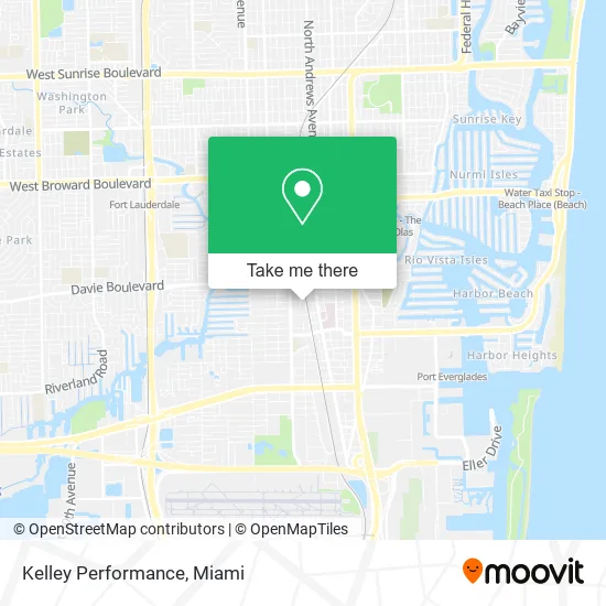
See Kelley Performance, Fort Lauderdale, on the map
Public Transit to Kelley Performance in Fort Lauderdale
Wondering how to get to Kelley Performance in Fort Lauderdale? Moovit helps you find the best way to get to Kelley Performance with step-by-step directions from the nearest public transit station.
Moovit provides free maps and live directions to help you navigate through your city. View schedules, routes, timetables, and find out how long does it take to get to Kelley Performance in real time.
Looking for the nearest stop or station to Kelley Performance? Check out this list of stops closest to your destination: Southwest 4th Avenue/Southwest 14th Court; Davie Boulevard/Southwest 4th Avenue; Andrews Avenue/Southeast 14th Street; Southeast 3rd Avenue/Southeast 14th Street; Riverfront Plaza.
Bus: 06, 30, 40, 01.Train: BLFM.Ferry: WATER TROLLEY.
Want to see if there’s another route that gets you there at an earlier time? Moovit helps you find alternative routes or times. Get directions from and directions to Kelley Performance easily from the Moovit App or Website.
We make riding to Kelley Performance easy, which is why over 1.5 million users, including users in Fort Lauderdale, trust Moovit as the best app for public transit. You don’t need to download an individual bus app or train app, Moovit is your all-in-one transit app that helps you find the best bus time or train time available.
For information on prices of bus and train, costs and ride fares to Kelley Performance, please check the Moovit app.
Use the app to navigate to popular places including to the airport, hospital, stadium, grocery store, mall, coffee shop, school, college, and university.
Kelley Performance Address: 204 SW 14th St Fort Lauderdale, FL 33315 street in Fort Lauderdale
- Aai Golf Cart Transport,
- J and D Diesel,
- Snapbox Self Storage,
- Compass Logistics & Marine,
- FLL Crossfit,
- Grate Ideas of America, LLC,
- DK International Associates Inc,
- Silescent Lighting Super Efficient,
- Agro Arms,
- Longbow Marine,
- Martenson Performance LLC,
- Trauma and Crime Scene Cleanup,
- Blower Door Testing Pro,
- Rmi Services,
- Hector L di Carlo, MD, Pa,
- Authentic Medical Solutions Fort Lauderdale,
- Buchwald Tax Firm Pa,
- Antibes Yachtwear USA,
- Uback Construction,
- Temple Beth El-David Posnack Pre School
Places Near Kelley Performance (Fort Lauderdale)
- Dolphin Mall Bus, Miami,
- Miami Design District, Miami,
- Port of Miami Cruise Terminal, Miami,
- Brickell City Centre, Miami,
- Miami Freedom Park, Miami,
- Zoo Miami, Miami,
- Sawgrass mall ( FL ), Miami Beach,
- Miami VA Hospital, Miami,
- Aventura Mall, Miami,
- Little Havana, Miami,
- Richard E. Gerstein Justice Building, Miami,
- Miami-Dade County Courthouse, Miami,
- Bayside Marketplace, Miami,
- Hard Rock Stadium, Miami Gardens,
- Marlins Park, Miami,
- Wynwood, Miami,
- Sawgrass Mall, Miami,
- Dolphin Mall, Miami,
- Aventura Mall, Miami Beach,
- Keiser University Flagship Campus, West Palm Beach
How to get to popular places in Miami with public transit
Get around Fort Lauderdale by public transit!
Traveling around Fort Lauderdale has never been so easy. See step by step directions as you travel to any attraction, street or major public transit station. View bus and train schedules, arrival times, service alerts and detailed routes on a map, so you know exactly how to get to anywhere in Fort Lauderdale.
When traveling to any destination around Fort Lauderdale use Moovit's Live Directions with Get Off Notifications to know exactly where and how far to walk, how long to wait for your line, and how many stops are left. Moovit will alert you when it's time to get off — no need to constantly re-check whether yours is the next stop.
Wondering how to use public transit in Fort Lauderdale or how to pay for public transit in Fort Lauderdale? Moovit public transit app can help you navigate your way with public transit easily, and at minimum cost. It includes public transit fees, ticket prices, and costs. Looking for a map of Fort Lauderdale public transit lines? Moovit public transit app shows all public transit maps in Fort Lauderdale with all Bus, Train, Light Rail and Ferry routes and stops on an interactive map.
Miami has 4 transit type(s), including: Bus, Train, Light Rail and Ferry, operated by several transit agencies, including Broward County Transit, Miami-Dade Transit, Metrorail, Palm Tran, Tri-Rail, Brightline, MARTY, City of Homestead Trolley, Key West Transit, Treasure Coast Connector, GoLine IRT, Amtrak, Greyhound-us, FlixBus-us and Aventura Express Shuttle Bus