How to get to Kely Chic Makeup by bus?
Click on the bus route to see step by step directions with maps, line arrival times and updated time schedules.
From PNC Bank Arts Center, Holmdel
149 minFrom Linden, NJ, Linden
79 minFrom HUUHHHH??, Woodbridge
28 minFrom Baps Shri Swaminarayan Mandir, Edison, NJ, USA, Edison
67 minFrom Walmart, Linden
79 minFrom Staten Island, NY, Staten Island
175 minFrom South Ave, Staten Island
154 minFrom Highland Park, NJ, Highland Park
71 minFrom Staten Island Mall, Staten Island
151 minFrom Edison NJ, Edison
72 min
How to get to Kely Chic Makeup by train?
Click on the train route to see step by step directions with maps, line arrival times and updated time schedules.
Bus stops near Kely Chic Makeup in Perth Amboy
Train station near Kely Chic Makeup in Perth Amboy
- Perth Amboy, 49 min walk,VIEW
Bus lines to Kely Chic Makeup in Perth Amboy
What are the closest stations to Kely Chic Makeup?
The closest stations to Kely Chic Makeup are:
- Rector St at Smith St is 82 yards away, 2 min walk.
- Smith St at High St is 95 yards away, 2 min walk.
- High St at Smith St is 172 yards away, 3 min walk.
- Perth Amboy is 4154 yards away, 49 min walk.
Which bus lines stop near Kely Chic Makeup?
These bus lines stop near Kely Chic Makeup: 116, 48, 813.
Which train line stops near Kely Chic Makeup?
NJCL (Bay Head)
What’s the nearest bus station to Kely Chic Makeup in Perth Amboy?
The nearest bus stations to Kely Chic Makeup in Perth Amboy are Rector St at Smith St and Smith St at High St. The closest one is a 2 min walk away.
What time is the first train to Kely Chic Makeup in Perth Amboy?
The NJCL is the first train that goes to Kely Chic Makeup in Perth Amboy. It stops nearby at 4:37 AM.
What time is the last train to Kely Chic Makeup in Perth Amboy?
The NJCL is the last train that goes to Kely Chic Makeup in Perth Amboy. It stops nearby at 1:52 AM.
What time is the first bus to Kely Chic Makeup in Perth Amboy?
The 116 is the first bus that goes to Kely Chic Makeup in Perth Amboy. It stops nearby at 4:25 AM.
What time is the last bus to Kely Chic Makeup in Perth Amboy?
The 116 is the last bus that goes to Kely Chic Makeup in Perth Amboy. It stops nearby at 1:32 AM.
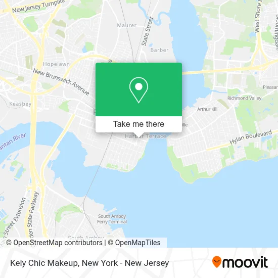
See Kely Chic Makeup, Perth Amboy, on the map
Public Transit to Kely Chic Makeup in Perth Amboy
Wondering how to get to Kely Chic Makeup in Perth Amboy? Moovit helps you find the best way to get to Kely Chic Makeup with step-by-step directions from the nearest public transit station.
Moovit provides free maps and live directions to help you navigate through your city. View schedules, routes, timetables, and find out how long does it take to get to Kely Chic Makeup in real time.
Looking for the nearest stop or station to Kely Chic Makeup? Check out this list of stops closest to your destination: Rector St at Smith St; Smith St at High St; High St at Smith St; Perth Amboy.
Bus: 116, 48, 813, 817, 815.Train: NJCL.
Want to see if there’s another route that gets you there at an earlier time? Moovit helps you find alternative routes or times. Get directions from and directions to Kely Chic Makeup easily from the Moovit App or Website.
We make riding to Kely Chic Makeup easy, which is why over 1.5 million users, including users in Perth Amboy, trust Moovit as the best app for public transit. You don’t need to download an individual bus app or train app, Moovit is your all-in-one transit app that helps you find the best bus time or train time available.
For information on prices of bus, train and subway, costs and ride fares to Kely Chic Makeup, please check the Moovit app.
Use the app to navigate to popular places including to the airport, hospital, stadium, grocery store, mall, coffee shop, school, college, and university.
Kely Chic Makeup Address: 59 Smith St street in Perth Amboy
- Vas Law,
- Carlos Chavarria Dmd,
- T-Mobile,
- Dentist Jaime Morales,
- Gm Solution Llc,
- First Care Chiropractic. Trenton, Perth Amboy, East Orange,
- 11vo Paso Aa,
- Lascano Atelier,
- De La Soul Aesthetics,
- George P. Smith,
- GPS of New Jersey MD PC,
- Calvary Chapel Perth Amboy,
- PRAHD Puerto Rican Association For Human Development,
- Terrazza Restaurant,
- KS Welding and Repair,
- Amazon Locker - Adrián,
- Drug Rehab Perth Amboy,
- Fpsweetsandmore,
- Prime & Petal,
- Td Bank Atm
Places Near Kely Chic Makeup (Perth Amboy)
- Mountainside Hospital, Glen Ridge,
- Wall Street, Manhattan,
- qqqq, Manhattan,
- Hudson Yards, Manhattan,
- Chinatown, Manhattan,
- Katz's Deli, Manhattan,
- 111 Centre New York City Supreme Court, Manhattan,
- Pier 83, Manhattan,
- 3 Stone St, Manhattan,
- Times Square, Manhattan,
- 1 Police Plaza, Manhattan,
- 26 Federal Plaza, Manhattan,
- 376 Hudson Street, Manhattan,
- SoHo, Manhattan,
- Rockefeller Center, Manhattan,
- 66 John Street, Manhattan,
- Bellevue Hospital, Manhattan,
- Queens Center Mall, Queens,
- San Gennaro Feast, Manhattan,
- 911 Memorial, Manhattan
How to get to popular places in New York - New Jersey with public transit
Get around Perth Amboy by public transit!
Traveling around Perth Amboy has never been so easy. See step by step directions as you travel to any attraction, street or major public transit station. View bus and train schedules, arrival times, service alerts and detailed routes on a map, so you know exactly how to get to anywhere in Perth Amboy.
When traveling to any destination around Perth Amboy use Moovit's Live Directions with Get Off Notifications to know exactly where and how far to walk, how long to wait for your line, and how many stops are left. Moovit will alert you when it's time to get off — no need to constantly re-check whether yours is the next stop.
Wondering how to use public transit in Perth Amboy or how to pay for public transit in Perth Amboy? Moovit public transit app can help you navigate your way with public transit easily, and at minimum cost. It includes public transit fees, ticket prices, and costs. Looking for a map of Perth Amboy public transit lines? Moovit public transit app shows all public transit maps in Perth Amboy with all Bus, Train, Subway, Light Rail, Ferry and Cable Car routes and stops on an interactive map.
New York - New Jersey has 6 transit type(s), including: Bus, Train, Subway, Light Rail, Ferry and Cable Car, operated by several transit agencies, including MTA Subway, Metro-North Railroad, LIRR, PATH, MTA New York City Transit - Express routes, MTA Bus, NJ Transit, NYC Ferry, NICE bus, Bee-Line Bus, NJ Transit Rail, Norwalk Transit District, Hartford Line, River Valley Transit and HART