How to get to Kenan Net by bus?
Click on the bus route to see step by step directions with maps, line arrival times and updated time schedules.
From Taspen, Kota Medan
31 minFrom Stasiun Belawan, Kota Medan
31 minFrom Amway Flagship Store, Kota Medan
31 minFrom SMA Negeri 2 Percut Sei Tuan Deli Serdang, Kota Medan
42 minFrom STM, Kota Medan
23 minFrom Kantor Taspen, Kota Medan
31 minFrom Klinik Pengobatan Alternatif Medical Herbal, Kota Medan
36 minFrom CV Lautan Anugerah Berkah Alam, Kota Medan
23 minFrom Terminal Penumpang Bandar Deli Pelabuhan Belawan, Kota Medan
25 minFrom Sinar Multi Anugrah. CV, Kota Medan
41 min
Bus stops near Kenan Net in Kota Medan
Bus lines to Kenan Net in Kota Medan
What are the closest stations to Kenan Net?
The closest stations to Kenan Net are:
- Jalan Marelan Vii, 15 is 107 meters away, 2 min walk.
- Jalan Platina Raya, No 193 is 274 meters away, 4 min walk.
- Jalan Marelan Raya, 11 is 524 meters away, 7 min walk.
Which bus lines stop near Kenan Net?
These bus lines stop near Kenan Net: 130, 17, 26, 53, 70.
What’s the nearest bus station to Kenan Net in Kota Medan?
The nearest bus station to Kenan Net in Kota Medan is Jalan Marelan Vii, 15. It’s a 2 min walk away.
What time is the first bus to Kenan Net in Kota Medan?
The 26 is the first bus that goes to Kenan Net in Kota Medan. It stops nearby at 5:35 AM.
What time is the last bus to Kenan Net in Kota Medan?
The 26 is the last bus that goes to Kenan Net in Kota Medan. It stops nearby at 8:14 PM.
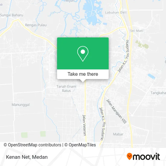
See Kenan Net, Kota Medan, on the map
Public Transit to Kenan Net in Kota Medan
Wondering how to get to Kenan Net in Kota Medan? Moovit helps you find the best way to get to Kenan Net with step-by-step directions from the nearest public transit station.
Moovit provides free maps and live directions to help you navigate through your city. View schedules, routes, timetables, and find out how long does it take to get to Kenan Net in real time.
Looking for the nearest stop or station to Kenan Net? Check out this list of stops closest to your destination: Jalan Marelan Vii; Jalan Platina Raya; Jalan Marelan Raya.
Bus: 130, 17, 26, 53, 70, 110, 118.
Want to see if there’s another route that gets you there at an earlier time? Moovit helps you find alternative routes or times. Get directions from and directions to Kenan Net easily from the Moovit App or Website.
We make riding to Kenan Net easy, which is why over 1.5 million users, including users in Kota Medan, trust Moovit as the best app for public transit. You don’t need to download an individual bus app or train app, Moovit is your all-in-one transit app that helps you find the best bus time or train time available.
For information on prices of bus, costs and ride fares to Kenan Net, please check the Moovit app.
Use the app to navigate to popular places including to the airport, hospital, stadium, grocery store, mall, coffee shop, school, college, and university.
Kenan Net Address: Jalan Marelan VII Medan 20245 street in Kota Medan
- Digit Photo,
- Pangkas Herman Jaya,
- Toko aan,
- Ess's World,
- Seqnal Ponsel,
- Bidan Sri Wahyuni,
- Toko Kelontong,
- Sofi,
- Mie Balap Cabang Stasiun,
- Masoyok Photography,
- Rumah,
- Id Olshop,
- Desa Toboh Gadang Timur,
- Multicom,
- Rz Music,
- Dans Meaters,
- Elis,
- Cv. Ronald Motor,
- Erni,
- Property
Places Near Kenan Net (Kota Medan)
- Gunung Sibayak, Kota Medan,
- Silangit, Kota Medan,
- Usu, Kota Medan,
- Loket Kbt Medan, Kota Medan,
- Istana Maimun, Kota Medan,
- Rs Murni Teguh, Kota Medan,
- Mikie Holiday Office, Kota Medan,
- Loket Gopans Jaya, Kota Medan,
- Toko Mas Seribu Medan Mall Lt. 1, Kota Medan,
- Pelabuhan Belawan Medan, Kota Medan,
- Manhattan Times Square, Kota Medan,
- Binjai, Kota Medan,
- Prof. Dr. Darwin Dalimunthe, Sp.Pd, Kota Medan,
- Bus To Berastagi, Kota Medan,
- Tanjung Morawa, Kota Medan,
- Berastagi, Tanah Karo, Kota Medan,
- Pengangkutan Megawati, Kota Medan,
- Terminal Damri Ke Kualanamu, Kota Medan,
- Sun Plaza, Kota Medan,
- Centre Point, Kota Medan
How to get to popular places in Medan with public transit
Get around Kota Medan by public transit!
Traveling around Kota Medan has never been so easy. See step by step directions as you travel to any attraction, street or major public transit station. View bus and train schedules, arrival times, service alerts and detailed routes on a map, so you know exactly how to get to anywhere in Kota Medan.
When traveling to any destination around Kota Medan use Moovit's Live Directions with Get Off Notifications to know exactly where and how far to walk, how long to wait for your line, and how many stops are left. Moovit will alert you when it's time to get off — no need to constantly re-check whether yours is the next stop.
Wondering how to use public transit in Kota Medan or how to pay for public transit in Kota Medan? Moovit public transit app can help you navigate your way with public transit easily, and at minimum cost. It includes public transit fees, ticket prices, and costs. Looking for a map of Kota Medan public transit lines? Moovit public transit app shows all public transit maps in Kota Medan with all bus routes and stops on an interactive map.
Medan has 1 transit type(s), including: bus, operated by several transit agencies, including TemanBus Medan, KPUM, Rahayu Medan Ceria, Medan Bus Transport, Koperasi Hikma, Morina, Wampu Mini Medan, Mekar Jaya Saudara, Mitra Swadaya Mandiri, Marjandi Suka, Gajah Mada Sakti, Nasional Transport, Medan Raya Express and Koperasi Desa Maju