How to get to Kernel by bus?
Click on the bus route to see step by step directions with maps, line arrival times and updated time schedules.
From Astoria Park, Queens
66 minFrom Fulton Ave, Bronx
74 minFrom Macy's, Queens
36 minFrom Ridgewood, Queens
57 minFrom Staten Island Ferry, Manhattan
64 minFrom Rider Avenue, Bronx
80 minFrom Pier 35 Park, Manhattan
66 minFrom Queens Center Mall, Queens
40 minFrom Middle Village, NY, Queens
56 minFrom King Spa, Palisades Park
50 min
How to get to Kernel by train?
Click on the train route to see step by step directions with maps, line arrival times and updated time schedules.
How to get to Kernel by subway?
Click on the subway route to see step by step directions with maps, line arrival times and updated time schedules.
Bus stops near Kernel in Manhattan
Subway stations near Kernel in Manhattan
Bus lines to Kernel in Manhattan
- 50TH ST, Midtown / W 39th Street,VIEW
- M50, West Side 42 St Pier Crosstown,VIEW
- BXM2, West Midtown Penn Sta-34 St Via Kappock St,VIEW
- 59TH ST, Midtown / W 39th Street,VIEW
- M20, Lincoln Center 66 St Via 8 Av,VIEW
- M104, 41 St Via Broadway/7 Av,VIEW
- M7, 14 St Via Columbus Via 7 Av,VIEW
- W44, Midtown / W 39th Street,VIEW
What are the closest stations to Kernel?
The closest stations to Kernel are:
- W 50th St & 8th Ave is 114 yards away, 2 min walk.
- W 50 St/8 Av is 116 yards away, 2 min walk.
- 50 St is 154 yards away, 3 min walk.
- 7 Av/W 50 St is 174 yards away, 3 min walk.
- 8th Ave & W 49th St is 180 yards away, 3 min walk.
- 7 Avenue & West 50 St is 205 yards away, 3 min walk.
- 57 St-7 Av is 350 yards away, 5 min walk.
- 7 Av is 694 yards away, 9 min walk.
Which bus lines stop near Kernel?
These bus lines stop near Kernel: 50TH ST, M104, M20, M50, M7, Q32, QM12, QM24.
Which train lines stop near Kernel?
These train lines stop near Kernel: 2, YEL.
Which subway lines stop near Kernel?
These subway lines stop near Kernel: 1, B, C, E, M, N, R, W.
What’s the nearest subway station to Kernel in Manhattan?
The nearest subway station to Kernel in Manhattan is 50 St. It’s a 3 min walk away.
What’s the nearest bus station to Kernel in Manhattan?
The nearest bus stations to Kernel in Manhattan are W 50th St & 8th Ave and W 50 St/8 Av. The closest one is a 2 min walk away.
What time is the first subway to Kernel in Manhattan?
The 1 is the first subway that goes to Kernel in Manhattan. It stops nearby at 3:01 AM.
What time is the last subway to Kernel in Manhattan?
The A is the last subway that goes to Kernel in Manhattan. It stops nearby at 3:59 AM.
What time is the first bus to Kernel in Manhattan?
The M104 is the first bus that goes to Kernel in Manhattan. It stops nearby at 3:05 AM.
What time is the last bus to Kernel in Manhattan?
The M7 is the last bus that goes to Kernel in Manhattan. It stops nearby at 3:10 AM.
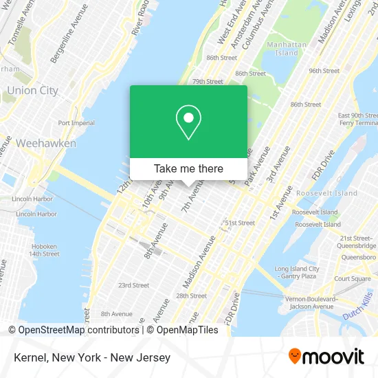
See Kernel, Manhattan, on the map
Public Transit to Kernel in Manhattan
Wondering how to get to Kernel in Manhattan? Moovit helps you find the best way to get to Kernel with step-by-step directions from the nearest public transit station.
Moovit provides free maps and live directions to help you navigate through your city. View schedules, routes, timetables, and find out how long does it take to get to Kernel in real time.
Looking for the nearest stop or station to Kernel? Check out this list of stops closest to your destination: W 50th St & 8th Ave; W 50 St/8 Av; 50 St; 7 Av/W 50 St; 8th Ave & W 49th St; 7 Avenue & West 50 St; 57 St-7 Av; 7 Av.
Bus: 50TH ST, M104, M20, M50, M7, Q32, QM12, QM24.Train: 2, YEL.Subway: 1, B, C, E, M, N, R, W, A, Q, 2, D.
Want to see if there’s another route that gets you there at an earlier time? Moovit helps you find alternative routes or times. Get directions from and directions to Kernel easily from the Moovit App or Website.
We make riding to Kernel easy, which is why over 1.5 million users, including users in Manhattan, trust Moovit as the best app for public transit. You don’t need to download an individual bus app or train app, Moovit is your all-in-one transit app that helps you find the best bus time or train time available.
For information on prices of subway, bus and train, costs and ride fares to Kernel, please check the Moovit app.
Use the app to navigate to popular places including to the airport, hospital, stadium, grocery store, mall, coffee shop, school, college, and university.
Kernel Address: 1633 Broadway street in Manhattan
- Clements Travel,
- Rosetta Bakery,
- American Italian Travel,
- Tribeca Loft,
- Paramount Plaza,
- 1801,
- Dcafe at Deloitte,
- Creative Juice,
- Ada Music,
- Tom Schmidt Travel,
- Perfetto Traveler,
- Global Travel Collection,
- Deloitte Gym,
- Genecom,
- Luxury In Travel,
- Paramount Group,
- Kasowitz Llp,
- Abm Parking Garage,
- citizenM Hotel New York Times Square,
- Amsterdam Court Hotel
Places Near Kernel (Manhattan)
- 376 Hudson Street, Manhattan,
- Chinatown, Manhattan,
- 1 Police Plaza, Manhattan,
- Bellevue Hospital, Manhattan,
- Wall Street, Manhattan,
- SoHo, Manhattan,
- Katz's Deli, Manhattan,
- Queens Center Mall, Queens,
- Mountainside Hospital, Glen Ridge,
- San Gennaro Feast, Manhattan,
- qqqq, Manhattan,
- Pier 83, Manhattan,
- 66 John Street, Manhattan,
- Hudson Yards, Manhattan,
- Times Square, Manhattan,
- Rockefeller Center, Manhattan,
- 911 Memorial, Manhattan,
- 26 Federal Plaza, Manhattan,
- 111 Centre New York City Supreme Court, Manhattan,
- 3 Stone St, Manhattan
How to get to popular places in New York - New Jersey with public transit
Get around Manhattan by public transit!
Traveling around Manhattan has never been so easy. See step by step directions as you travel to any attraction, street or major public transit station. View bus and train schedules, arrival times, service alerts and detailed routes on a map, so you know exactly how to get to anywhere in Manhattan.
When traveling to any destination around Manhattan use Moovit's Live Directions with Get Off Notifications to know exactly where and how far to walk, how long to wait for your line, and how many stops are left. Moovit will alert you when it's time to get off — no need to constantly re-check whether yours is the next stop.
Wondering how to use public transit in Manhattan or how to pay for public transit in Manhattan? Moovit public transit app can help you navigate your way with public transit easily, and at minimum cost. It includes public transit fees, ticket prices, and costs. Looking for a map of Manhattan public transit lines? Moovit public transit app shows all public transit maps in Manhattan with all Bus, Train, Subway, Light Rail, Ferry and Cable Car routes and stops on an interactive map.
New York - New Jersey has 6 transit type(s), including: Bus, Train, Subway, Light Rail, Ferry and Cable Car, operated by several transit agencies, including MTA Subway, Metro-North Railroad, LIRR, PATH, MTA New York City Transit - Express routes, MTA Bus, NJ Transit, NYC Ferry, NICE bus, Bee-Line Bus, NJ Transit Rail, Norwalk Transit District, Hartford Line, River Valley Transit and HART