How to get to KeyMe by bus?
Click on the bus route to see step by step directions with maps, line arrival times and updated time schedules.
From Brothers Auto Parts (Brothers Auto Salvage), Indianapolis City (Balance)
44 minFrom CMC 7244 Indianapolis, Indianapolis City (Balance)
25 minFrom Sunoco, Indianapolis City (Balance)
29 minFrom N Franklin Rd / E 56th St, Lawrence
58 minFrom 42nd Street and Arlington Ave., Indianapolis City (Balance)
51 minFrom Exit 89/Shadeland Ave/W, Indianapolis City (Balance)
57 minFrom Ivy Tech Community College, Lawrence
44 minFrom Truth & Life Church, Indianapolis City (Balance)
47 minFrom Fort Benjamin Harrison Track, Lawrence
47 minFrom Urgent Dental Center Linwood, Indianapolis City (Balance)
34 min
Bus stop near KeyMe in Indianapolis City (Balance)
- Washington St - 10700 E, 5 min walk,VIEW
Bus lines to KeyMe in Indianapolis City (Balance)
What are the closest stations to KeyMe?
The closest stations to KeyMe are:
- Washington St - 10700 E is 282 yards away, 5 min walk.
Which bus lines stop near KeyMe?
These bus lines stop near KeyMe: 10, 21, 8, 87.
What’s the nearest bus station to KeyMe in Indianapolis City (Balance)?
The nearest bus station to KeyMe in Indianapolis City (Balance) is Washington St - 10700 E. It’s a 5 min walk away.
What time is the first bus to KeyMe in Indianapolis City (Balance)?
The 87 is the first bus that goes to KeyMe in Indianapolis City (Balance). It stops nearby at 4:58 AM.
What time is the last bus to KeyMe in Indianapolis City (Balance)?
The 8 is the last bus that goes to KeyMe in Indianapolis City (Balance). It stops nearby at 11:14 PM.
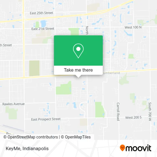
See KeyMe, Indianapolis City (Balance), on the map
Public Transit to KeyMe in Indianapolis City (Balance)
Wondering how to get to KeyMe in Indianapolis City (Balance)? Moovit helps you find the best way to get to KeyMe with step-by-step directions from the nearest public transit station.
Moovit provides free maps and live directions to help you navigate through your city. View schedules, routes, timetables, and find out how long does it take to get to KeyMe in real time.
Looking for the nearest stop or station to KeyMe? Check out this list of stops closest to your destination: Washington St - 10700 E.
Bus: 10, 21, 8, 87.
Want to see if there’s another route that gets you there at an earlier time? Moovit helps you find alternative routes or times. Get directions from and directions to KeyMe easily from the Moovit App or Website.
We make riding to KeyMe easy, which is why over 1.5 million users, including users in Indianapolis City (Balance), trust Moovit as the best app for public transit. You don’t need to download an individual bus app or train app, Moovit is your all-in-one transit app that helps you find the best bus time or train time available.
For information on prices of bus, costs and ride fares to KeyMe, please check the Moovit app.
Use the app to navigate to popular places including to the airport, hospital, stadium, grocery store, mall, coffee shop, school, college, and university.
KeyMe Address: 10617 E Washington St Indianapolis, IN 46229 street in Indianapolis City (Balance)
- Parmex Locksmith,
- Ifixandrepair,
- Walmart Store,
- WESTERN UNION,
- Walmart Supercenter,
- Onemain Financial,
- Cumberland Flowers,
- HOBBY LOBBY,
- Pana Donuts,
- Ecoatm,
- Sam's Club Gas,
- 10859 E Washington St Parking,
- Dragon Smoke & Vape Shop,
- National Bank,
- Tech Locksmith Inc,
- Soul Food Shack,
- Metaphor Threads,
- WW Formerly Weight Watchers,
- Washington Park East Cemetery Burial & Cremation Services,
- Goodwill
Places Near KeyMe (Indianapolis City (Balance))
- Plainfield, IN, Plainfield,
- 119 W 19th St Parking, Indianapolis City (Balance),
- Eskenazi Hospital, Indianapolis City (Balance),
- Train Ride At Castleton Mall, Indianapolis City (Balance),
- St. Vincent Hospital - Indianapolis, Indianapolis City (Balance),
- St. Vincent entrance #1, Indianapolis City (Balance),
- Lilly Corporate Center (Eli Lilly & Co), Indianapolis City (Balance),
- Indiana Convention Center, Indianapolis City (Balance),
- Indianapolis Motor Speedway, Speedway,
- Lucas Oil Stadium, Indianapolis City (Balance),
- Jersey Barn, Indianapolis City (Balance),
- Indianapolis Airport Zone 2, Indianapolis City (Balance),
- Methodist Hospital of Indianapolis, Indianapolis City (Balance),
- I U Health Methodist Hospital, Indianapolis City (Balance),
- Castleton Square Mall, Indianapolis,
- I-465 / I-65 Interchange, Indianapolis City (Balance),
- Indiana, Indianapolis City (Balance),
- Gainbridge Fieldhouse, Indianapolis City (Balance),
- THE BALT, Indianapolis City (Balance),
- Cotter's Massage Parlor With Happy Endings, Indianapolis City (Balance)
How to get to popular places in Indianapolis with public transit
Get around Indianapolis City (Balance) by public transit!
Traveling around Indianapolis City (Balance) has never been so easy. See step by step directions as you travel to any attraction, street or major public transit station. View bus and train schedules, arrival times, service alerts and detailed routes on a map, so you know exactly how to get to anywhere in Indianapolis City (Balance).
When traveling to any destination around Indianapolis City (Balance) use Moovit's Live Directions with Get Off Notifications to know exactly where and how far to walk, how long to wait for your line, and how many stops are left. Moovit will alert you when it's time to get off — no need to constantly re-check whether yours is the next stop.
Wondering how to use public transit in Indianapolis City (Balance) or how to pay for public transit in Indianapolis City (Balance)? Moovit public transit app can help you navigate your way with public transit easily, and at minimum cost. It includes public transit fees, ticket prices, and costs. Looking for a map of Indianapolis City (Balance) public transit lines? Moovit public transit app shows all public transit maps in Indianapolis City (Balance) with all bus routes and stops on an interactive map.
Indianapolis has 1 transit type(s), including: bus, operated by several transit agencies, including IndyGo, FlixBus-us and Greyhound-us