How to get to KeyMe by bus?
Click on the bus route to see step by step directions with maps, line arrival times and updated time schedules.
From Vienna, Virginia, Fairfax County
69 minFrom Navy Federal Credit Union, Fairfax County
85 minFrom Arabx Com Inc, Fairfax County
63 minFrom National Reconnaissance Office, Fairfax County
57 minFrom Fairfax County Courthouse, Fairfax County
74 minFrom Oakton, Virginia, Fairfax County
73 minFrom Walmart, Fairfax County
56 minFrom Leesburg VA-684, Fairfax County
53 minFrom Dulles Expo Center, Fairfax County
74 minFrom Northern Virginia Community College - Loudoun Campus, Loudoun County
48 min
How to get to KeyMe by metro?
Click on the metro route to see step by step directions with maps, line arrival times and updated time schedules.
Bus stops near KeyMe in Fairfax County
Metro station near KeyMe in Fairfax County
- Herndon, 32 min walk,VIEW
Bus lines to KeyMe in Fairfax County
What are the closest stations to KeyMe?
The closest stations to KeyMe are:
- Hunter Woods Plaza is 56 yards away, 1 min walk.
- Colts Neck Rd @ Hunters Square Ct is 136 yards away, 2 min walk.
- Glade Dr @ Breton Ct is 305 yards away, 4 min walk.
- Reston Pkwy @ Glade Dr is 504 yards away, 7 min walk.
- Herndon is 2723 yards away, 32 min walk.
Which bus lines stop near KeyMe?
These bus lines stop near KeyMe: 605, RIBS1, RIBS2, RIBS3.
Which metro line stops near KeyMe?
SILVER (Ashburn)
What’s the nearest bus station to KeyMe in Fairfax County?
The nearest bus station to KeyMe in Fairfax County is Hunter Woods Plaza. It’s a 1 min walk away.
What time is the first metro to KeyMe in Fairfax County?
The SILVER is the first metro that goes to KeyMe in Fairfax County. It stops nearby at 5:00 AM.
What time is the last metro to KeyMe in Fairfax County?
The SILVER is the last metro that goes to KeyMe in Fairfax County. It stops nearby at 12:55 AM.
What time is the first bus to KeyMe in Fairfax County?
The RIBS2 is the first bus that goes to KeyMe in Fairfax County. It stops nearby at 4:32 AM.
What time is the last bus to KeyMe in Fairfax County?
The RIBS2 is the last bus that goes to KeyMe in Fairfax County. It stops nearby at 12:39 AM.
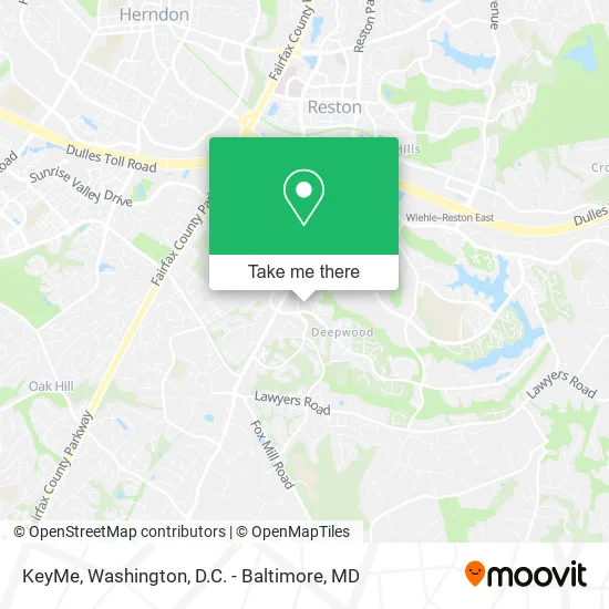
See KeyMe, Fairfax County, on the map
Public Transit to KeyMe in Fairfax County
Wondering how to get to KeyMe in Fairfax County? Moovit helps you find the best way to get to KeyMe with step-by-step directions from the nearest public transit station.
Moovit provides free maps and live directions to help you navigate through your city. View schedules, routes, timetables, and find out how long does it take to get to KeyMe in real time.
Looking for the nearest stop or station to KeyMe? Check out this list of stops closest to your destination: Hunter Woods Plaza; Colts Neck Rd @ Hunters Square Ct; Glade Dr @ Breton Ct; Reston Pkwy @ Glade Dr; Herndon.
Bus: 605, RIBS1, RIBS2, RIBS3, 951, 553.Metro: SILVER.
Want to see if there’s another route that gets you there at an earlier time? Moovit helps you find alternative routes or times. Get directions from and directions to KeyMe easily from the Moovit App or Website.
We make riding to KeyMe easy, which is why over 1.5 million users, including users in Fairfax County, trust Moovit as the best app for public transit. You don’t need to download an individual bus app or train app, Moovit is your all-in-one transit app that helps you find the best bus time or train time available.
For information on prices of bus and metro, costs and ride fares to KeyMe, please check the Moovit app.
Use the app to navigate to popular places including to the airport, hospital, stadium, grocery store, mall, coffee shop, school, college, and university.
KeyMe Address: 2304 Hunters Woods Plz Reston, VA 20191 street in Fairfax County
- STARBUCKS,
- Amazon Locker-Sushi,
- Coinstar - Bitcoin ATM,
- Iglesia Proyeccion Y Poder,
- Tdaf,
- Wells Fargo Home Mortgage,
- Best Irrigation System,
- Reston Glade,
- RTC Realtors -Your Reston Town Center Specialists,
- Dotlotus,
- Joyce Allred Soccer Field,
- Signature Paving and Masonry,
- About & Testimonials,
- Hunter Woods Park,
- Hunter Woods Picnic Pavilion,
- Unitedhealth Group,
- Hunters Woods Garden Plot 1,
- Quality Painting,
- Southgate Community Center,
- Wine Palate
Places Near KeyMe (Fairfax County)
- National Museum of African American History and Culture, Washington,
- Museum Of The Bible, Washington,
- Washington National Cathedral, Washington,
- PG Mall, Prince George's County,
- Rock Creek Tennis Center, Washington,
- Pennsylvania Ave NW (3rd st and pennsylvania), Washington,
- The Anthem, Washington,
- Basilica of the National Shrine, Washington,
- M&T Bank Stadium, Baltimore,
- National Zoo, Washington,
- Warner Theatre, Washington,
- Georgetown, Washington,
- National Mall, Washington,
- Amazon Hq2, Arlington County,
- Camden Yards, Baltimore,
- Westfield Montgomery Mall, Montgomery County,
- Washington DC VA Medical Center, Washington,
- Marriott Marquis Washington, DC, Washington,
- Capital One Arena, Washington,
- Sibley Memorial Hospital, Washington
How to get to popular places in Washington, D.C. - Baltimore, MD with public transit
Get around Fairfax County by public transit!
Traveling around Fairfax County has never been so easy. See step by step directions as you travel to any attraction, street or major public transit station. View bus and train schedules, arrival times, service alerts and detailed routes on a map, so you know exactly how to get to anywhere in Fairfax County.
When traveling to any destination around Fairfax County use Moovit's Live Directions with Get Off Notifications to know exactly where and how far to walk, how long to wait for your line, and how many stops are left. Moovit will alert you when it's time to get off — no need to constantly re-check whether yours is the next stop.
Wondering how to use public transit in Fairfax County or how to pay for public transit in Fairfax County? Moovit public transit app can help you navigate your way with public transit easily, and at minimum cost. It includes public transit fees, ticket prices, and costs. Looking for a map of Fairfax County public transit lines? Moovit public transit app shows all public transit maps in Fairfax County with all Bus, Train, Metro, Light Rail and Ferry routes and stops on an interactive map.
Washington, D.C. - Baltimore, MD has 5 transit type(s), including: Bus, Train, Metro, Light Rail and Ferry, operated by several transit agencies, including WMATA, Montgomery County Ride On, Fairfax Connector, TheBus, PRTC, DASH - Alexandria, Arlington Transit (ART), RTA of Central Maryland, MDOT MTA, MDOT MTA Light RailLink, MDOT MTA Commuter Bus, MDOT MTA Local Bus, FXBGO!, Virginia Railway Express (VRE) and MARC