How to get to KeyMe by bus?
Click on the bus route to see step by step directions with maps, line arrival times and updated time schedules.
From Glenstone Museum, Montgomery County
66 minFrom Park Potomac Place, Montgomery County
58 minFrom Clarksburg Premium Outlets, Montgomery County
62 minFrom Germantown, Maryland, Montgomery County
24 minFrom Rockville, MD, Montgomery County
56 minFrom HJF, Montgomery County
55 minFrom Clarksburg Premium Outlets, Montgomery County
70 minFrom Montgomery College-Rockville, Montgomery County
53 minFrom Walmart Supercenter, Montgomery County
44 minFrom Adventist HealthCare Shady Grove Medical Center, Montgomery County
40 min
How to get to KeyMe by train?
Click on the train route to see step by step directions with maps, line arrival times and updated time schedules.
Bus stops near KeyMe in Montgomery County
Train station near KeyMe in Montgomery County
- Washington Grove Marc Eb, 23 min walk,VIEW
Bus lines to KeyMe in Montgomery County
What are the closest stations to KeyMe?
The closest stations to KeyMe are:
- Md 117 & W Diamond Ave & Bureau Dr Far Side Wb is 327 yards away, 5 min walk.
- Quince Orchard Rd & Firstfield Rd is 357 yards away, 5 min walk.
- W Diamond Ave & Bureau Rd is 369 yards away, 5 min walk.
- Bureau Drive 100 is 525 yards away, 7 min walk.
- Gaithersburg Park & Ride is 839 yards away, 11 min walk.
- Perry Pkwy & @220 is 1679 yards away, 20 min walk.
- Washington Grove Marc Eb is 1900 yards away, 23 min walk.
Which bus lines stop near KeyMe?
These bus lines stop near KeyMe: 56, 71, 78, NIST SHUTTLE.
Which train line stops near KeyMe?
MARC (Outbound - Washington)
What’s the nearest train station to KeyMe in Montgomery County?
The nearest train station to KeyMe in Montgomery County is Washington Grove Marc Eb. It’s a 23 min walk away.
What’s the nearest bus station to KeyMe in Montgomery County?
The nearest bus stations to KeyMe in Montgomery County are Md 117 & W Diamond Ave & Bureau Dr Far Side Wb, Quince Orchard Rd & Firstfield Rd and W Diamond Ave & Bureau Rd. The closest one is a 5 min walk away.
What time is the first train to KeyMe in Montgomery County?
The MARC is the first train that goes to KeyMe in Montgomery County. It stops nearby at 5:27 AM.
What time is the last train to KeyMe in Montgomery County?
The MARC is the last train that goes to KeyMe in Montgomery County. It stops nearby at 8:00 PM.
What time is the first bus to KeyMe in Montgomery County?
The 201 is the first bus that goes to KeyMe in Montgomery County. It stops nearby at 4:00 AM.
What time is the last bus to KeyMe in Montgomery County?
The 54 is the last bus that goes to KeyMe in Montgomery County. It stops nearby at 11:49 PM.
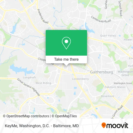
See KeyMe, Montgomery County, on the map
Public Transit to KeyMe in Montgomery County
Wondering how to get to KeyMe in Montgomery County? Moovit helps you find the best way to get to KeyMe with step-by-step directions from the nearest public transit station.
Moovit provides free maps and live directions to help you navigate through your city. View schedules, routes, timetables, and find out how long does it take to get to KeyMe in real time.
Looking for the nearest stop or station to KeyMe? Check out this list of stops closest to your destination: Md 117 & W Diamond Ave & Bureau Dr Far Side Wb; Quince Orchard Rd & Firstfield Rd; W Diamond Ave & Bureau Rd; Bureau Drive 100; Gaithersburg Park & Ride; Perry Pkwy & @220; Washington Grove Marc Eb.
Bus: 56, 71, 78, NIST SHUTTLE, 201, 204.Train: MARC.
Want to see if there’s another route that gets you there at an earlier time? Moovit helps you find alternative routes or times. Get directions from and directions to KeyMe easily from the Moovit App or Website.
We make riding to KeyMe easy, which is why over 1.5 million users, including users in Montgomery County, trust Moovit as the best app for public transit. You don’t need to download an individual bus app or train app, Moovit is your all-in-one transit app that helps you find the best bus time or train time available.
For information on prices of bus, metro and train, costs and ride fares to KeyMe, please check the Moovit app.
Use the app to navigate to popular places including to the airport, hospital, stadium, grocery store, mall, coffee shop, school, college, and university.
KeyMe Address: 46 Bureau Dr Gaithersburg, MD 20878 street in Montgomery County
- Coinstar - Bitcoin ATM,
- PNC Bank,
- Diamond Square Shopping Center,
- Speedy Laundromat,
- Gaithersburg Mailbox Locks Change,
- Tacos de Birria,
- Gaithersburg Mas Locksmith Company,
- Truist Bank,
- Hibachi Sushi Supreme Buffet,
- Whimsy Nail Bar,
- Roaming Rooster,
- Street smart Beauty,
- Shred Nations,
- Xavier Snead - TD Wealth Financial Advisor,
- TD Bank, America's Most Convenient Bank ATM,
- O'Leary's Restaurant & Pub,
- Woodlands Restaurant,
- Planvest Financial,
- Aesthetics & Body,
- Mcdonald's
Places Near KeyMe (Montgomery County)
- PG Mall, Prince George's County,
- Amazon Hq2, Arlington County,
- M&T Bank Stadium, Baltimore,
- Marriott Marquis Washington, DC, Washington,
- Westfield Montgomery Mall, Montgomery County,
- The Anthem, Washington,
- Warner Theatre, Washington,
- Capital One Arena, Washington,
- Washington National Cathedral, Washington,
- National Museum of African American History and Culture, Washington,
- National Zoo, Washington,
- Museum Of The Bible, Washington,
- Basilica of the National Shrine, Washington,
- Pennsylvania Ave NW (3rd st and pennsylvania), Washington,
- Sibley Memorial Hospital, Washington,
- National Mall, Washington,
- Camden Yards, Baltimore,
- Georgetown, Washington,
- Washington DC VA Medical Center, Washington,
- Rock Creek Tennis Center, Washington
How to get to popular places in Washington, D.C. - Baltimore, MD with public transit
Get around Montgomery County by public transit!
Traveling around Montgomery County has never been so easy. See step by step directions as you travel to any attraction, street or major public transit station. View bus and train schedules, arrival times, service alerts and detailed routes on a map, so you know exactly how to get to anywhere in Montgomery County.
When traveling to any destination around Montgomery County use Moovit's Live Directions with Get Off Notifications to know exactly where and how far to walk, how long to wait for your line, and how many stops are left. Moovit will alert you when it's time to get off — no need to constantly re-check whether yours is the next stop.
Wondering how to use public transit in Montgomery County or how to pay for public transit in Montgomery County? Moovit public transit app can help you navigate your way with public transit easily, and at minimum cost. It includes public transit fees, ticket prices, and costs. Looking for a map of Montgomery County public transit lines? Moovit public transit app shows all public transit maps in Montgomery County with all Bus, Train, Metro, Light Rail and Ferry routes and stops on an interactive map.
Washington, D.C. - Baltimore, MD has 5 transit type(s), including: Bus, Train, Metro, Light Rail and Ferry, operated by several transit agencies, including WMATA, Montgomery County Ride On, Fairfax Connector, TheBus, PRTC, DASH - Alexandria, Arlington Transit (ART), RTA of Central Maryland, MDOT MTA, MDOT MTA Light RailLink, MDOT MTA Commuter Bus, MDOT MTA Local Bus, FXBGO!, Virginia Railway Express (VRE) and MARC