How to get to Key Food by bus?
Click on the bus route to see step by step directions with maps, line arrival times and updated time schedules.
From Uhealth Sole Mia Medical Center - Parking Garage, Miami
48 minFrom Brickell City Centre Metromover Station, Miami
41 minFrom Lorraine Hotel, Miami Beach
36 minFrom Bal Harbour, Miami Beach
64 minFrom Costco Wholesale, Miami
39 minFrom NW 27th Ave / NW 79th St, Miami
35 minFrom 5th Street and Collins Ave, Miami Beach
49 minFrom Nordstrom Rack, Miami
67 minFrom Skyviews Miami Observation Wheel, Miami
33 minFrom Opa-Locka Hialeah Flea Market, Miami
81 min
Bus stops near Key Food in Miami
Train station near Key Food in Miami
- Allapattah Station, 34 min walk,VIEW
Light Rail stations near Key Food in Miami
- School Board, 38 min walk,VIEW
Bus lines to Key Food in Miami
What are the closest stations to Key Food?
The closest stations to Key Food are:
- Ne 2 Av & Ne 54 St is 131 yards away, 2 min walk.
- Ne 54 St & Ne 2 Av is 163 yards away, 3 min walk.
- Allapattah Station is 2803 yards away, 34 min walk.
- School Board is 3175 yards away, 38 min walk.
Which bus lines stop near Key Food?
These bus lines stop near Key Food: 203, 54, 9.
What’s the nearest bus station to Key Food in Miami?
The nearest bus station to Key Food in Miami is Ne 2 Av & Ne 54 St. It’s a 2 min walk away.
What time is the first light rail to Key Food in Miami?
The MMO is the first light rail that goes to Key Food in Miami. It stops nearby at 5:32 AM.
What time is the last light rail to Key Food in Miami?
The MMO is the last light rail that goes to Key Food in Miami. It stops nearby at 10:10 PM.
What time is the first train to Key Food in Miami?
The ORANGE is the first train that goes to Key Food in Miami. It stops nearby at 5:10 AM.
What time is the last train to Key Food in Miami?
The GREEN is the last train that goes to Key Food in Miami. It stops nearby at 12:34 AM.
What time is the first bus to Key Food in Miami?
The 9 is the first bus that goes to Key Food in Miami. It stops nearby at 4:23 AM.
What time is the last bus to Key Food in Miami?
The 9 is the last bus that goes to Key Food in Miami. It stops nearby at 1:08 AM.
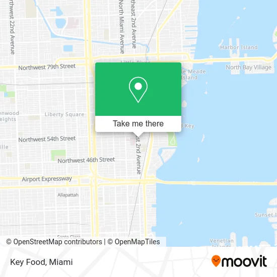
See Key Food, Miami, on the map
Public Transit to Key Food in Miami
Wondering how to get to Key Food in Miami? Moovit helps you find the best way to get to Key Food with step-by-step directions from the nearest public transit station.
Moovit provides free maps and live directions to help you navigate through your city. View schedules, routes, timetables, and find out how long does it take to get to Key Food in real time.
Looking for the nearest stop or station to Key Food? Check out this list of stops closest to your destination: Ne 2 Av & Ne 54 St; Ne 54 St & Ne 2 Av; Allapattah Station; School Board.
Bus: 203, 54, 9, MIAHAIT.Train: GREEN, ORANGE.
Want to see if there’s another route that gets you there at an earlier time? Moovit helps you find alternative routes or times. Get directions from and directions to Key Food easily from the Moovit App or Website.
We make riding to Key Food easy, which is why over 1.5 million users, including users in Miami, trust Moovit as the best app for public transit. You don’t need to download an individual bus app or train app, Moovit is your all-in-one transit app that helps you find the best bus time or train time available.
For information on prices of bus and light rail, costs and ride fares to Key Food, please check the Moovit app.
Use the app to navigate to popular places including to the airport, hospital, stadium, grocery store, mall, coffee shop, school, college, and university.
Key Food Address: 5299 NE 2nd Ave Miami, FL 33137 street in Miami
- Keyme Locksmiths,
- Bravo Supermarkets,
- Little Haiti,
- Northeast 2nd Avenue & Northeast 54th Street,
- D & B Atm SVCS,
- Toys for the Poor Foundation Inc,
- TMWFL- 0965fl,
- 1 Stop Wireless,
- Holy Smoked,
- German American Bank Itm,
- Chase,
- Christ Seul Espoir,
- Churchill's Pub (Churchills Pub),
- 5400 NE 1st Ct Parking,
- Miami Jewish Health Systems,
- Total by Verizon,
- Clean Cottage,
- Gilson Interior,
- Vspstudios,
- Biophase Research
Places Near Key Food (Miami)
- Zoo Miami, Miami,
- Sawgrass mall ( FL ), Miami Beach,
- Miami-Dade County Courthouse, Miami,
- Wynwood, Miami,
- Bayside Marketplace, Miami,
- Port of Miami Cruise Terminal, Miami,
- Sawgrass Mall, Miami,
- Dolphin Mall Bus, Miami,
- Miami Freedom Park, Miami,
- Little Havana, Miami,
- Brickell City Centre, Miami,
- Keiser University Flagship Campus, West Palm Beach,
- Miami Design District, Miami,
- Richard E. Gerstein Justice Building, Miami,
- Aventura Mall, Miami Beach,
- Aventura Mall, Miami,
- Miami VA Hospital, Miami,
- Marlins Park, Miami,
- Dolphin Mall, Miami,
- Hard Rock Stadium, Miami Gardens
How to get to popular places in Miami with public transit
Get around Miami by public transit!
Traveling around Miami has never been so easy. See step by step directions as you travel to any attraction, street or major public transit station. View bus and train schedules, arrival times, service alerts and detailed routes on a map, so you know exactly how to get to anywhere in Miami.
When traveling to any destination around Miami use Moovit's Live Directions with Get Off Notifications to know exactly where and how far to walk, how long to wait for your line, and how many stops are left. Moovit will alert you when it's time to get off — no need to constantly re-check whether yours is the next stop.
Wondering how to use public transit in Miami or how to pay for public transit in Miami? Moovit public transit app can help you navigate your way with public transit easily, and at minimum cost. It includes public transit fees, ticket prices, and costs. Looking for a map of Miami public transit lines? Moovit public transit app shows all public transit maps in Miami with all Bus, Train, Light Rail and Ferry routes and stops on an interactive map.
Miami has 4 transit type(s), including: Bus, Train, Light Rail and Ferry, operated by several transit agencies, including Broward County Transit, Miami-Dade Transit, Metrorail, Palm Tran, Tri-Rail, Brightline, MARTY, City of Homestead Trolley, Key West Transit, Treasure Coast Connector, GoLine IRT, Amtrak, Greyhound-us, FlixBus-us and Aventura Express Shuttle Bus