How to get to Keycafe by bus?
Click on the bus route to see step by step directions with maps, line arrival times and updated time schedules.
From Pork & Beans, Miami
78 minFrom The Salvation Army, Miami
62 minFrom Brickell City Centre, Miami
50 minFrom Vizcaya Metrorail Station, Miami
71 minFrom NW 17th Ave / NW 54th St, Miami
65 minFrom NW 79th St / NW 7th Ave, Miami
65 minFrom Consulado General De Nicaragua, Miami
53 minFrom Avenida Eva Peron, Miami
36 minFrom Bascom Palmer Eye Institute, Miami
56 minFrom Ministerio Internacional El Rey Jesus, Miami
67 min
Bus stops near Keycafe in Miami Beach
Bus lines to Keycafe in Miami Beach
What are the closest stations to Keycafe?
The closest stations to Keycafe are:
- Lincoln Rd & Washington Av is 281 yards away, 4 min walk.
- 17 St & Pennsylvania Av is 284 yards away, 4 min walk.
- Washington Av & Lincoln Rd is 289 yards away, 4 min walk.
- Lincoln Rd @ James Ave is 311 yards away, 4 min walk.
Which bus lines stop near Keycafe?
These bus lines stop near Keycafe: 100, 14, 20, 36.
What’s the nearest bus station to Keycafe in Miami Beach?
The nearest bus stations to Keycafe in Miami Beach are Lincoln Rd & Washington Av, 17 St & Pennsylvania Av, Washington Av & Lincoln Rd and Lincoln Rd @ James Ave. The closest one is a 4 min walk away.
What time is the first bus to Keycafe in Miami Beach?
The 79 is the first bus that goes to Keycafe in Miami Beach. It stops nearby at 3:02 AM.
What time is the last bus to Keycafe in Miami Beach?
The 100 is the last bus that goes to Keycafe in Miami Beach. It stops nearby at 3:37 AM.
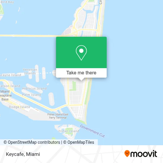
See Keycafe, Miami Beach, on the map
Public Transit to Keycafe in Miami Beach
Wondering how to get to Keycafe in Miami Beach? Moovit helps you find the best way to get to Keycafe with step-by-step directions from the nearest public transit station.
Moovit provides free maps and live directions to help you navigate through your city. View schedules, routes, timetables, and find out how long does it take to get to Keycafe in real time.
Looking for the nearest stop or station to Keycafe? Check out this list of stops closest to your destination: Lincoln Rd & Washington Av; 17 St & Pennsylvania Av; Washington Av & Lincoln Rd; Lincoln Rd @ James Ave.
Bus: 100, 14, 20, 36, 15, 150, 79.
Want to see if there’s another route that gets you there at an earlier time? Moovit helps you find alternative routes or times. Get directions from and directions to Keycafe easily from the Moovit App or Website.
We make riding to Keycafe easy, which is why over 1.7 million users, including users in Miami Beach, trust Moovit as the best app for public transit. You don’t need to download an individual bus app or train app, Moovit is your all-in-one transit app that helps you find the best bus time or train time available.
For information on prices of bus, light rail and train, costs and ride fares to Keycafe, please check the Moovit app.
Use the app to navigate to popular places including to the airport, hospital, stadium, grocery store, mall, coffee shop, school, college, and university.
Keycafe Address: 516 Espanola Way street in Miami Beach
- Havana 1957 Cuban Cuisine,
- Washington Ave / Espanola Way,
- Miami Ink - Love Hate Tattoos (Love Hate Tattoos and Choppers),
- Miami Ink Tattoo Studio,
- Riviere South Beach Hotel Miami Beach,
- Miami-Dade Transit - Metrobus Route 150 (Airport Flyer),
- President Hotel Miami Beach FL USA,
- Washington Avenue & 13th Street,
- President Villa Miami Beach,
- Dollar Rent A Car,
- The President Hotel South Beach,
- Tropics Hotel,
- Hilton Grand Vacations Club McAlpin Ocean Plaza Miami (Hilton Garden Inns),
- McAlpin,
- Royal Palm South Beach,
- Penguin Hotel Miami Beach,
- The Betsy Hotel South Beach Miami Beach,
- Edgewater South Beach,
- 16th Street & Collins Avenue Garage,
- Beach Outlet
Places Near Keycafe (Miami Beach)
- Miami-Dade County Courthouse, Miami,
- Miami Freedom Park, Miami,
- Dolphin Mall, Miami,
- Little Havana, Miami,
- Aventura Mall, Miami Beach,
- Aventura Mall, Miami,
- Richard E. Gerstein Justice Building, Miami,
- Bayside Marketplace, Miami,
- Marlins Park, Miami,
- Wynwood, Miami,
- Keiser University Flagship Campus, West Palm Beach,
- Brickell City Centre, Miami,
- Port of Miami Cruise Terminal, Miami,
- Miami VA Hospital, Miami,
- Zoo Miami, Miami,
- Miami Design District, Miami,
- Sawgrass mall ( FL ), Miami Beach,
- Sawgrass Mall, Miami,
- Hard Rock Stadium, Miami Gardens,
- Dolphin Mall Bus, Miami
How to get to popular places in Miami with public transit
Get around Miami Beach by public transit!
Traveling around Miami Beach has never been so easy. See step by step directions as you travel to any attraction, street or major public transit station. View bus and train schedules, arrival times, service alerts and detailed routes on a map, so you know exactly how to get to anywhere in Miami Beach.
When traveling to any destination around Miami Beach use Moovit's Live Directions with Get Off Notifications to know exactly where and how far to walk, how long to wait for your line, and how many stops are left. Moovit will alert you when it's time to get off — no need to constantly re-check whether yours is the next stop.
Wondering how to use public transit in Miami Beach or how to pay for public transit in Miami Beach? Moovit public transit app can help you navigate your way with public transit easily, and at minimum cost. It includes public transit fees, ticket prices, and costs. Looking for a map of Miami Beach public transit lines? Moovit public transit app shows all public transit maps in Miami Beach with all Bus, Train, Light Rail and Ferry routes and stops on an interactive map.
Miami has 4 transit type(s), including: Bus, Train, Light Rail and Ferry, operated by several transit agencies, including Broward County Transit, Miami-Dade Transit, Metrorail, Palm Tran, Tri-Rail, Brightline, MARTY, City of Homestead Trolley, Key West Transit, Treasure Coast Connector, GoLine IRT, Amtrak, Greyhound-us, FlixBus-us and Aventura Express Shuttle Bus