How to get to Keyfillery by bus?
Click on the bus route to see step by step directions with maps, line arrival times and updated time schedules.
From Park & Ride-SW 296th St Busway, Homestead
271 minFrom Exit 1/Florida City/S, Homestead
302 minFrom Homestead, FL, Homestead
254 minFrom Florida Keys Outlet Center, Homestead
255 minFrom Florida City, FL, Homestead
250 minFrom Florida City, Homestead
247 minFrom SW 187th Ave / SW 344th St, Homestead
260 minFrom Walmart (Walmart Florida City), Homestead
248 min
Bus stops near Keyfillery in Key West
Bus lines to Keyfillery in Key West
What are the closest stations to Keyfillery?
The closest stations to Keyfillery are:
- Caroline & William is 183 yards away, 3 min walk.
- Truman Ave & Windsor Lane is 689 yards away, 9 min walk.
Which bus line stops near Keyfillery?
LKS (Stock Island/Key West)
What’s the nearest bus station to Keyfillery in Key West?
The nearest bus station to Keyfillery in Key West is Caroline & William. It’s a 3 min walk away.
What time is the first bus to Keyfillery in Key West?
The LKS is the first bus that goes to Keyfillery in Key West. It stops nearby at 5:40 AM.
What time is the last bus to Keyfillery in Key West?
The DL is the last bus that goes to Keyfillery in Key West. It stops nearby at 10:40 PM.
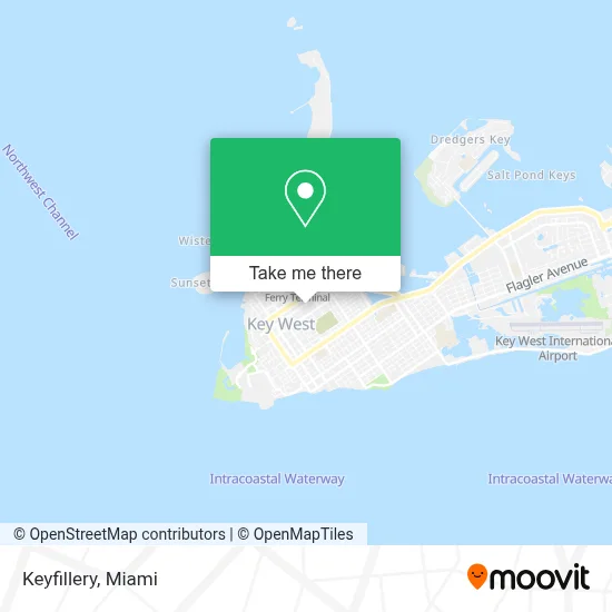
See Keyfillery, Key West, on the map
Public Transit to Keyfillery in Key West
Wondering how to get to Keyfillery in Key West? Moovit helps you find the best way to get to Keyfillery with step-by-step directions from the nearest public transit station.
Moovit provides free maps and live directions to help you navigate through your city. View schedules, routes, timetables, and find out how long does it take to get to Keyfillery in real time.
Looking for the nearest stop or station to Keyfillery? Check out this list of stops closest to your destination: Caroline & William; Truman Ave & Windsor Lane.
Bus: LKS, DL, WFX.
Want to see if there’s another route that gets you there at an earlier time? Moovit helps you find alternative routes or times. Get directions from and directions to Keyfillery easily from the Moovit App or Website.
We make riding to Keyfillery easy, which is why over 1.7 million users, including users in Key West, trust Moovit as the best app for public transit. You don’t need to download an individual bus app or train app, Moovit is your all-in-one transit app that helps you find the best bus time or train time available.
For information on prices of bus, costs and ride fares to Keyfillery, please check the Moovit app.
Use the app to navigate to popular places including to the airport, hospital, stadium, grocery store, mall, coffee shop, school, college, and university.
Keyfillery Address: 830 Fleming St street in Key West
- Eaton Street Seafood Market,
- Fantasy Fest,
- Clothing Optional Charters,
- Key West Bight Ferry Terminal,
- Banana Republic,
- Conch Republic Seafood Company,
- McGrail & Rowley,
- Greeen House,
- Key,
- Truman Adult Book & Video,
- Sloppy Joe's (Joe's Tap Room),
- Mile 0,
- Cuba Cuba,
- Hyatt Centric Key West Resort & Spa,
- I-95 Crew Services in,
- Social Security Administration,
- Ronald Augustine Tarot Readings,
- The Hemingway Home and Museum (Hemingway House),
- Mallory Square,
- Mallory Square Parking Lot
Places Near Keyfillery (Key West)
- Miami VA Hospital, Miami,
- Little Havana, Miami,
- Miami-Dade County Courthouse, Miami,
- Miami Freedom Park, Miami,
- Aventura Mall, Miami Beach,
- Wynwood, Miami,
- Bayside Marketplace, Miami,
- Sawgrass Mall, Miami,
- Keiser University Flagship Campus, West Palm Beach,
- Port of Miami Cruise Terminal, Miami,
- Aventura Mall, Miami,
- Marlins Park, Miami,
- Richard E. Gerstein Justice Building, Miami,
- Dolphin Mall Bus, Miami,
- Sawgrass mall ( FL ), Miami Beach,
- Miami Design District, Miami,
- Brickell City Centre, Miami,
- Dolphin Mall, Miami,
- Zoo Miami, Miami,
- Hard Rock Stadium, Miami Gardens
How to get to popular places in Miami with public transit
Get around Key West by public transit!
Traveling around Key West has never been so easy. See step by step directions as you travel to any attraction, street or major public transit station. View bus and train schedules, arrival times, service alerts and detailed routes on a map, so you know exactly how to get to anywhere in Key West.
When traveling to any destination around Key West use Moovit's Live Directions with Get Off Notifications to know exactly where and how far to walk, how long to wait for your line, and how many stops are left. Moovit will alert you when it's time to get off — no need to constantly re-check whether yours is the next stop.
Wondering how to use public transit in Key West or how to pay for public transit in Key West? Moovit public transit app can help you navigate your way with public transit easily, and at minimum cost. It includes public transit fees, ticket prices, and costs. Looking for a map of Key West public transit lines? Moovit public transit app shows all public transit maps in Key West with all Bus, Train, Light Rail and Ferry routes and stops on an interactive map.
Miami has 4 transit type(s), including: Bus, Train, Light Rail and Ferry, operated by several transit agencies, including Broward County Transit, Miami-Dade Transit, Metrorail, Palm Tran, Tri-Rail, Brightline, MARTY, City of Homestead Trolley, Key West Transit, Treasure Coast Connector, GoLine IRT, Amtrak, Greyhound-us, FlixBus-us and Aventura Express Shuttle Bus