How to get to Keyifzade Cafe by bus?
Click on the bus route to see step by step directions with maps, line arrival times and updated time schedules.
From Osmaniye Polikliniği, Bakirköy
93 minFrom Şişli Florence Nightingale Hastanesi, Şişli
85 minFrom Canpark AVM, Ümraniye
137 minFrom Kandilli, Kandilli, Üsküdar
135 minFrom Erenköy Fizik Tedavi ve Rehabilitasyon Hastanesi, Kadıköy
112 minFrom Volkswagen Arena, Sariyer
124 minFrom İstanbul EAH Bakırköy Osmaniye Semt Polikliniği, Bakirköy
92 minFrom Move It!, Kozyatağı, Kadıköy
122 minFrom Vadi Istanbul Avm, Sariyer
100 minFrom 20D Dudullu - Kadıköy, Ataşehir
112 min
How to get to Keyifzade Cafe by train?
Click on the train route to see step by step directions with maps, line arrival times and updated time schedules.
How to get to Keyifzade Cafe by metro?
Click on the metro route to see step by step directions with maps, line arrival times and updated time schedules.
Bus stop near Keyifzade Cafe in Istanbul
- Sarayburnu - Eminönü (Sahil) Yönü, 14 min walk,VIEW
Bus lines to Keyifzade Cafe in Istanbul
- BN1, Mehmetçik Sokak-Eminönü Mısır Çarşısı,VIEW
What are the closest stations to Keyifzade Cafe?
The closest stations to Keyifzade Cafe are:
- Sarayburnu - Eminönü (Sahil) Yönü is 178 meters away, 14 min walk.
Which bus lines stop near Keyifzade Cafe?
These bus lines stop near Keyifzade Cafe: 66, BN1.
Which train line stops near Keyifzade Cafe?
B1 (Gebze)
Which metro line stops near Keyifzade Cafe?
M2 (Yenikapı→Hacıosman)
What’s the nearest bus station to Keyifzade Cafe in Istanbul?
The nearest bus station to Keyifzade Cafe in Istanbul is Sarayburnu - Eminönü (Sahil) Yönü. It’s a 14 min walk away.
What time is the first bus to Keyifzade Cafe in Istanbul?
The BN1 is the first bus that goes to Keyifzade Cafe in Istanbul. It stops nearby at 7:49 AM.
What time is the last bus to Keyifzade Cafe in Istanbul?
The BN1 is the last bus that goes to Keyifzade Cafe in Istanbul. It stops nearby at 1:10 AM.
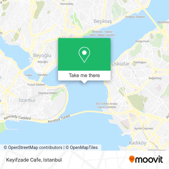
See Keyifzade Cafe, Istanbul, on the map
Public Transit to Keyifzade Cafe in Istanbul
Wondering how to get to Keyifzade Cafe in Istanbul? Moovit helps you find the best way to get to Keyifzade Cafe with step-by-step directions from the nearest public transit station.
Moovit provides free maps and live directions to help you navigate through your city. View schedules, routes, timetables, and find out how long does it take to get to Keyifzade Cafe in real time.
Looking for the nearest stop or station to Keyifzade Cafe? Check out this list of stops closest to your destination: Sarayburnu - Eminönü (Sahil) Yönü.
Bus: 66, BN1.Train: B1.Metro: M2.
Want to see if there’s another route that gets you there at an earlier time? Moovit helps you find alternative routes or times. Get directions from and directions to Keyifzade Cafe easily from the Moovit App or Website.
We make riding to Keyifzade Cafe easy, which is why over 1.5 million users, including users in Istanbul, trust Moovit as the best app for public transit. You don’t need to download an individual bus app or train app, Moovit is your all-in-one transit app that helps you find the best bus time or train time available.
For information on prices of bus, metro, train and Dolmus & Minibus, costs and ride fares to Keyifzade Cafe, please check the Moovit app.
Use the app to navigate to popular places including to the airport, hospital, stadium, grocery store, mall, coffee shop, school, college, and university.
Location: Istanbul
- Kabataş - Kadıköy Deniz Otobüsü,
- Eminönü'ne Doğru,
- Suudi Arabistan Havayolları,
- Sultanahmet Camii,
- Istanbul Boğaz Geçişi,
- Harem - Sirkeci,
- mısır çarşısı söğütlü çeşme,
- Sırkecı IDO Kantın,
- Sehir Hatlari Moda Vapuru,
- Sirkeci - Harem,
- Real Alışveriş Merkezi,
- Port Of Istanbul,
- Sehit Metin Sulus Vapuru,
- Eminönü Üsküdar Hattı,
- M/F Galatasaray Feribotu,
- seremoni tekne boğaz turu,
- Boğaz'ın En Derin Yeri,
- Port of Damietta,
- Kadıköy Eminönü Hattı,
- Aqua Dolphin Servis
Places Near Keyifzade Cafe (Istanbul)
- Şehit Prof. Dr. İlhan Varank Eğitim Ve Araştırma Hastanesi, Sancaktepe,
- Başakşehir Çam Ve Sakura Şehir Hastanesi, Basaksehir,
- Hz. Yuşa Tepesi, Beykoz,
- Mall Of İstanbul, Basaksehir,
- Hilltown AVM, Maltepe,
- Beylikdüzü - 4 Nolu Minibüs Hattı, Beylikduzu,
- Karaköy Genelevi, Karaköy, Beyoğlu,
- Bakırköy Sosyete Pazarı, Bakirköy,
- METROPOL IsTaNBuL, Ataşehir,
- VİALAND AVM, Eyüp,
- Topkule Kışlası 47.Komando Tugay Komutanlığı, Esenler,
- Tersane İstanbul, Beyoğlu,
- Mehmet Emin Tokadî Hz. Türbesi, Fatih,
- 212 AVM, Bagcilar,
- 2 Nolu Minibüss, Beylikduzu,
- İstinye Park, Sariyer,
- 41 Burda AVM, Kocaeli Merkezi,
- Gebze Koop Durağı, Gebze,
- Gebze-Harem Minibüs Hattı, Gebze,
- İstanbul
How to get to popular places in Istanbul with public transit
Get around Istanbul by public transit!
Traveling around Istanbul has never been so easy. See step by step directions as you travel to any attraction, street or major public transit station. View bus and train schedules, arrival times, service alerts and detailed routes on a map, so you know exactly how to get to anywhere in Istanbul.
When traveling to any destination around Istanbul use Moovit's Live Directions with Get Off Notifications to know exactly where and how far to walk, how long to wait for your line, and how many stops are left. Moovit will alert you when it's time to get off — no need to constantly re-check whether yours is the next stop.
Wondering how to use public transit in Istanbul or how to pay for public transit in Istanbul? Moovit public transit app can help you navigate your way with public transit easily, and at minimum cost. It includes public transit fees, ticket prices, and costs. Looking for a map of Istanbul public transit lines? Moovit public transit app shows all public transit maps in Istanbul with all Bus, Train, Metro, Tram, Ferry, Metrobus and Dolmus & Minibus routes and stops on an interactive map.
Istanbul has 7 transit type(s), including: Bus, Train, Metro, Tram, Ferry, Metrobus and Dolmus & Minibus, operated by several transit agencies, including Marmaray, Metro İstanbul, Metrobüs, UAB, İETT, İETT ÇIFT KATLI HATLAR, İETT BÖLGESEL HATLAR, TCDD, Şehir Hatları, Dentur Avrasya, Beyden, Turyol, Mavi Marmara, Havaist and Prenstur