How to get to Keyme Locksmiths by bus?
Click on the bus route to see step by step directions with maps, line arrival times and updated time schedules.
From Zoolala, Indianapolis City (Balance)
71 minFrom Yrc/Usf Drop Lot, Indianapolis City (Balance)
73 minFrom Pershing Place, Indianapolis City (Balance)
22 minFrom Amazon Fulfillment Center - IND8, Indianapolis City (Balance)
96 minFrom bp, Indianapolis City (Balance)
56 minFrom Central Library, Indianapolis City (Balance)
52 minFrom Indiana State Museum, Indianapolis City (Balance)
39 minFrom Scottish Rite West Lot, Indianapolis City (Balance)
53 minFrom IUPUI: Riverwalk Apartments, Indianapolis City (Balance)
33 minFrom Butler University, Indianapolis City (Balance)
60 min
Bus stops near Keyme Locksmiths in Indianapolis City (Balance)
Bus lines to Keyme Locksmiths in Indianapolis City (Balance)
What are the closest stations to Keyme Locksmiths?
The closest stations to Keyme Locksmiths are:
- Georgetown Rd & Brock St is 367 yards away, 5 min walk.
- Georgetown Rd & Century Plaza Rd is 1332 yards away, 16 min walk.
Which bus lines stop near Keyme Locksmiths?
These bus lines stop near Keyme Locksmiths: 25, 37.
What’s the nearest bus station to Keyme Locksmiths in Indianapolis City (Balance)?
The nearest bus station to Keyme Locksmiths in Indianapolis City (Balance) is Georgetown Rd & Brock St. It’s a 5 min walk away.
What time is the first bus to Keyme Locksmiths in Indianapolis City (Balance)?
The 37 is the first bus that goes to Keyme Locksmiths in Indianapolis City (Balance). It stops nearby at 5:03 AM.
What time is the last bus to Keyme Locksmiths in Indianapolis City (Balance)?
The 37 is the last bus that goes to Keyme Locksmiths in Indianapolis City (Balance). It stops nearby at 11:12 PM.
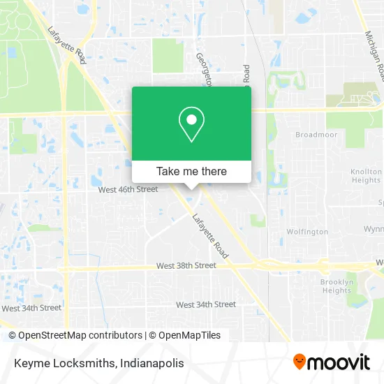
See Keyme Locksmiths, Indianapolis City (Balance), on the map
Public Transit to Keyme Locksmiths in Indianapolis City (Balance)
Wondering how to get to Keyme Locksmiths in Indianapolis City (Balance)? Moovit helps you find the best way to get to Keyme Locksmiths with step-by-step directions from the nearest public transit station.
Moovit provides free maps and live directions to help you navigate through your city. View schedules, routes, timetables, and find out how long does it take to get to Keyme Locksmiths in real time.
Looking for the nearest stop or station to Keyme Locksmiths? Check out this list of stops closest to your destination: Georgetown Rd & Brock St; Georgetown Rd & Century Plaza Rd.
Bus: 25, 37.
Want to see if there’s another route that gets you there at an earlier time? Moovit helps you find alternative routes or times. Get directions from and directions to Keyme Locksmiths easily from the Moovit App or Website.
We make riding to Keyme Locksmiths easy, which is why over 1.5 million users, including users in Indianapolis City (Balance), trust Moovit as the best app for public transit. You don’t need to download an individual bus app or train app, Moovit is your all-in-one transit app that helps you find the best bus time or train time available.
For information on prices of bus, costs and ride fares to Keyme Locksmiths, please check the Moovit app.
Use the app to navigate to popular places including to the airport, hospital, stadium, grocery store, mall, coffee shop, school, college, and university.
Keyme Locksmiths Address: 4545 Lafayette Rd Indianapolis, IN 46254 street in Indianapolis City (Balance)
- Chiropractic Insurance Accepted,
- Blue Locksmith Inc Indianapolis,
- Walmart Store,
- Eco Atm,
- Walmart Supercenter,
- Walmart Lafayette Rd,
- Shoe Carnival,
- Juanita R. Taylor, DDS-Caringsmiles 4u,
- Familia Dental,
- Centries Properties,
- Columbia,
- Dish Network,
- Verizon Wireless,
- Ashley K Mundil, Aprn,
- Amazon Locker-Touche,
- David P Wasserman, do,
- Grace and Unity Church Inc.,
- Hoosier Car & Truck Sales,
- New Zion Temple Church,
- Dolly Rani MD
Places Near Keyme Locksmiths (Indianapolis City (Balance))
- Jersey Barn, Indianapolis City (Balance),
- THE BALT, Indianapolis City (Balance),
- Methodist Hospital of Indianapolis, Indianapolis City (Balance),
- St. Vincent entrance #1, Indianapolis City (Balance),
- Indiana, Indianapolis City (Balance),
- Indianapolis Motor Speedway, Speedway,
- I-465 / I-65 Interchange, Indianapolis City (Balance),
- Train Ride At Castleton Mall, Indianapolis City (Balance),
- Lucas Oil Stadium, Indianapolis City (Balance),
- Plainfield, IN, Plainfield,
- Eskenazi Hospital, Indianapolis City (Balance),
- Gainbridge Fieldhouse, Indianapolis City (Balance),
- St. Vincent Hospital - Indianapolis, Indianapolis City (Balance),
- 119 W 19th St Parking, Indianapolis City (Balance),
- Cotter's Massage Parlor With Happy Endings, Indianapolis City (Balance),
- Castleton Square Mall, Indianapolis,
- I U Health Methodist Hospital, Indianapolis City (Balance),
- Lilly Corporate Center (Eli Lilly & Co), Indianapolis City (Balance),
- Indianapolis Airport Zone 2, Indianapolis City (Balance),
- Indiana Convention Center, Indianapolis City (Balance)
How to get to popular places in Indianapolis with public transit
Get around Indianapolis City (Balance) by public transit!
Traveling around Indianapolis City (Balance) has never been so easy. See step by step directions as you travel to any attraction, street or major public transit station. View bus and train schedules, arrival times, service alerts and detailed routes on a map, so you know exactly how to get to anywhere in Indianapolis City (Balance).
When traveling to any destination around Indianapolis City (Balance) use Moovit's Live Directions with Get Off Notifications to know exactly where and how far to walk, how long to wait for your line, and how many stops are left. Moovit will alert you when it's time to get off — no need to constantly re-check whether yours is the next stop.
Wondering how to use public transit in Indianapolis City (Balance) or how to pay for public transit in Indianapolis City (Balance)? Moovit public transit app can help you navigate your way with public transit easily, and at minimum cost. It includes public transit fees, ticket prices, and costs. Looking for a map of Indianapolis City (Balance) public transit lines? Moovit public transit app shows all public transit maps in Indianapolis City (Balance) with all bus routes and stops on an interactive map.
Indianapolis has 1 transit type(s), including: bus, operated by several transit agencies, including IndyGo, FlixBus-us and Greyhound-us