How to get to Keyme Locksmiths by bus?
Click on the bus route to see step by step directions with maps, line arrival times and updated time schedules.
From Angelika Film Center, Manhattan
74 minFrom College Point, Queens
80 minFrom Hilton New York Midtown, Manhattan
58 minFrom College Point DMV, Queens
68 minFrom Times Square, Manhattan
65 minFrom Elmhurst, NY, Queens
72 minFrom 32nd St, Manhattan
55 minFrom Shea Stadium, Queens
85 minFrom 30-56 Whitestone Expwy, Queens
72 min
How to get to Keyme Locksmiths by train?
Click on the train route to see step by step directions with maps, line arrival times and updated time schedules.
How to get to Keyme Locksmiths by subway?
Click on the subway route to see step by step directions with maps, line arrival times and updated time schedules.
Bus stops near Keyme Locksmiths in Manhattan
Train station near Keyme Locksmiths in Manhattan
- Harlem-125th St., 5 min walk,VIEW
Bus lines to Keyme Locksmiths in Manhattan
- M60-SBS, Select Bus La Guardia Airport,VIEW
- M101, Ft George Via 3 Av Via Amsterdam Av,VIEW
- M125, The Hub 3 Av/149 St Via 125 St,VIEW
- M7, 14 St Via Columbus Via 7 Av,VIEW
- M102, East Village 6 St Via Lex Av,VIEW
- SHORTLINE HUDSON, Montgomery,VIEW
- M2, Washington Hts Bway-168 St Via Madison,VIEW
- M1, Limited Soho Centre St Via 5 Av/Broadway,VIEW
What are the closest stations to Keyme Locksmiths?
The closest stations to Keyme Locksmiths are:
- W 125 St/Malcolm X Blvd is 78 yards away, 1 min walk.
- Malcolm X Blvd/W 125 St is 84 yards away, 2 min walk.
- Lenox Ave & W 125th St is 118 yards away, 2 min walk.
- Adam C Powell Blvd/W 125 St is 266 yards away, 4 min walk.
- Mount Morris Park West/W 124 St is 332 yards away, 5 min walk.
- Harlem-125th St. is 351 yards away, 5 min walk.
- 116 St is 806 yards away, 10 min walk.
- 125 St is 1059 yards away, 13 min walk.
Which bus lines stop near Keyme Locksmiths?
These bus lines stop near Keyme Locksmiths: M101, M2, M60-SBS, M7.
Which train lines stop near Keyme Locksmiths?
These train lines stop near Keyme Locksmiths: 1, 2, 3.
Which subway lines stop near Keyme Locksmiths?
These subway lines stop near Keyme Locksmiths: 2, 3.
What’s the nearest subway station to Keyme Locksmiths in Manhattan?
The nearest subway station to Keyme Locksmiths in Manhattan is 116 St. It’s a 10 min walk away.
What’s the nearest train station to Keyme Locksmiths in Manhattan?
The nearest train station to Keyme Locksmiths in Manhattan is Harlem-125th St.. It’s a 5 min walk away.
What’s the nearest bus station to Keyme Locksmiths in Manhattan?
The nearest bus station to Keyme Locksmiths in Manhattan is W 125 St/Malcolm X Blvd. It’s a 1 min walk away.
What time is the first subway to Keyme Locksmiths in Manhattan?
The 3 is the first subway that goes to Keyme Locksmiths in Manhattan. It stops nearby at 3:02 AM.
What time is the last subway to Keyme Locksmiths in Manhattan?
The A is the last subway that goes to Keyme Locksmiths in Manhattan. It stops nearby at 4:14 AM.
What time is the first train to Keyme Locksmiths in Manhattan?
The 2 is the first train that goes to Keyme Locksmiths in Manhattan. It stops nearby at 5:29 AM.
What time is the last train to Keyme Locksmiths in Manhattan?
The 2 is the last train that goes to Keyme Locksmiths in Manhattan. It stops nearby at 2:06 AM.
What time is the first bus to Keyme Locksmiths in Manhattan?
The M60-SBS is the first bus that goes to Keyme Locksmiths in Manhattan. It stops nearby at 3:01 AM.
What time is the last bus to Keyme Locksmiths in Manhattan?
The M7 is the last bus that goes to Keyme Locksmiths in Manhattan. It stops nearby at 3:11 AM.
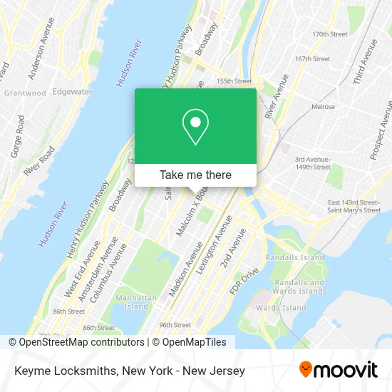
See Keyme Locksmiths, Manhattan, on the map
Public Transit to Keyme Locksmiths in Manhattan
Wondering how to get to Keyme Locksmiths in Manhattan? Moovit helps you find the best way to get to Keyme Locksmiths with step-by-step directions from the nearest public transit station.
Moovit provides free maps and live directions to help you navigate through your city. View schedules, routes, timetables, and find out how long does it take to get to Keyme Locksmiths in real time.
Looking for the nearest stop or station to Keyme Locksmiths? Check out this list of stops closest to your destination: W 125 St/Malcolm X Blvd; Malcolm X Blvd/W 125 St; Lenox Ave & W 125th St; Adam C Powell Blvd/W 125 St; Mount Morris Park West/W 124 St; Harlem-125th St.; 116 St; 125 St.
Bus: M101, M2, M60-SBS, M7, M125, M102, SHORTLINE HUDSON.Train: 1, 2, 3, 4, 5.Subway: 2, 3, A, B, C, D.
Want to see if there’s another route that gets you there at an earlier time? Moovit helps you find alternative routes or times. Get directions from and directions to Keyme Locksmiths easily from the Moovit App or Website.
We make riding to Keyme Locksmiths easy, which is why over 1.5 million users, including users in Manhattan, trust Moovit as the best app for public transit. You don’t need to download an individual bus app or train app, Moovit is your all-in-one transit app that helps you find the best bus time or train time available.
For information on prices of subway, bus and train, costs and ride fares to Keyme Locksmiths, please check the Moovit app.
Use the app to navigate to popular places including to the airport, hospital, stadium, grocery store, mall, coffee shop, school, college, and university.
Keyme Locksmiths Address: 105 W 125th St T 1 street in Manhattan
- Golden Krust Caribbean Restaurant & Bakery,
- Ups Alliance Shipping Partner,
- Mikes Discount Electronics,
- Amazon Locker - Tempestades,
- The Ethiopian World Federation,
- Bagel Point Catering,
- Whole Foods Market,
- Libertyx Bitcoin Atm,
- Mendez Boxing,
- Ups Access Point Location,
- H&M Harlem,
- Amazon Locker - Kim,
- Cap Usa,
- Mimi's Trendy Trinkets Llc,
- Cj & Comery Llc,
- 125th Street & Lenox Avenue (Malcolm X / 7th Avenue) (Manhattan, NY),
- 125th St, NY,
- Sistaz Cakes,
- Shop Yobachi,
- The National Urban League
Places Near Keyme Locksmiths (Manhattan)
- Rockefeller Center, Manhattan,
- Chinatown, Manhattan,
- Wall Street, Manhattan,
- 66 John Street, Manhattan,
- 3 Stone St, Manhattan,
- 111 Centre New York City Supreme Court, Manhattan,
- 26 Federal Plaza, Manhattan,
- Mountainside Hospital, Glen Ridge,
- Pier 83, Manhattan,
- Times Square, Manhattan,
- Katz's Deli, Manhattan,
- Bellevue Hospital, Manhattan,
- 911 Memorial, Manhattan,
- qqqq, Manhattan,
- SoHo, Manhattan,
- 376 Hudson Street, Manhattan,
- 1 Police Plaza, Manhattan,
- San Gennaro Feast, Manhattan,
- Hudson Yards, Manhattan,
- Queens Center Mall, Queens
How to get to popular places in New York - New Jersey with public transit
Get around Manhattan by public transit!
Traveling around Manhattan has never been so easy. See step by step directions as you travel to any attraction, street or major public transit station. View bus and train schedules, arrival times, service alerts and detailed routes on a map, so you know exactly how to get to anywhere in Manhattan.
When traveling to any destination around Manhattan use Moovit's Live Directions with Get Off Notifications to know exactly where and how far to walk, how long to wait for your line, and how many stops are left. Moovit will alert you when it's time to get off — no need to constantly re-check whether yours is the next stop.
Wondering how to use public transit in Manhattan or how to pay for public transit in Manhattan? Moovit public transit app can help you navigate your way with public transit easily, and at minimum cost. It includes public transit fees, ticket prices, and costs. Looking for a map of Manhattan public transit lines? Moovit public transit app shows all public transit maps in Manhattan with all Bus, Train, Subway, Light Rail, Ferry and Cable Car routes and stops on an interactive map.
New York - New Jersey has 6 transit type(s), including: Bus, Train, Subway, Light Rail, Ferry and Cable Car, operated by several transit agencies, including MTA Subway, Metro-North Railroad, LIRR, PATH, MTA New York City Transit - Express routes, MTA Bus, NJ Transit, NYC Ferry, NICE bus, Bee-Line Bus, NJ Transit Rail, Norwalk Transit District, Hartford Line, River Valley Transit and HART