Directions to Keyme Locksmiths (Manhattan) with public transportation
The following transit lines have routes that pass near Keyme Locksmiths
 Bus: 119, 34TH ST, BXM4, M20, M34-SBS.
- Train: EMPIRE SERVICE, YEL, ACELA, ADIRONDACK, BERKSHIRE FLYER.
- Subway: 1, 2, C, E, A.
How to get to Keyme Locksmiths by bus?
Click on the bus route to see step by step directions with maps, line arrival times and updated time schedules.
From Macy's, Queens
40 minFrom East 96th Street, Manhattan
59 minFrom Rucker Park, Manhattan
78 minFrom Castle Clinton National Monument, Manhattan
44 minFrom Middle Village, NY, Queens
56 minFrom SeaGlass Carousel, Manhattan
45 minFrom Metro North Station, Yankee Stadium, Bronx
75 minFrom Liberty State Park, Jersey City
90 min
How to get to Keyme Locksmiths by train?
Click on the train route to see step by step directions with maps, line arrival times and updated time schedules.
How to get to Keyme Locksmiths by subway?
Click on the subway route to see step by step directions with maps, line arrival times and updated time schedules.
Subway stations near Keyme Locksmiths in Manhattan
Bus stops near Keyme Locksmiths in Manhattan
Train station near Keyme Locksmiths in Manhattan
- 34 St-Penn Station, 4 min walk,VIEW
Bus lines to Keyme Locksmiths in Manhattan
- M34-SBS, Select Bus East Side Fdr Dr Crosstown,VIEW
- M34A-SBS, Select Bus Waterside Via 34 St Via 2 Av,VIEW
- M7, 14 St Via Columbus Via 7 Av,VIEW
- M20, Lincoln Center 66 St Via 8 Av,VIEW
- SHORTLINE HUDSON, 500 - Monroe - Chester - Goshen,VIEW
- SHORTLINE HUDSON, 200 - Northern District – Nanuet,VIEW
- SHORTLINE HUDSON, 800 - Pennsylvania,VIEW
- SHORTLINE HUDSON, 700 - Newburgh - Poughkeepsie,VIEW
- SHORTLINE HUDSON, 300 - NYC - Middletown,VIEW
- M11, 23 St,VIEW
- FLIXBUS N2470, Atlanta - DC - NYC,VIEW
- FLIXBUS N2471, NYC Chinatown - Atlanta,VIEW
- FLIXBUS 2601, NYC - Washington DC,VIEW
- FLIXBUS N2601, NYC - Richmond - Virginia Beach,VIEW
- FLIXBUS 2602, NYC - Philadelphia,VIEW
- FLIXBUS 2605, NYC - Richmond,VIEW
- FLIXBUS N2605, Boston - NYC - Richmond,VIEW
- FLIXBUS 2610, NYC - Boston,VIEW
- FLIXBUS N2610, NYC - Boston,VIEW
- FLIXBUS N2615, NYC - Boston - Portland - Bangor,VIEW
What are the closest stations to Keyme Locksmiths?
The closest stations to Keyme Locksmiths are:
- 34 St-Penn Station is 37 yards away, 1 min walk.
- W 34 St/8 Av is 82 yards away, 2 min walk.
- 28 St is 91 yards away, 2 min walk.
- 7 Av/W 28 St is 131 yards away, 2 min walk.
- W 26th St & 7th Ave is 295 yards away, 4 min walk.
- 9 Av/W 30 St is 419 yards away, 5 min walk.
- New York Midtown (31st St & 8th Ave) is 503 yards away, 6 min walk.
Which bus lines stop near Keyme Locksmiths?
These bus lines stop near Keyme Locksmiths: 119, 34TH ST, BXM4, M20, M34-SBS, M7.
Which train lines stop near Keyme Locksmiths?
These train lines stop near Keyme Locksmiths: EMPIRE SERVICE, YEL.
Which subway lines stop near Keyme Locksmiths?
These subway lines stop near Keyme Locksmiths: 1, 2, C, E.
What’s the nearest subway station to Keyme Locksmiths in Manhattan?
The nearest subway station to Keyme Locksmiths in Manhattan is 34 St-Penn Station. It’s a 1 min walk away.
What’s the nearest train station to Keyme Locksmiths in Manhattan?
The nearest train station to Keyme Locksmiths in Manhattan is 34 St-Penn Station. It’s a 4 min walk away.
What’s the nearest bus station to Keyme Locksmiths in Manhattan?
The nearest bus stations to Keyme Locksmiths in Manhattan are W 34 St/8 Av and 7 Av/W 28 St. The closest one is a 2 min walk away.
What time is the first subway to Keyme Locksmiths in Manhattan?
The E is the first subway that goes to Keyme Locksmiths in Manhattan. It stops nearby at 3:00 AM.
What time is the last subway to Keyme Locksmiths in Manhattan?
The 2 is the last subway that goes to Keyme Locksmiths in Manhattan. It stops nearby at 3:58 AM.
What time is the first train to Keyme Locksmiths in Manhattan?
The PORT JEFFERSON BRANCH is the first train that goes to Keyme Locksmiths in Manhattan. It stops nearby at 3:01 AM.
What time is the last train to Keyme Locksmiths in Manhattan?
The RONKONKOMA BRANCH is the last train that goes to Keyme Locksmiths in Manhattan. It stops nearby at 3:15 AM.
What time is the first bus to Keyme Locksmiths in Manhattan?
The FLIXBUS N2605 is the first bus that goes to Keyme Locksmiths in Manhattan. It stops nearby at 3:00 AM.
What time is the last bus to Keyme Locksmiths in Manhattan?
The FLIXBUS N2640 is the last bus that goes to Keyme Locksmiths in Manhattan. It stops nearby at 4:30 PM.
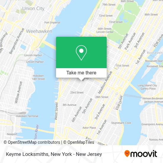
See Keyme Locksmiths, Manhattan, on the map
Public Transit to Keyme Locksmiths in Manhattan
Wondering how to get to Keyme Locksmiths in Manhattan? Moovit helps you find the best way to get to Keyme Locksmiths with step-by-step directions from the nearest public transit station.
Moovit provides free maps and live directions to help you navigate through your city. View schedules, routes, timetables, and find out how long does it take to get to Keyme Locksmiths in real time.
Looking for the nearest stop or station to Keyme Locksmiths? Check out this list of stops closest to your destination: 34 St-Penn Station; W 34 St/8 Av; 28 St; 7 Av/W 28 St; W 26th St & 7th Ave; 9 Av/W 30 St; New York Midtown (31st St & 8th Ave).
Bus: 119, 34TH ST, BXM4, M20, M34-SBS, M7, M34A-SBS, SHORTLINE HUDSON, SHORTLINE HUDSON, SHORTLINE HUDSON, SHORTLINE HUDSON, SHORTLINE HUDSON.Train: EMPIRE SERVICE, YEL, ACELA, ADIRONDACK, BERKSHIRE FLYER, CARDINAL, CAROLINIAN.Subway: 1, 2, C, E, A.
Want to see if there’s another route that gets you there at an earlier time? Moovit helps you find alternative routes or times. Get directions from and directions to Keyme Locksmiths easily from the Moovit App or Website.
We make riding to Keyme Locksmiths easy, which is why over 1.5 million users, including users in Manhattan, trust Moovit as the best app for public transit. You don’t need to download an individual bus app or train app, Moovit is your all-in-one transit app that helps you find the best bus time or train time available.
For information on prices of subway, bus, train and light rail, costs and ride fares to Keyme Locksmiths, please check the Moovit app.
Use the app to navigate to popular places including to the airport, hospital, stadium, grocery store, mall, coffee shop, school, college, and university.
Keyme Locksmiths Address: 368 8th Ave street in Manhattan
- Indeed Thoughts,
- 34 St 8 Ave,
- Atm 7eleven-Fcti,
- W 28th St & 8th Ave,
- Ahrc Traumatic Brain Injury,
- Local Locker Storage,
- W 29th St (8th ave 29th),
- 253 W 28 St Corp,
- High Line Orthodontics,
- Ny1 Dental,
- Green Blend Eatery,
- Kpa Talent Management / Production,
- Green Blend / Balanced Food,
- Galaxy,
- Nơi Tìm Đến Ước Mơ,
- Ohio Wesleyan University,
- Swift Graphic Design Agency,
- Lamartine Chelsea,
- Word Wise Book - Author Will Jelbert,
- Ajc Jewelry Contracting
Places Near Keyme Locksmiths (Manhattan)
- 66 John Street, Manhattan,
- Mountainside Hospital, Glen Ridge,
- 26 Federal Plaza, Manhattan,
- Times Square, Manhattan,
- SoHo, Manhattan,
- qqqq, Manhattan,
- Chinatown, Manhattan,
- 1 Police Plaza, Manhattan,
- 111 Centre New York City Supreme Court, Manhattan,
- Wall Street, Manhattan,
- Rockefeller Center, Manhattan,
- 3 Stone St, Manhattan,
- Katz's Deli, Manhattan,
- 911 Memorial, Manhattan,
- Queens Center Mall, Queens,
- San Gennaro Feast, Manhattan,
- Pier 83, Manhattan,
- 376 Hudson Street, Manhattan,
- Hudson Yards, Manhattan,
- Bellevue Hospital, Manhattan
How to get to popular places in New York - New Jersey with public transit
Get around Manhattan by public transit!
Traveling around Manhattan has never been so easy. See step by step directions as you travel to any attraction, street or major public transit station. View bus and train schedules, arrival times, service alerts and detailed routes on a map, so you know exactly how to get to anywhere in Manhattan.
When traveling to any destination around Manhattan use Moovit's Live Directions with Get Off Notifications to know exactly where and how far to walk, how long to wait for your line, and how many stops are left. Moovit will alert you when it's time to get off — no need to constantly re-check whether yours is the next stop.
Wondering how to use public transit in Manhattan or how to pay for public transit in Manhattan? Moovit public transit app can help you navigate your way with public transit easily, and at minimum cost. It includes public transit fees, ticket prices, and costs. Looking for a map of Manhattan public transit lines? Moovit public transit app shows all public transit maps in Manhattan with all Bus, Train, Subway, Light Rail, Ferry and Cable Car routes and stops on an interactive map.
New York - New Jersey has 6 transit type(s), including: Bus, Train, Subway, Light Rail, Ferry and Cable Car, operated by several transit agencies, including MTA Subway, Metro-North Railroad, LIRR, PATH, MTA New York City Transit - Express routes, MTA Bus, NJ Transit, NYC Ferry, NICE bus, Bee-Line Bus, NJ Transit Rail, Norwalk Transit District, Hartford Line, River Valley Transit and HART