How to get to Keys Computer Repair by bus?
Click on the bus route to see step by step directions with maps, line arrival times and updated time schedules.
From Fairfield Inn & Suites by Marriott Key West at the Keys Collection, Key West
100 minFrom Wisteria Island, Key West
106 minFrom Fort Zachary Taylor Historic State Park, Key West
117 minFrom Naval Air Station Key West Trumbo Point Annex, Key West
129 minFrom Bluewater Key RV Resort, Key West
94 minFrom The Hemingway Home and Museum (Hemingway House), Key West
102 minFrom Hyatt Residence Club-Key West Windward Pointe, Key West
99 minFrom Smathers Beach, Key West
91 min
Bus stops near Keys Computer Repair in Miami
Bus lines to Keys Computer Repair in Miami
What are the closest stations to Keys Computer Repair?
The closest stations to Keys Computer Repair are:
- Mile Marker 50 Marathon is 241 yards away, 3 min walk.
- US1 & 52nd Street is 292 yards away, 4 min walk.
Which bus line stops near Keys Computer Repair?
LKS (Stock Island/Key West)
What’s the nearest bus station to Keys Computer Repair in Miami?
The nearest bus station to Keys Computer Repair in Miami is Mile Marker 50 Marathon. It’s a 3 min walk away.
What time is the first bus to Keys Computer Repair in Miami?
The LKS is the first bus that goes to Keys Computer Repair in Miami. It stops nearby at 5:43 AM.
What time is the last bus to Keys Computer Repair in Miami?
The 301 is the last bus that goes to Keys Computer Repair in Miami. It stops nearby at 11:00 PM.
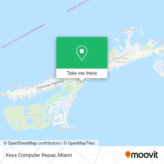
See Keys Computer Repair, Miami, on the map
Public Transit to Keys Computer Repair in Miami
Wondering how to get to Keys Computer Repair in Miami? Moovit helps you find the best way to get to Keys Computer Repair with step-by-step directions from the nearest public transit station.
Moovit provides free maps and live directions to help you navigate through your city. View schedules, routes, timetables, and find out how long does it take to get to Keys Computer Repair in real time.
Looking for the nearest stop or station to Keys Computer Repair? Check out this list of stops closest to your destination: Mile Marker 50 Marathon; US1 & 52nd Street.
Bus: LKS, 301.
Want to see if there’s another route that gets you there at an earlier time? Moovit helps you find alternative routes or times. Get directions from and directions to Keys Computer Repair easily from the Moovit App or Website.
We make riding to Keys Computer Repair easy, which is why over 1.7 million users, including users in Miami, trust Moovit as the best app for public transit. You don’t need to download an individual bus app or train app, Moovit is your all-in-one transit app that helps you find the best bus time or train time available.
For information on prices of bus, costs and ride fares to Keys Computer Repair, please check the Moovit app.
Use the app to navigate to popular places including to the airport, hospital, stadium, grocery store, mall, coffee shop, school, college, and university.
Keys Computer Repair Address: 6679 Overseas Hwy street in Miami
- Baptist Health Orthopedics - Marathon,
- Iglesia Bautista Hispana El Faro Marathon,
- Winn-Dixie,
- 7 Mile Buffet,
- Marathon at Mile Marker 50,
- Sombrero Beach Rental,
- Stacey Pierce-Pegum, LMT,
- The Home Depot,
- Marathon FL USA,
- Grassy Key,
- Tranquility Bay Beach House Resort,
- Turtle Hospital,
- Faro Blanco Resort,
- Faro Blanco Resort & Yacht Club,
- Circle K,
- Seven Mile Bridge,
- Isla Bella Beach Resort,
- Crawl Key (Mile Marker 54) Public Boat Ramp,
- Sunshine Key Rv Resort And Marina,
- 58
Places Near Keys Computer Repair (Miami)
- Wynwood, Miami,
- Miami-Dade County Courthouse, Miami,
- Port of Miami Cruise Terminal, Miami,
- Aventura Mall, Miami,
- Miami Freedom Park, Miami,
- Dolphin Mall Bus, Miami,
- Richard E. Gerstein Justice Building, Miami,
- Sawgrass Mall, Miami,
- Bayside Marketplace, Miami,
- Miami Design District, Miami,
- Brickell City Centre, Miami,
- Marlins Park, Miami,
- Little Havana, Miami,
- Sawgrass mall ( FL ), Miami Beach,
- Miami VA Hospital, Miami,
- Keiser University Flagship Campus, West Palm Beach,
- Dolphin Mall, Miami,
- Hard Rock Stadium, Miami Gardens,
- Aventura Mall, Miami Beach,
- Zoo Miami, Miami
How to get to popular places in Miami with public transit
Get around Miami by public transit!
Traveling around Miami has never been so easy. See step by step directions as you travel to any attraction, street or major public transit station. View bus and train schedules, arrival times, service alerts and detailed routes on a map, so you know exactly how to get to anywhere in Miami.
When traveling to any destination around Miami use Moovit's Live Directions with Get Off Notifications to know exactly where and how far to walk, how long to wait for your line, and how many stops are left. Moovit will alert you when it's time to get off — no need to constantly re-check whether yours is the next stop.
Wondering how to use public transit in Miami or how to pay for public transit in Miami? Moovit public transit app can help you navigate your way with public transit easily, and at minimum cost. It includes public transit fees, ticket prices, and costs. Looking for a map of Miami public transit lines? Moovit public transit app shows all public transit maps in Miami with all Bus, Train, Light Rail and Ferry routes and stops on an interactive map.
Miami has 4 transit type(s), including: Bus, Train, Light Rail and Ferry, operated by several transit agencies, including Broward County Transit, Miami-Dade Transit, Metrorail, Palm Tran, Tri-Rail, Brightline, MARTY, City of Homestead Trolley, Key West Transit, Treasure Coast Connector, GoLine IRT, Amtrak, Greyhound-us, FlixBus-us and Aventura Express Shuttle Bus