How to get to Keyswithsydney by bus?
Click on the bus route to see step by step directions with maps, line arrival times and updated time schedules.
From Walmart, Baltimore
77 minFrom I-695 @ Exit 18 (Liberty Rd/MD 26), Baltimore County
66 minFrom Morgan State University, Baltimore
81 minFrom Lyric Theater, Baltimore
83 minFrom Coppin State University, Baltimore
71 minFrom I-695 @ Exit 26 (York Rd/MD 45), Baltimore County
70 minFrom Towson, MD, Baltimore County
63 minFrom I-695 Exit 29 (Loch Raven Blvd (MD 542)/Cromwell Bridge Rd), Baltimore County
71 minFrom Owings Mills, Maryland, Baltimore County
72 minFrom Walters Art Museum, Baltimore
79 min
Bus stop near Keyswithsydney in Baltimore County
- Smith Ave & Laurelwood Ave FS Wb, 7 min walk,VIEW
Light Rail stations near Keyswithsydney in Baltimore County
- Falls Road, 48 min walk,VIEW
What are the closest stations to Keyswithsydney?
The closest stations to Keyswithsydney are:
- Smith Ave & Laurelwood Ave FS Wb is 512 yards away, 7 min walk.
- Falls Road is 4066 yards away, 48 min walk.
Which bus line stops near Keyswithsydney?
34 (Catonsville)
What’s the nearest bus station to Keyswithsydney in Baltimore County?
The nearest bus station to Keyswithsydney in Baltimore County is Smith Ave & Laurelwood Ave FS Wb. It’s a 7 min walk away.
What time is the first light rail to Keyswithsydney in Baltimore County?
The LIGHT RAILLINK is the first light rail that goes to Keyswithsydney in Baltimore County. It stops nearby at 4:32 AM.
What time is the last light rail to Keyswithsydney in Baltimore County?
The LIGHT RAILLINK is the last light rail that goes to Keyswithsydney in Baltimore County. It stops nearby at 1:09 AM.
What time is the first bus to Keyswithsydney in Baltimore County?
The 34 is the first bus that goes to Keyswithsydney in Baltimore County. It stops nearby at 5:15 AM.
What time is the last bus to Keyswithsydney in Baltimore County?
The 34 is the last bus that goes to Keyswithsydney in Baltimore County. It stops nearby at 11:23 PM.
See Keyswithsydney, Baltimore County, on the map
Public Transit to Keyswithsydney in Baltimore County
Wondering how to get to Keyswithsydney in Baltimore County? Moovit helps you find the best way to get to Keyswithsydney with step-by-step directions from the nearest public transit station.
Moovit provides free maps and live directions to help you navigate through your city. View schedules, routes, timetables, and find out how long does it take to get to Keyswithsydney in real time.
Looking for the nearest stop or station to Keyswithsydney? Check out this list of stops closest to your destination: Smith Ave & Laurelwood Ave FS Wb; Falls Road.
Bus: 34, 92.
Want to see if there’s another route that gets you there at an earlier time? Moovit helps you find alternative routes or times. Get directions from and directions to Keyswithsydney easily from the Moovit App or Website.
We make riding to Keyswithsydney easy, which is why over 1.7 million users, including users in Baltimore County, trust Moovit as the best app for public transit. You don’t need to download an individual bus app or train app, Moovit is your all-in-one transit app that helps you find the best bus time or train time available.
For information on prices of bus, metro and light rail, costs and ride fares to Keyswithsydney, please check the Moovit app.
Use the app to navigate to popular places including to the airport, hospital, stadium, grocery store, mall, coffee shop, school, college, and university.
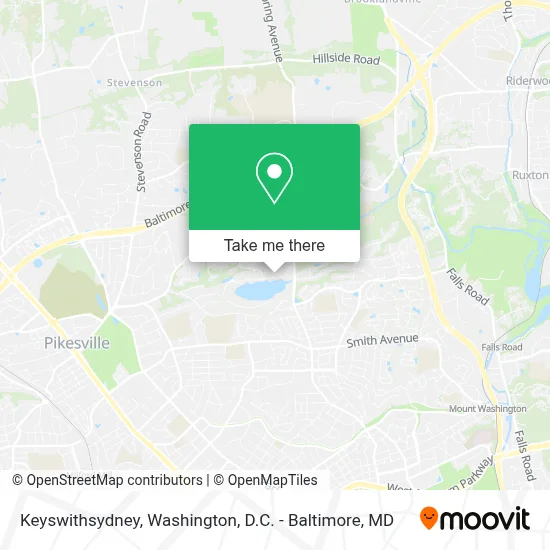
Keyswithsydney Address: 2580 Quarry Lake Dr street in Baltimore County
- The Overlook at Quarry Lake,
- Greenspring Shopping Center,
- James R. Howard III Appalachian Challenge® Course,
- Smith Ave and Greenspring,
- Pikesville High School,
- Beazer Homes - The Parke at Mount Washington,
- Pikesville Middle School,
- Mt Washington,
- Johns Hopkins University,
- King King & Associates,
- Pikesville, MD,
- Reisterstown Road & Clarks Lane,
- Paisley Experience,
- Ashley Ramtahal Real Estate Services (Odessa Moseley Real Estate),
- Gandhi Health Care,
- Post Office,
- Wholesale Outlet of MD,
- Oasis Ministries of MD,
- Club,
- T-Mobile
Places Near Keyswithsydney (Baltimore County)
- National Museum of African American History and Culture, Washington,
- Pennsylvania Ave NW (3rd st and pennsylvania), Washington,
- Camden Yards, Baltimore,
- Westfield Montgomery Mall, Montgomery County,
- M&T Bank Stadium, Baltimore,
- Amazon Hq2, Arlington County,
- Georgetown, Washington,
- National Zoo, Washington,
- Marriott Marquis Washington, DC, Washington,
- Sibley Memorial Hospital, Washington,
- Rock Creek Tennis Center, Washington,
- PG Mall, Prince George's County,
- Warner Theatre, Washington,
- Museum Of The Bible, Washington,
- Basilica of the National Shrine, Washington,
- Capital One Arena, Washington,
- National Theatre, Washington,
- The Anthem, Washington,
- Washington National Cathedral, Washington,
- Washington DC VA Medical Center, Washington
How to get to popular places in Washington, D.C. - Baltimore, MD with public transit
Get around Baltimore County by public transit!
Traveling around Baltimore County has never been so easy. See step by step directions as you travel to any attraction, street or major public transit station. View bus and train schedules, arrival times, service alerts and detailed routes on a map, so you know exactly how to get to anywhere in Baltimore County.
When traveling to any destination around Baltimore County use Moovit's Live Directions with Get Off Notifications to know exactly where and how far to walk, how long to wait for your line, and how many stops are left. Moovit will alert you when it's time to get off — no need to constantly re-check whether yours is the next stop.
Wondering how to use public transit in Baltimore County or how to pay for public transit in Baltimore County? Moovit public transit app can help you navigate your way with public transit easily, and at minimum cost. It includes public transit fees, ticket prices, and costs. Looking for a map of Baltimore County public transit lines? Moovit public transit app shows all public transit maps in Baltimore County with all Bus, Train, Metro, Light Rail and Ferry routes and stops on an interactive map.
Washington, D.C. - Baltimore, MD has 5 transit type(s), including: Bus, Train, Metro, Light Rail and Ferry, operated by several transit agencies, including WMATA, Montgomery County Ride On, Fairfax Connector, TheBus, PRTC, DASH - Alexandria, Arlington Transit (ART), RTA of Central Maryland, MDOT MTA, MDOT MTA Light RailLink, MDOT MTA Commuter Bus, MDOT MTA Local Bus, FXBGO!, Virginia Railway Express (VRE) and MARC