How to get to Khalsa by bus?
Click on the bus route to see step by step directions with maps, line arrival times and updated time schedules.
Bus stops near Khalsa in Reims
Bus lines to Khalsa in Reims
- 22, U22-NEUVILETTE MAIRIE <> ROYALE,VIEW
- 23, U23-ODILE MADELIN <> ROYALE,VIEW
- U1, U1-P+R THILLOIS <> C.C CERNAY,VIEW
- U2, U2-ROUTE DE WITRY <> C.C. CHAMPFLEURY,VIEW
- U8, U8-CHAMPEA/CROIX BLANCHE <> LA COUTURELLE,VIEW
- C, Gare Centre,VIEW
- E2, St-Etienne/Sui.,VIEW
- E3, Saint-Symphorien,VIEW
- E4, Betheniville,VIEW
- E5, Cathedrale,VIEW
- O1, Moulin Housse,VIEW
- U9, C.C. Cormontreuil,VIEW
- TRAM, Leon Blum,VIEW
- 20, Gare Clairmarais,VIEW
- U3, Maurencienne,VIEW
- U4, Orgeval,VIEW
- U6, Croix Blandin,VIEW
- U7, Hopital Debre,VIEW
What are the closest stations to Khalsa?
The closest stations to Khalsa are:
- Royale is 193 meters away, 3 min walk.
- Forum is 241 meters away, 4 min walk.
- Saint-Symphorien is 291 meters away, 4 min walk.
- Cathedrale is 405 meters away, 6 min walk.
- Chanzy is 489 meters away, 7 min walk.
- Opera-Cathedrale is 525 meters away, 7 min walk.
- Gare De Reims - Centre is 693 meters away, 9 min walk.
Which bus lines stop near Khalsa?
These bus lines stop near Khalsa: O1, U9.
What’s the nearest bus station to Khalsa in Reims?
The nearest bus station to Khalsa in Reims is Royale. It’s a 3 min walk away.
What time is the first light rail to Khalsa in Reims?
The TRAM is the first light rail that goes to Khalsa in Reims. It stops nearby at 5:14 AM.
What time is the last light rail to Khalsa in Reims?
The TRAM is the last light rail that goes to Khalsa in Reims. It stops nearby at 12:57 AM.
What time is the first bus to Khalsa in Reims?
The U9 is the first bus that goes to Khalsa in Reims. It stops nearby at 5:21 AM.
What time is the last bus to Khalsa in Reims?
The U2 is the last bus that goes to Khalsa in Reims. It stops nearby at 12:43 AM.
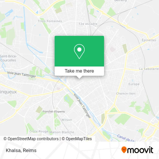
See Khalsa, Reims, on the map
Public Transit to Khalsa in Reims
Wondering how to get to Khalsa in Reims? Moovit helps you find the best way to get to Khalsa with step-by-step directions from the nearest public transit station.
Moovit provides free maps and live directions to help you navigate through your city. View schedules, routes, timetables, and find out how long does it take to get to Khalsa in real time.
Looking for the nearest stop or station to Khalsa? Check out this list of stops closest to your destination: Royale; Forum; Saint-Symphorien; Cathedrale; Chanzy; Opera-Cathedrale; Gare De Reims - Centre.
Bus: O1, U9, 22, 23, U1, U2, U8, C, E2, E3, E4, E5, TRAM.
Want to see if there’s another route that gets you there at an earlier time? Moovit helps you find alternative routes or times. Get directions from and directions to Khalsa easily from the Moovit App or Website.
We make riding to Khalsa easy, which is why over 1.5 million users, including users in Reims, trust Moovit as the best app for public transit. You don’t need to download an individual bus app or train app, Moovit is your all-in-one transit app that helps you find the best bus time or train time available.
For information on prices of bus, costs and ride fares to Khalsa, please check the Moovit app.
Use the app to navigate to popular places including to the airport, hospital, stadium, grocery store, mall, coffee shop, school, college, and university.
Khalsa Address: 30 Rue de Vesle 51100 Reims street in Reims
- Mikoutiere 2.0,
- Dr. Lamy Bordier Florence,
- Société Générale,
- Rue De Vesle,
- Manhattan Shoes,
- Roxy,
- Comptoir des Cotonniers,
- Magasins Galeries Lafayette,
- Harmonie,
- El Ganso,
- Zadig & Voltaire,
- Guess,
- Segm Reims,
- Balaboosté,
- Dim,
- Aubade,
- Tommy Jeans,
- Jb Martin,
- Kiko,
- Régnier Cécile
Places Near Khalsa (Reims)
- Ikea, Thillois,
- CHU, Reims,
- Hôpital Maison Blanche, Reims,
- Parc Des Expositions, Reims,
- Hôpital Debré, Reims,
- Centre Commercial Cernay, Reims,
- Bezannes, Bezannes,
- Tinqueux, Tinqueux,
- La Neuvillette, Reims,
- E. Leclerc Champfleury, Champfleury,
- Cormontreuil, Reims,
- Leclerc, Saint-Brice-Courcelles,
- Parc de Champagne, Reims,
- Campus Croix Rouge, Reims,
- Bétheny, Bétheny,
- Carrefour, Tinqueux,
- Gare Tgv, Bezannes,
- Polyclinique Reims Bezannes, Bezannes,
- St Remi, Reims,
- Croix Blandin, Reims
How to get to popular places in Reims with public transit
Get around Reims by public transit!
Traveling around Reims has never been so easy. See step by step directions as you travel to any attraction, street or major public transit station. View bus and train schedules, arrival times, service alerts and detailed routes on a map, so you know exactly how to get to anywhere in Reims.
When traveling to any destination around Reims use Moovit's Live Directions with Get Off Notifications to know exactly where and how far to walk, how long to wait for your line, and how many stops are left. Moovit will alert you when it's time to get off — no need to constantly re-check whether yours is the next stop.
Wondering how to use public transit in Reims or how to pay for public transit in Reims? Moovit public transit app can help you navigate your way with public transit easily, and at minimum cost. It includes public transit fees, ticket prices, and costs. Looking for a map of Reims public transit lines? Moovit public transit app shows all public transit maps in Reims with all Bus and Light Rail routes and stops on an interactive map.
Reims has 2 transit type(s), including: Bus and Light Rail, operated by several transit agencies, including Transdev Reims