Directions to Kilpatrick Howard M - Kilpatrick, Howard M (Hartford) with public transportation
The following transit lines have routes that pass near Kilpatrick Howard M - Kilpatrick, Howard M
How to get to Kilpatrick Howard M - Kilpatrick, Howard M by bus?
Click on the bus route to see step by step directions with maps, line arrival times and updated time schedules.
How to get to Kilpatrick Howard M - Kilpatrick, Howard M by train?
Click on the train route to see step by step directions with maps, line arrival times and updated time schedules.
Bus stops near Kilpatrick Howard M - Kilpatrick, Howard M in Hartford
Train station near Kilpatrick Howard M - Kilpatrick, Howard M in Hartford
- Hartford Union Station, 24 min walk,VIEW
Bus lines to Kilpatrick Howard M - Kilpatrick, Howard M in Hartford
What are the closest stations to Kilpatrick Howard M - Kilpatrick, Howard M?
The closest stations to Kilpatrick Howard M - Kilpatrick, Howard M are:
- Woodland St @ Ashley St is 4 yards away, 1 min walk.
- Ashley St @ Woodland St is 21 yards away, 1 min walk.
- Hartford Union Station is 1991 yards away, 24 min walk.
Which bus lines stop near Kilpatrick Howard M - Kilpatrick, Howard M?
These bus lines stop near Kilpatrick Howard M - Kilpatrick, Howard M: 76, FLIXBUS 2610, GREYHOUND US0230, GREYHOUND US0255S.
Which train lines stop near Kilpatrick Howard M - Kilpatrick, Howard M?
These train lines stop near Kilpatrick Howard M - Kilpatrick, Howard M: AMTRAK HARTFORD LINE, HARTFORD LINE, VALLEY FLYER, VERMONTER.
What’s the nearest train station to Kilpatrick Howard M - Kilpatrick, Howard M in Hartford?
The nearest train station to Kilpatrick Howard M - Kilpatrick, Howard M in Hartford is Hartford Union Station. It’s a 24 min walk away.
What’s the nearest bus station to Kilpatrick Howard M - Kilpatrick, Howard M in Hartford?
The nearest bus stations to Kilpatrick Howard M - Kilpatrick, Howard M in Hartford are Woodland St @ Ashley St and Ashley St @ Woodland St. The closest one is a 1 min walk away.
What time is the first train to Kilpatrick Howard M - Kilpatrick, Howard M in Hartford?
The NORTHEAST REGIONAL is the first train that goes to Kilpatrick Howard M - Kilpatrick, Howard M in Hartford. It stops nearby at 5:11 AM.
What time is the last train to Kilpatrick Howard M - Kilpatrick, Howard M in Hartford?
The NORTHEAST REGIONAL is the last train that goes to Kilpatrick Howard M - Kilpatrick, Howard M in Hartford. It stops nearby at 11:49 PM.
What time is the first bus to Kilpatrick Howard M - Kilpatrick, Howard M in Hartford?
The 161 is the first bus that goes to Kilpatrick Howard M - Kilpatrick, Howard M in Hartford. It stops nearby at 4:57 AM.
What time is the last bus to Kilpatrick Howard M - Kilpatrick, Howard M in Hartford?
The 161 is the last bus that goes to Kilpatrick Howard M - Kilpatrick, Howard M in Hartford. It stops nearby at 12:36 AM.
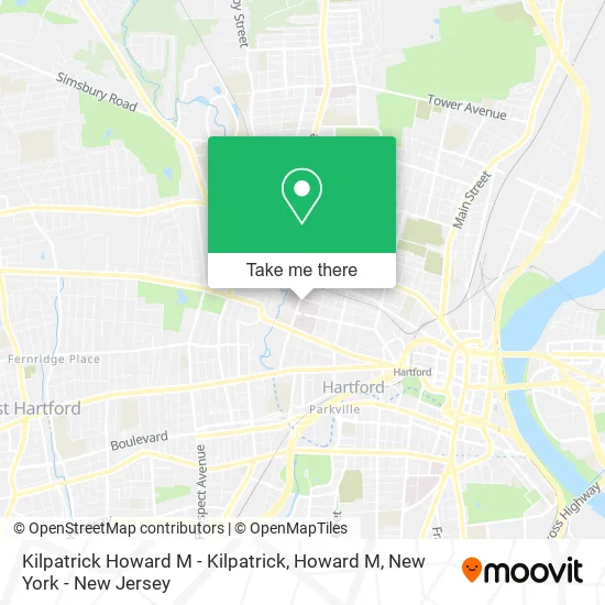
See Kilpatrick Howard M - Kilpatrick, Howard M, Hartford, on the map
Public Transit to Kilpatrick Howard M - Kilpatrick, Howard M in Hartford
Wondering how to get to Kilpatrick Howard M - Kilpatrick, Howard M in Hartford? Moovit helps you find the best way to get to Kilpatrick Howard M - Kilpatrick, Howard M with step-by-step directions from the nearest public transit station.
Moovit provides free maps and live directions to help you navigate through your city. View schedules, routes, timetables, and find out how long does it take to get to Kilpatrick Howard M - Kilpatrick, Howard M in real time.
Looking for the nearest stop or station to Kilpatrick Howard M - Kilpatrick, Howard M? Check out this list of stops closest to your destination: Woodland St @ Ashley St; Ashley St @ Woodland St; Hartford Union Station.
Bus: 76, FLIXBUS 2610, GREYHOUND US0230, GREYHOUND US0255S, 74, 161.Train: AMTRAK HARTFORD LINE, HARTFORD LINE, VALLEY FLYER, VERMONTER, NORTHEAST REGIONAL.
Want to see if there’s another route that gets you there at an earlier time? Moovit helps you find alternative routes or times. Get directions from and directions to Kilpatrick Howard M - Kilpatrick, Howard M easily from the Moovit App or Website.
We make riding to Kilpatrick Howard M - Kilpatrick, Howard M easy, which is why over 1.5 million users, including users in Hartford, trust Moovit as the best app for public transit. You don’t need to download an individual bus app or train app, Moovit is your all-in-one transit app that helps you find the best bus time or train time available.
For information on prices of train and bus, costs and ride fares to Kilpatrick Howard M - Kilpatrick, Howard M, please check the Moovit app.
Use the app to navigate to popular places including to the airport, hospital, stadium, grocery store, mall, coffee shop, school, college, and university.
Kilpatrick Howard M - Kilpatrick, Howard M Address: 114 Woodland St Hartford, CT 06105 street in Hartford
- Williams Zack MD - Williams, Zack MD,
- Radiation Therapy,
- Campbell Jazelle MD - Campbell, Jazelle MD,
- Rehabilitation Services Physical Occupational and Speech Therapy,
- Nayer S Bukhari MD,
- Cruz Juliane MD - Cruz, Juliane MD,
- Soucier Richard J, MD,
- Gengras Cafeteria,
- 114 Woodland St,
- Access Physical Therapy & Wellness,
- Lighthouse Surgery Center,
- Trinity Health,
- U-Haul,
- Tejeda Grocery Store,
- Marilyn Claudio, MSW,
- Saint Francis Hospital and Medical Center,
- Mandell JCC Fitness Center at Saint Francis,
- Physical Therapy Aide,
- St Francis Radiology,
- AmpUp
Places Near Kilpatrick Howard M - Kilpatrick, Howard M (Hartford)
- SoHo, Manhattan,
- Mountainside Hospital, Glen Ridge,
- Wall Street, Manhattan,
- 376 Hudson Street, Manhattan,
- 3 Stone St, Manhattan,
- 26 Federal Plaza, Manhattan,
- Bellevue Hospital, Manhattan,
- San Gennaro Feast, Manhattan,
- Chinatown, Manhattan,
- 66 John Street, Manhattan,
- Pier 83, Manhattan,
- Queens Center Mall, Queens,
- 911 Memorial, Manhattan,
- 1 Police Plaza, Manhattan,
- Katz's Deli, Manhattan,
- Times Square, Manhattan,
- Rockefeller Center, Manhattan,
- 111 Centre New York City Supreme Court, Manhattan,
- qqqq, Manhattan,
- Hudson Yards, Manhattan
How to get to popular places in New York - New Jersey with public transit
Get around Hartford by public transit!
Traveling around Hartford has never been so easy. See step by step directions as you travel to any attraction, street or major public transit station. View bus and train schedules, arrival times, service alerts and detailed routes on a map, so you know exactly how to get to anywhere in Hartford.
When traveling to any destination around Hartford use Moovit's Live Directions with Get Off Notifications to know exactly where and how far to walk, how long to wait for your line, and how many stops are left. Moovit will alert you when it's time to get off — no need to constantly re-check whether yours is the next stop.
Wondering how to use public transit in Hartford or how to pay for public transit in Hartford? Moovit public transit app can help you navigate your way with public transit easily, and at minimum cost. It includes public transit fees, ticket prices, and costs. Looking for a map of Hartford public transit lines? Moovit public transit app shows all public transit maps in Hartford with all Bus, Train, Subway, Light Rail, Ferry and Cable Car routes and stops on an interactive map.
New York - New Jersey has 6 transit type(s), including: Bus, Train, Subway, Light Rail, Ferry and Cable Car, operated by several transit agencies, including MTA Subway, Metro-North Railroad, LIRR, PATH, MTA New York City Transit - Express routes, MTA Bus, NJ Transit, NYC Ferry, NICE bus, Bee-Line Bus, NJ Transit Rail, Norwalk Transit District, Hartford Line, River Valley Transit and HART