How to get to King Daniel by bus?
Click on the bus route to see step by step directions with maps, line arrival times and updated time schedules.
From Glendale, NY, Queens
55 minFrom Costco, Queens
34 minFrom Ridgewood, NY, Queens
51 minFrom Rucker Park, Manhattan
75 minFrom Hobby Lobby, Queens
56 minFrom Mall del Sol Guayaquil,Ecuador, Queens
50 minFrom Walmart, North Bergen
67 minFrom Walmart, Jersey City
70 minFrom American Dream, East Rutherford
66 min
How to get to King Daniel by train?
Click on the train route to see step by step directions with maps, line arrival times and updated time schedules.
How to get to King Daniel by subway?
Click on the subway route to see step by step directions with maps, line arrival times and updated time schedules.
Bus stops near King Daniel in Manhattan
- Lexington Av/E 31 St, 1 min walk,VIEW
- Madison Av/E 31 St, 3 min walk,VIEW
- Madison Av/E 28 St, 3 min walk,VIEW
- Madison Av/E 29 St, 3 min walk,VIEW
- Madison Ave @ 32nd St, 3 min walk,VIEW
- Lexington Av/E 34 St, 3 min walk,VIEW
- Madison Av /E 29 St, 4 min walk,VIEW
- Madison Av/E 32 St, 4 min walk,VIEW
- Madison Av/ E 33 St, 5 min walk,VIEW
Train station near King Daniel in Manhattan
- 33rd Street, 5 min walk,VIEW
Bus lines to King Daniel in Manhattan
- M101, East Village 3 Av-6 St Via Lex Av,VIEW
- M102, East Village 6 St Via Lex Av,VIEW
- M103, City Hall Via Lex Av,VIEW
- BXM3, Yonkers Getty Sq Via Sedgwick Av Via Broadway,VIEW
- BXM4, Woodlawn 242 St Via Concourse Via Katonah Av,VIEW
- BM1, Mill Basin - Downtown/Midtown,VIEW
- BM2, Canarsie/Spring Creek - Downtown/Midtown,VIEW
- BM3, Sheepshead Bay - Downtown/Midtown,VIEW
- BM4, Gerritsen Beach - Downtown/Midtown,VIEW
- M1, Limited Harlem 147 St Via Madison Av,VIEW
- M2, Limited Washington Hts Broadway-168 St,VIEW
- M3, 125 St St. Nicholas Av,VIEW
- BXM11, Wakefield 241 St Via Bronx Zoo Via White Plains Rd,VIEW
- BXM18, Riverdale 263 St Via Madison Av Via H. Hudson Pky,VIEW
- 28, Central Ave @ Harding Ave,VIEW
- SIM6, Eltvlle Trans Ctr Via F Cap Bl Via Gfrds,VIEW
- SIM11, New Dorp Via Hylan Bl,VIEW
- X27, Bay Ridge - Manhattan Express,VIEW
- X28, Sea Gate / Bensonhurst - Manhattan Express,VIEW
- X37, Bay Ridge - Midtown Manhattan Express,VIEW
What are the closest stations to King Daniel?
The closest stations to King Daniel are:
- Lexington Av/E 31 St is 16 yards away, 1 min walk.
- 34 St-Herald Sq is 145 yards away, 2 min walk.
- Madison Av/E 31 St is 183 yards away, 3 min walk.
- Madison Av/E 28 St is 187 yards away, 3 min walk.
- Madison Av/E 29 St is 220 yards away, 3 min walk.
- Madison Ave @ 32nd St is 227 yards away, 3 min walk.
- Lexington Av/E 34 St is 232 yards away, 3 min walk.
- Madison Av /E 29 St is 261 yards away, 4 min walk.
- Madison Av/E 32 St is 285 yards away, 4 min walk.
- 28 St is 288 yards away, 4 min walk.
- 33rd Street is 348 yards away, 5 min walk.
- Madison Av/ E 33 St is 360 yards away, 5 min walk.
Which bus lines stop near King Daniel?
These bus lines stop near King Daniel: M102, M2, M34A-SBS, QM12, QM18, QM24, X37.
Which train lines stop near King Daniel?
These train lines stop near King Daniel: 1, PORT WASHINGTON BRANCH, YEL.
Which subway lines stop near King Daniel?
These subway lines stop near King Daniel: 6, 6X, B.
What’s the nearest subway station to King Daniel in Manhattan?
The nearest subway station to King Daniel in Manhattan is 34 St-Herald Sq. It’s a 2 min walk away.
What’s the nearest train station to King Daniel in Manhattan?
The nearest train station to King Daniel in Manhattan is 33rd Street. It’s a 5 min walk away.
What’s the nearest bus station to King Daniel in Manhattan?
The nearest bus station to King Daniel in Manhattan is Lexington Av/E 31 St. It’s a 1 min walk away.
What time is the first subway to King Daniel in Manhattan?
The Q is the first subway that goes to King Daniel in Manhattan. It stops nearby at 3:00 AM.
What time is the last subway to King Daniel in Manhattan?
The N is the last subway that goes to King Daniel in Manhattan. It stops nearby at 3:59 AM.
What time is the first train to King Daniel in Manhattan?
The ATW is the first train that goes to King Daniel in Manhattan. It stops nearby at 3:21 AM.
What time is the last train to King Daniel in Manhattan?
The ATW is the last train that goes to King Daniel in Manhattan. It stops nearby at 3:21 AM.
What time is the first bus to King Daniel in Manhattan?
The M101 is the first bus that goes to King Daniel in Manhattan. It stops nearby at 3:07 AM.
What time is the last bus to King Daniel in Manhattan?
The M103 is the last bus that goes to King Daniel in Manhattan. It stops nearby at 3:17 AM.
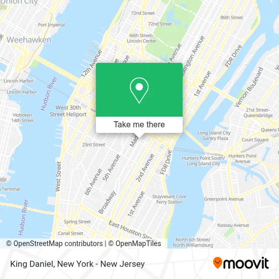
See King Daniel, Manhattan, on the map
Public Transit to King Daniel in Manhattan
Wondering how to get to King Daniel in Manhattan? Moovit helps you find the best way to get to King Daniel with step-by-step directions from the nearest public transit station.
Moovit provides free maps and live directions to help you navigate through your city. View schedules, routes, timetables, and find out how long does it take to get to King Daniel in real time.
Looking for the nearest stop or station to King Daniel? Check out this list of stops closest to your destination: Lexington Av/E 31 St; 34 St-Herald Sq; Madison Av/E 31 St; Madison Av/E 28 St; Madison Av/E 29 St; Madison Ave @ 32nd St; Lexington Av/E 34 St; Madison Av /E 29 St; Madison Av/E 32 St; 28 St; 33rd Street; Madison Av/ E 33 St.
Bus: M102, M2, M34A-SBS, QM12, QM18, QM24, X37, M101, M103, BXM3, BXM4, BM1, BM2, BM3, BM4.Train: 1, PORT WASHINGTON BRANCH, YEL, ATW, BLU.Subway: 6, 6X, B, D, F, FX, M, 4.
Want to see if there’s another route that gets you there at an earlier time? Moovit helps you find alternative routes or times. Get directions from and directions to King Daniel easily from the Moovit App or Website.
We make riding to King Daniel easy, which is why over 1.5 million users, including users in Manhattan, trust Moovit as the best app for public transit. You don’t need to download an individual bus app or train app, Moovit is your all-in-one transit app that helps you find the best bus time or train time available.
For information on prices of bus, subway and train, costs and ride fares to King Daniel, please check the Moovit app.
Use the app to navigate to popular places including to the airport, hospital, stadium, grocery store, mall, coffee shop, school, college, and university.
King Daniel Address: 460 Park Ave S street in Manhattan
- Front Office Sports,
- Superhuman,
- Panda Builder,
- Hadron Cloud Technologies,
- Brandstyle Communications,
- Chase,
- Absolute Best Care Nanny Agency,
- Hair & Spa Party 24 Hours,
- The News & Documentary Emmy Awards,
- Dig,
- Mrballen,
- Popluxe,
- Snakblox,
- Lautus Cleaning Services,
- Park Ave S 31st St,
- Park Ave 31st,
- Labyrinth,
- Aeshita Dwivedi, Md,
- Paul Marc Belsky, Md,
- Alan Spiegel, Md
Places Near King Daniel (Manhattan)
- 111 Centre New York City Supreme Court, Manhattan,
- Times Square, Manhattan,
- Bellevue Hospital, Manhattan,
- 911 Memorial, Manhattan,
- qqqq, Manhattan,
- Mountainside Hospital, Glen Ridge,
- Pier 83, Manhattan,
- 376 Hudson Street, Manhattan,
- 26 Federal Plaza, Manhattan,
- SoHo, Manhattan,
- 3 Stone St, Manhattan,
- 66 John Street, Manhattan,
- Chinatown, Manhattan,
- 1 Police Plaza, Manhattan,
- San Gennaro Feast, Manhattan,
- Hudson Yards, Manhattan,
- Queens Center Mall, Queens,
- Wall Street, Manhattan,
- Katz's Deli, Manhattan,
- Rockefeller Center, Manhattan
How to get to popular places in New York - New Jersey with public transit
Get around Manhattan by public transit!
Traveling around Manhattan has never been so easy. See step by step directions as you travel to any attraction, street or major public transit station. View bus and train schedules, arrival times, service alerts and detailed routes on a map, so you know exactly how to get to anywhere in Manhattan.
When traveling to any destination around Manhattan use Moovit's Live Directions with Get Off Notifications to know exactly where and how far to walk, how long to wait for your line, and how many stops are left. Moovit will alert you when it's time to get off — no need to constantly re-check whether yours is the next stop.
Wondering how to use public transit in Manhattan or how to pay for public transit in Manhattan? Moovit public transit app can help you navigate your way with public transit easily, and at minimum cost. It includes public transit fees, ticket prices, and costs. Looking for a map of Manhattan public transit lines? Moovit public transit app shows all public transit maps in Manhattan with all Bus, Train, Subway, Light Rail, Ferry and Cable Car routes and stops on an interactive map.
New York - New Jersey has 6 transit type(s), including: Bus, Train, Subway, Light Rail, Ferry and Cable Car, operated by several transit agencies, including MTA Subway, Metro-North Railroad, LIRR, PATH, MTA New York City Transit - Express routes, MTA Bus, NJ Transit, NYC Ferry, NICE bus, Bee-Line Bus, NJ Transit Rail, Norwalk Transit District, Hartford Line, River Valley Transit and HART