How to get to Kings Point, Delray Beach, Florida by bus?
Click on the bus route to see step by step directions with maps, line arrival times and updated time schedules.
From Bethesda Hospital East-ER, Boynton Beach-Delray Beach
54 minFrom Palm Beach State College, Boca Raton
56 minFrom Boynton Beach Mall, Boynton Beach-Delray Beach
48 minFrom Lynn University, Boca Raton
27 minFrom Glades Road & Butts Road, Boca Raton
34 minFrom Military Trail & Yamato Rd., Boca Raton
22 minFrom Boynton Beach, FL, Boynton Beach-Delray Beach
65 minFrom Mizner Park, Boca Raton
73 minFrom Boca Raton, FL, Boca Raton
69 minFrom Somerset Academy Canyons Charter School, Sunshine Parkway
52 min
Bus stops near Kings Point, Delray Beach, Florida in Boynton Beach-Delray Beach
Train station near Kings Point, Delray Beach, Florida in Boynton Beach-Delray Beach
- Delray Beach Station, 59 min walk,VIEW
Bus lines to Kings Point, Delray Beach, Florida in Boynton Beach-Delray Beach
What are the closest stations to Kings Point, Delray Beach, Florida?
The closest stations to Kings Point, Delray Beach, Florida are:
- MILITARY TRL at LINTON BLVD is 348 yards away, 5 min walk.
- LINTON BLVD at MILITARY TRL/DERAY M is 562 yards away, 7 min walk.
- LAKES OF DELRAY BLVD at WHITNEY RD is 2239 yards away, 27 min walk.
- Delray Beach Station is 4927 yards away, 59 min walk.
Which bus lines stop near Kings Point, Delray Beach, Florida?
These bus lines stop near Kings Point, Delray Beach, Florida: 3, 88.
What’s the nearest bus station to Kings Point, Delray Beach, Florida in Boynton Beach-Delray Beach?
The nearest bus station to Kings Point, Delray Beach, Florida in Boynton Beach-Delray Beach is MILITARY TRL at LINTON BLVD. It’s a 5 min walk away.
What time is the first train to Kings Point, Delray Beach, Florida in Boynton Beach-Delray Beach?
The TRIRAIL is the first train that goes to Kings Point, Delray Beach, Florida in Boynton Beach-Delray Beach. It stops nearby at 4:21 AM.
What time is the last train to Kings Point, Delray Beach, Florida in Boynton Beach-Delray Beach?
The FLORIDIAN is the last train that goes to Kings Point, Delray Beach, Florida in Boynton Beach-Delray Beach. It stops nearby at 4:42 PM.
What time is the first bus to Kings Point, Delray Beach, Florida in Boynton Beach-Delray Beach?
The 3 is the first bus that goes to Kings Point, Delray Beach, Florida in Boynton Beach-Delray Beach. It stops nearby at 5:38 AM.
What time is the last bus to Kings Point, Delray Beach, Florida in Boynton Beach-Delray Beach?
The 3 is the last bus that goes to Kings Point, Delray Beach, Florida in Boynton Beach-Delray Beach. It stops nearby at 9:50 PM.
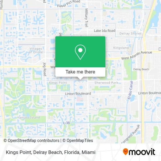
See Kings Point, Delray Beach, Florida, Boynton Beach-Delray Beach, on the map
Public Transit to Kings Point, Delray Beach, Florida in Boynton Beach-Delray Beach
Wondering how to get to Kings Point, Delray Beach, Florida in Boynton Beach-Delray Beach? Moovit helps you find the best way to get to Kings Point, Delray Beach, Florida with step-by-step directions from the nearest public transit station.
Moovit provides free maps and live directions to help you navigate through your city. View schedules, routes, timetables, and find out how long does it take to get to Kings Point, Delray Beach, Florida in real time.
Looking for the nearest stop or station to Kings Point, Delray Beach, Florida? Check out this list of stops closest to your destination: MILITARY TRL at LINTON BLVD; LINTON BLVD at MILITARY TRL/DERAY M; LAKES OF DELRAY BLVD at WHITNEY RD; Delray Beach Station.
Bus: 3, 88, 81.Train: TRIRAIL, FLORIDIAN, SILVER METEOR.
Want to see if there’s another route that gets you there at an earlier time? Moovit helps you find alternative routes or times. Get directions from and directions to Kings Point, Delray Beach, Florida easily from the Moovit App or Website.
We make riding to Kings Point, Delray Beach, Florida easy, which is why over 1.7 million users, including users in Boynton Beach-Delray Beach, trust Moovit as the best app for public transit. You don’t need to download an individual bus app or train app, Moovit is your all-in-one transit app that helps you find the best bus time or train time available.
For information on prices of bus, costs and ride fares to Kings Point, Delray Beach, Florida, please check the Moovit app.
Use the app to navigate to popular places including to the airport, hospital, stadium, grocery store, mall, coffee shop, school, college, and university.
Location: Boynton Beach-Delray Beach, Miami
- Gleneagles Country Club,
- South Military Trail & Linton Boulevard,
- DELRAY Medical Center-ER,
- Delray,
- Walmart,
- Orlando Fl,
- Sugar Daddies,
- Kings Point, Florida,
- Karina Does It All,
- Old Germantown Rd / Linton Blvd,
- Total Image Boutique,
- Echelon Marketing,
- Mza Optics,
- 3g's Gourmet Deli,
- Amazon Locker-Keir,
- Ollie's Bargain Outlet,
- American Heritage School - Delray Beach,
- Floral Lakes Community Association,
- Home Services at the Home Depot,
- Truck Rental Center at the Home Depot
Places Near Kings Point, Delray Beach, Florida (Boynton Beach-Delray Beach)
- Sawgrass Mall, Miami,
- Marlins Park, Miami,
- Bayside Marketplace, Miami,
- Miami VA Hospital, Miami,
- Dolphin Mall, Miami,
- Wynwood, Miami,
- Port of Miami Cruise Terminal, Miami,
- Little Havana, Miami,
- Miami Design District, Miami,
- Brickell City Centre, Miami,
- Miami Freedom Park, Miami,
- Keiser University Flagship Campus, West Palm Beach,
- Richard E. Gerstein Justice Building, Miami,
- Sawgrass mall ( FL ), Miami Beach,
- Aventura Mall, Miami,
- Dolphin Mall Bus, Miami,
- Zoo Miami, Miami,
- Aventura Mall, Miami Beach,
- Hard Rock Stadium, Miami Gardens,
- Miami-Dade County Courthouse, Miami
How to get to popular places in Miami with public transit
Get around Boynton Beach-Delray Beach by public transit!
Traveling around Boynton Beach-Delray Beach has never been so easy. See step by step directions as you travel to any attraction, street or major public transit station. View bus and train schedules, arrival times, service alerts and detailed routes on a map, so you know exactly how to get to anywhere in Boynton Beach-Delray Beach.
When traveling to any destination around Boynton Beach-Delray Beach use Moovit's Live Directions with Get Off Notifications to know exactly where and how far to walk, how long to wait for your line, and how many stops are left. Moovit will alert you when it's time to get off — no need to constantly re-check whether yours is the next stop.
Wondering how to use public transit in Boynton Beach-Delray Beach or how to pay for public transit in Boynton Beach-Delray Beach? Moovit public transit app can help you navigate your way with public transit easily, and at minimum cost. It includes public transit fees, ticket prices, and costs. Looking for a map of Boynton Beach-Delray Beach public transit lines? Moovit public transit app shows all public transit maps in Boynton Beach-Delray Beach with all Bus, Train, Light Rail and Ferry routes and stops on an interactive map.
Miami has 4 transit type(s), including: Bus, Train, Light Rail and Ferry, operated by several transit agencies, including Broward County Transit, Miami-Dade Transit, Metrorail, Palm Tran, Tri-Rail, Brightline, MARTY, City of Homestead Trolley, Key West Transit, Treasure Coast Connector, GoLine IRT, Amtrak, Greyhound-us, FlixBus-us and Aventura Express Shuttle Bus