How to get to Kingslocks by bus?
Click on the bus route to see step by step directions with maps, line arrival times and updated time schedules.
From I-695 @ Exit 17 (Security Blvd/MD 122), Baltimore County
102 minFrom Randallstown, MD, Baltimore County
122 minFrom Johns Hopkins Medicine at Green Spring Station, Baltimore County
128 minFrom I-83 Exit 16 (Timonium Road), Baltimore County
149 minFrom I-695 @ Exit 18 (Liberty Rd/MD 26), Baltimore County
100 minFrom Mva, Baltimore
47 minFrom Reisterstown Road Plaza, Baltimore
43 minFrom Pimlico Race Course, Baltimore
89 min
How to get to Kingslocks by metro?
Click on the metro route to see step by step directions with maps, line arrival times and updated time schedules.
Metro station near Kingslocks in Baltimore County
- Owings Mills Metro, 5 min walk,VIEW
Bus stop near Kingslocks in Baltimore County
- Reisterstown Rd & Taube Ct Sb Opp, 7 min walk,VIEW
Bus lines to Kingslocks in Baltimore County
- 87, Glyndon,VIEW
What are the closest stations to Kingslocks?
The closest stations to Kingslocks are:
- Owings Mills Metro is 397 yards away, 5 min walk.
- Reisterstown Rd & Taube Ct Sb Opp is 484 yards away, 7 min walk.
Which bus lines stop near Kingslocks?
These bus lines stop near Kingslocks: 87, 89.
Which metro line stops near Kingslocks?
METRO (Towards Owing Mills)
What’s the nearest metro station to Kingslocks in Baltimore County?
The nearest metro station to Kingslocks in Baltimore County is Owings Mills Metro. It’s a 5 min walk away.
What’s the nearest bus station to Kingslocks in Baltimore County?
The nearest bus station to Kingslocks in Baltimore County is Reisterstown Rd & Taube Ct Sb Opp. It’s a 7 min walk away.
What time is the first metro to Kingslocks in Baltimore County?
The METRO is the first metro that goes to Kingslocks in Baltimore County. It stops nearby at 4:28 AM.
What time is the last metro to Kingslocks in Baltimore County?
The METRO is the last metro that goes to Kingslocks in Baltimore County. It stops nearby at 12:31 AM.
What time is the first bus to Kingslocks in Baltimore County?
The 87 is the first bus that goes to Kingslocks in Baltimore County. It stops nearby at 4:08 AM.
What time is the last bus to Kingslocks in Baltimore County?
The 87 is the last bus that goes to Kingslocks in Baltimore County. It stops nearby at 1:02 AM.
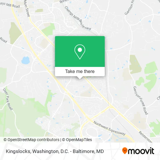
See Kingslocks, Baltimore County, on the map
Public Transit to Kingslocks in Baltimore County
Wondering how to get to Kingslocks in Baltimore County? Moovit helps you find the best way to get to Kingslocks with step-by-step directions from the nearest public transit station.
Moovit provides free maps and live directions to help you navigate through your city. View schedules, routes, timetables, and find out how long does it take to get to Kingslocks in real time.
Looking for the nearest stop or station to Kingslocks? Check out this list of stops closest to your destination: Owings Mills Metro; Reisterstown Rd & Taube Ct Sb Opp.
Bus: 87, 89.Metro: METRO.
Want to see if there’s another route that gets you there at an earlier time? Moovit helps you find alternative routes or times. Get directions from and directions to Kingslocks easily from the Moovit App or Website.
We make riding to Kingslocks easy, which is why over 1.5 million users, including users in Baltimore County, trust Moovit as the best app for public transit. You don’t need to download an individual bus app or train app, Moovit is your all-in-one transit app that helps you find the best bus time or train time available.
For information on prices of bus, metro and light rail, costs and ride fares to Kingslocks, please check the Moovit app.
Use the app to navigate to popular places including to the airport, hospital, stadium, grocery store, mall, coffee shop, school, college, and university.
Kingslocks Address: 29 Hiddencreek Ct Owings Mills, MD 21117 street in Baltimore County
- Little Feet's Daycare,
- Brown Legacy Produ,
- Ollie's Bargain (Ollies Bargain Outlet),
- Open Door Christian Center,
- NPLH Service Group,
- Royal Sedan & Limo,
- Board of Education Business Office,
- American Lock & Key,
- Jordin Lee Novak, Pharmd,
- 11200 Reisterstown Rd Parking,
- Target,
- Homestead Health Services,
- Moclean Cleaning Services,
- All Staffing Inc,
- ChargePoint,
- Richmar Apartments,
- Iglesia Pentecostal Unida Latinoamericana,
- Holistic Homecare Services,
- Rich Mar Apartments Pool,
- Handy Northwest
Places Near Kingslocks (Baltimore County)
- Museum Of The Bible, Washington,
- Washington DC VA Medical Center, Washington,
- Washington National Cathedral, Washington,
- M&T Bank Stadium, Baltimore,
- Marriott Marquis Washington, DC, Washington,
- National Theatre, Washington,
- Warner Theatre, Washington,
- The Anthem, Washington,
- Capital One Arena, Washington,
- Sibley Memorial Hospital, Washington,
- Basilica of the National Shrine, Washington,
- National Zoo, Washington,
- Pennsylvania Ave NW (3rd st and pennsylvania), Washington,
- Westfield Montgomery Mall, Montgomery County,
- PG Mall, Prince George's County,
- Georgetown, Washington,
- Amazon Hq2, Arlington County,
- National Museum of African American History and Culture, Washington,
- Camden Yards, Baltimore,
- Rock Creek Tennis Center, Washington
How to get to popular places in Washington, D.C. - Baltimore, MD with public transit
Get around Baltimore County by public transit!
Traveling around Baltimore County has never been so easy. See step by step directions as you travel to any attraction, street or major public transit station. View bus and train schedules, arrival times, service alerts and detailed routes on a map, so you know exactly how to get to anywhere in Baltimore County.
When traveling to any destination around Baltimore County use Moovit's Live Directions with Get Off Notifications to know exactly where and how far to walk, how long to wait for your line, and how many stops are left. Moovit will alert you when it's time to get off — no need to constantly re-check whether yours is the next stop.
Wondering how to use public transit in Baltimore County or how to pay for public transit in Baltimore County? Moovit public transit app can help you navigate your way with public transit easily, and at minimum cost. It includes public transit fees, ticket prices, and costs. Looking for a map of Baltimore County public transit lines? Moovit public transit app shows all public transit maps in Baltimore County with all Bus, Train, Metro, Light Rail and Ferry routes and stops on an interactive map.
Washington, D.C. - Baltimore, MD has 5 transit type(s), including: Bus, Train, Metro, Light Rail and Ferry, operated by several transit agencies, including WMATA, Montgomery County Ride On, Fairfax Connector, TheBus, PRTC, DASH - Alexandria, Arlington Transit (ART), RTA of Central Maryland, MDOT MTA, MDOT MTA Light RailLink, MDOT MTA Commuter Bus, MDOT MTA Local Bus, FXBGO!, Virginia Railway Express (VRE) and MARC