How to get to Kios Merdeka by bus?
Click on the bus route to see step by step directions with maps, line arrival times and updated time schedules.
From PT. Karyatama Mitra Sejati / PT. Luhur Asa Vrima - Janti, Kota Yogyakarta
68 minFrom Pt. Adila Prezkifarindo Duta Yogyakarta, Kota Yogyakarta
68 minFrom Temanggung, Jawa Tengah, Kota Yogyakarta
54 minFrom jl palagan tentara pelajar gang kenanga jongkang, Sleman
79 minFrom 4R futsal,jl. Parangtritis,Yogyakarta, Kota Yogyakarta
53 minFrom Jl. Raya Wonosari - Semin, Kota Yogyakarta
48 minFrom Rumah Duka "Budi Abadi", Kota Yogyakarta
54 minFrom Klaten, Jawa Tengah, Kota Yogyakarta
74 minFrom RM. Gudeg Sagan, Kota Yogyakarta
55 min
Bus stops near Kios Merdeka in Kota Yogyakarta
Train station near Kios Merdeka in Kota Yogyakarta
- Patukan, 45 min walk,VIEW
Bus lines to Kios Merdeka in Kota Yogyakarta
What are the closest stations to Kios Merdeka?
The closest stations to Kios Merdeka are:
- Tpb - Tamantirto (Timur Jalan) is 99 meters away, 2 min walk.
- Tpb - Ponpes Hamalatul Quran is 776 meters away, 11 min walk.
- Patukan is 3484 meters away, 45 min walk.
Which bus line stops near Kios Merdeka?
6A (Gamping - Malioboro - Gamping)
What’s the nearest bus station to Kios Merdeka in Kota Yogyakarta?
The nearest bus station to Kios Merdeka in Kota Yogyakarta is Tpb - Tamantirto (Timur Jalan). It’s a 2 min walk away.
What time is the first train to Kios Merdeka in Kota Yogyakarta?
The PRAMEKS is the first train that goes to Kios Merdeka in Kota Yogyakarta. It stops nearby at 6:54 AM.
What time is the last train to Kios Merdeka in Kota Yogyakarta?
The PRAMEKS is the last train that goes to Kios Merdeka in Kota Yogyakarta. It stops nearby at 6:04 PM.
What time is the first bus to Kios Merdeka in Kota Yogyakarta?
The 6B is the first bus that goes to Kios Merdeka in Kota Yogyakarta. It stops nearby at 5:38 AM.
What time is the last bus to Kios Merdeka in Kota Yogyakarta?
The 6A is the last bus that goes to Kios Merdeka in Kota Yogyakarta. It stops nearby at 9:55 PM.
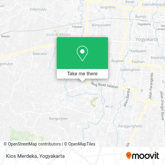
See Kios Merdeka, Kota Yogyakarta, on the map
Public Transit to Kios Merdeka in Kota Yogyakarta
Wondering how to get to Kios Merdeka in Kota Yogyakarta? Moovit helps you find the best way to get to Kios Merdeka with step-by-step directions from the nearest public transit station.
Moovit provides free maps and live directions to help you navigate through your city. View schedules, routes, timetables, and find out how long does it take to get to Kios Merdeka in real time.
Looking for the nearest stop or station to Kios Merdeka? Check out this list of stops closest to your destination: Tpb - Tamantirto (Timur Jalan); Tpb - Ponpes Hamalatul Quran; Patukan.
Bus: 6A, 6B.Train: PRAMEKS.
Want to see if there’s another route that gets you there at an earlier time? Moovit helps you find alternative routes or times. Get directions from and directions to Kios Merdeka easily from the Moovit App or Website.
We make riding to Kios Merdeka easy, which is why over 1.5 million users, including users in Kota Yogyakarta, trust Moovit as the best app for public transit. You don’t need to download an individual bus app or train app, Moovit is your all-in-one transit app that helps you find the best bus time or train time available.
For information on prices of bus, costs and ride fares to Kios Merdeka, please check the Moovit app.
Use the app to navigate to popular places including to the airport, hospital, stadium, grocery store, mall, coffee shop, school, college, and university.
Kios Merdeka Address: Jalan Ridang Bantul 55799 street in Kota Yogyakarta
- Toko Briyan,
- Klinik Anugerah,
- Roti Bakar Bang Ipin Tamantirto,
- Anugrah,
- Servise Jam Amin,
- Masjid al Barokah Gonjen,
- Red Corner,
- Io,
- Rumah Sayaaa,
- Jual Makanan Dimsum,
- Nasi Pecel Bu Rara,
- Toko Marsidah,
- Reparasi Sepatu Tas Jogja,
- Tahu Go Kasihan Yk,
- Toko Madura Yanto,
- Macgyver Vermak Jeans Dan Tas,
- Kunindo Mulia Utama. CV,
- Ropi,
- Persewaan Tenda Dan Kursi Riatama,
- Sate Taichan 8 Kopiloki Tamantirto
Places Near Kios Merdeka (Kota Yogyakarta)
- Goa Maria Sendangsono,Kulon Progo, Kota Yogyakarta,
- Universitas Islam Indonesia (UII), Kota Yogyakarta,
- Kids Fun, Kota Yogyakarta,
- Kebun Binatang Gembira Loka, Kota Yogyakarta,
- Sleman City Hall, Sleman,
- KOPI KLOTOK, Kota Yogyakarta,
- RS.SARDJITO yogyakarta, Kota Yogyakarta,
- Ahli Patah Tulang Cik Verly, Kota Yogyakarta,
- Jogja Expo Center (JEC), Kota Yogyakarta,
- Wonosari, Gunungkidul, Kota Yogyakarta,
- Merapi Lava Tour, Kota Yogyakarta,
- Akademi Militer, Magelang, Kota Yogyakarta,
- Bangsal Bedah Cendana RSUP Dr.Sardjito,jogjakarta, Kota Yogyakarta,
- Universitas Gadjah Mada (UGM), Kota Yogyakarta,
- Gereja Dan Candi Hati Kudus Yesus Ganjuran, Kota Yogyakarta,
- Plaza Pasar Ngasem, Kota Yogyakarta,
- Ambarukmo plaza, Kota Yogyakarta,
- Gua Maria Ganjuran, Kota Yogyakarta,
- Universitas Muhammadiyah Yogyakarta (UMY),
- Praktek dr. Ahmad Asmedi,M.Kes,Sp.S, Bantul
How to get to popular places in Yogyakarta with public transit
Get around Kota Yogyakarta by public transit!
Traveling around Kota Yogyakarta has never been so easy. See step by step directions as you travel to any attraction, street or major public transit station. View bus and train schedules, arrival times, service alerts and detailed routes on a map, so you know exactly how to get to anywhere in Kota Yogyakarta.
When traveling to any destination around Kota Yogyakarta use Moovit's Live Directions with Get Off Notifications to know exactly where and how far to walk, how long to wait for your line, and how many stops are left. Moovit will alert you when it's time to get off — no need to constantly re-check whether yours is the next stop.
Wondering how to use public transit in Kota Yogyakarta or how to pay for public transit in Kota Yogyakarta? Moovit public transit app can help you navigate your way with public transit easily, and at minimum cost. It includes public transit fees, ticket prices, and costs. Looking for a map of Kota Yogyakarta public transit lines? Moovit public transit app shows all public transit maps in Kota Yogyakarta with all Bus and Train routes and stops on an interactive map.
Yogyakarta has 2 transit type(s), including: Bus and Train, operated by several transit agencies, including Trans Jogja, AKDP (Angkutan Kota Dalam Provinsi), SatelQu, KAI Commuter, KAI Bandara and DAMRI