How to get to Kirkpatrick Koenig by bus?
Click on the bus route to see step by step directions with maps, line arrival times and updated time schedules.
From Keiser University-West Palm Beach, Royal Palm Beach-West Jupiter
61 minFrom The Ballpark of the Palm Beaches, West Palm Beach
72 minFrom Congress/45th Street, West Palm Beach
57 minFrom I-95, Boynton Beach-Delray Beach
54 minFrom Palm Beach Outlets, West Palm Beach
48 minFrom Good Samaritan Hospital, West Palm Beach
44 minFrom Whispers All Girl Staff, West Palm Beach
60 minFrom HCA Florida JFK North Hospital-ER, West Palm Beach
69 minFrom Saint Marys Hospital, West Palm Beach
59 minFrom Lake Worth, FL, Lake Worth
20 min
Bus stops near Kirkpatrick Koenig in West Palm Beach
Train station near Kirkpatrick Koenig in West Palm Beach
- West Palm Beach, 10 min walk,VIEW
What are the closest stations to Kirkpatrick Koenig?
The closest stations to Kirkpatrick Koenig are:
- DIXIE HWY at BUNKER RANCH RD is 168 yards away, 3 min walk.
- LAKE AVE at BRIGGS ST is 344 yards away, 5 min walk.
- West Palm Beach is 749 yards away, 10 min walk.
Which bus line stops near Kirkpatrick Koenig?
1 (Rt 1 Southbound)
What’s the nearest train station to Kirkpatrick Koenig in West Palm Beach?
The nearest train station to Kirkpatrick Koenig in West Palm Beach is West Palm Beach. It’s a 10 min walk away.
What’s the nearest bus station to Kirkpatrick Koenig in West Palm Beach?
The nearest bus station to Kirkpatrick Koenig in West Palm Beach is DIXIE HWY at BUNKER RANCH RD. It’s a 3 min walk away.
What time is the first train to Kirkpatrick Koenig in West Palm Beach?
The BLFM is the first train that goes to Kirkpatrick Koenig in West Palm Beach. It stops nearby at 5:50 AM.
What time is the last train to Kirkpatrick Koenig in West Palm Beach?
The BLFM is the last train that goes to Kirkpatrick Koenig in West Palm Beach. It stops nearby at 12:20 AM.
What time is the first bus to Kirkpatrick Koenig in West Palm Beach?
The 1 is the first bus that goes to Kirkpatrick Koenig in West Palm Beach. It stops nearby at 5:25 AM.
What time is the last bus to Kirkpatrick Koenig in West Palm Beach?
The 1 is the last bus that goes to Kirkpatrick Koenig in West Palm Beach. It stops nearby at 10:47 PM.
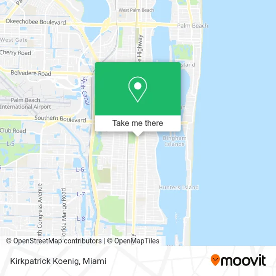
See Kirkpatrick Koenig, West Palm Beach, on the map
Public Transit to Kirkpatrick Koenig in West Palm Beach
Wondering how to get to Kirkpatrick Koenig in West Palm Beach? Moovit helps you find the best way to get to Kirkpatrick Koenig with step-by-step directions from the nearest public transit station.
Moovit provides free maps and live directions to help you navigate through your city. View schedules, routes, timetables, and find out how long does it take to get to Kirkpatrick Koenig in real time.
Looking for the nearest stop or station to Kirkpatrick Koenig? Check out this list of stops closest to your destination: DIXIE HWY at BUNKER RANCH RD; LAKE AVE at BRIGGS ST; West Palm Beach.
Bus: 1, 60.Train: BLFM.
Want to see if there’s another route that gets you there at an earlier time? Moovit helps you find alternative routes or times. Get directions from and directions to Kirkpatrick Koenig easily from the Moovit App or Website.
We make riding to Kirkpatrick Koenig easy, which is why over 1.7 million users, including users in West Palm Beach, trust Moovit as the best app for public transit. You don’t need to download an individual bus app or train app, Moovit is your all-in-one transit app that helps you find the best bus time or train time available.
For information on prices of bus, costs and ride fares to Kirkpatrick Koenig, please check the Moovit app.
Use the app to navigate to popular places including to the airport, hospital, stadium, grocery store, mall, coffee shop, school, college, and university.
Kirkpatrick Koenig Address: 4622 S Dixie Hwy street in West Palm Beach
- Lakewood,
- El Bonche Bar,
- Georgia Ave,
- All Axis 3D Studios,
- Goodwill West Palm Beach / South Dixie Store & Donation Center,
- Conniston Middle School,
- The Bunker Artspace | The Collection of Beth Rudin DeWoody,
- Publix Super Markets,
- Nearly New Thrift Shop,
- Denise Skinner- Realtor,
- Primera Iglesia Bautista Hispana,
- Slim Body Center,
- Palm Beach Zoo,
- Palm Beach Zoo at Dreher Park,
- Cafe Med,
- Mar A Lago Building,
- Forest Hill Blvd / US-1,
- Mar a Lago,
- Hilton-Palm Beach,
- Joseph's Classic Market
Places Near Kirkpatrick Koenig (West Palm Beach)
- Little Havana, Miami,
- Marlins Park, Miami,
- Sawgrass Mall, Miami,
- Dolphin Mall Bus, Miami,
- Sawgrass mall ( FL ), Miami Beach,
- Richard E. Gerstein Justice Building, Miami,
- Zoo Miami, Miami,
- Wynwood, Miami,
- Brickell City Centre, Miami,
- Hard Rock Stadium, Miami Gardens,
- Aventura Mall, Miami,
- Miami VA Hospital, Miami,
- Miami-Dade County Courthouse, Miami,
- Keiser University Flagship Campus, West Palm Beach,
- Miami Design District, Miami,
- Dolphin Mall, Miami,
- Aventura Mall, Miami Beach,
- Bayside Marketplace, Miami,
- Port of Miami Cruise Terminal, Miami,
- Miami Freedom Park, Miami
How to get to popular places in Miami with public transit
Get around West Palm Beach by public transit!
Traveling around West Palm Beach has never been so easy. See step by step directions as you travel to any attraction, street or major public transit station. View bus and train schedules, arrival times, service alerts and detailed routes on a map, so you know exactly how to get to anywhere in West Palm Beach.
When traveling to any destination around West Palm Beach use Moovit's Live Directions with Get Off Notifications to know exactly where and how far to walk, how long to wait for your line, and how many stops are left. Moovit will alert you when it's time to get off — no need to constantly re-check whether yours is the next stop.
Wondering how to use public transit in West Palm Beach or how to pay for public transit in West Palm Beach? Moovit public transit app can help you navigate your way with public transit easily, and at minimum cost. It includes public transit fees, ticket prices, and costs. Looking for a map of West Palm Beach public transit lines? Moovit public transit app shows all public transit maps in West Palm Beach with all Bus, Train, Light Rail and Ferry routes and stops on an interactive map.
Miami has 4 transit type(s), including: Bus, Train, Light Rail and Ferry, operated by several transit agencies, including Broward County Transit, Miami-Dade Transit, Metrorail, Palm Tran, Tri-Rail, Brightline, MARTY, City of Homestead Trolley, Key West Transit, Treasure Coast Connector, GoLine IRT, Amtrak, Greyhound-us, FlixBus-us and Aventura Express Shuttle Bus