Kissimmee station - Monday schedule
| Line | Direction | Time |
|---|---|---|
| SUNRAIL | Northbound | 5:53 AM |
| SUNRAIL | Southbound | 6:20 AM |
| SUNRAIL | Northbound | 6:23 AM |
| SUNRAIL | Southbound | 6:50 AM |
| SUNRAIL | Northbound | 6:53 AM |
| SUNRAIL | Southbound | 7:20 AM |
| SUNRAIL | Northbound | 7:23 AM |
| SUNRAIL | Southbound | 7:50 AM |
| SUNRAIL | Northbound | 7:53 AM |
| SUNRAIL | Southbound | 8:20 AM |
| SUNRAIL | Northbound | 8:23 AM |
| SUNRAIL | Southbound | 8:50 AM |
| SUNRAIL | Northbound | 8:53 AM |
| SUNRAIL | Southbound | 9:20 AM |
| SUNRAIL | Southbound | 10:20 AM |
| FLORIDIAN | Miami | 10:43 AM |
| SUNRAIL | Northbound | 10:53 AM |
| SUNRAIL | Southbound | 11:20 AM |
| SUNRAIL | Northbound | 12:23 PM |
| SUNRAIL | Southbound | 12:50 PM |
| SILVER METEOR | New York | 12:57 PM |
| SUNRAIL | Northbound | 1:23 PM |
| SILVER METEOR | Miami | 1:41 PM |
| SUNRAIL | Southbound | 1:50 PM |
| SUNRAIL | Northbound | 2:23 PM |
Directions to Kissimmee station with public transit
The following transit lines have routes that pass near Kissimmee
 Bus: 10, 26, 407, 56, 18.
How to get to Kissimmee station by bus?
Click on the bus route to see step by step directions with maps, line arrival times and updated time schedules.
Bus stops near Kissimmee stop
- Pleasant St & Neptune Rd, 1 min walk,
Bus lines to Kissimmee station
- 10, E. U.S. 192/ST. CLOUD,
- 18, S. ORANGE AVE/KISSIMMEE,
- 26, PLEASANT HILL RD/POINCIANA,
- 55, W. U.S. 192/FOUR CORNERS,
- 56, W. U.S. 192/MAGIC KINGDOM,
- 57, JOHN YOUNG PARKWAY,
- 108, U.S. 441/KISSIMMEE,
- 407, KISSIMMEE/MEDICAL CITY/OIA FASTLINK,
- 441, FASTLINK 441,
What are the closest stations to Kissimmee?
The closest stations to Kissimmee are:
- Pleasant St & Neptune Rd is 27 yards away, 1 min walk.
Which bus lines stop near Kissimmee?
These bus lines stop near Kissimmee: 10, 26, 407, 56.
What’s the nearest bus station to Kissimmee?
The nearest bus station to Kissimmee is Pleasant St & Neptune Rd. It’s a 1 min walk away.
What time is the first bus to Kissimmee?
The 56 is the first bus that goes to Kissimmee. It stops nearby at 4:00 AM.
What time is the last bus to Kissimmee?
The 56 is the last bus that goes to Kissimmee. It stops nearby at 12:01 AM.
See Kissimmee station on the map
Public transit to Kissimmee station
Looking for directions to Kissimmee in Kissimmee, United States?
Download the Moovit App to find the current schedule and step-by-step directions for Bus routes that pass through Kissimmee.
Looking for the nearest stops closest to Kissimmee ? Check out this list of closest stops to your destination: Pleasant St & Neptune Rd.
Bus: 10, 26, 407, 56, 18, 55.
We make riding on public transit to Kissimmee easy, which is why over 1.5 million users, including users in Kissimmee trust Moovit as the best app for public transit.
Use the app to navigate to popular places including to the airport, hospital, stadium, grocery store, mall, coffee shop, school, college, and university.
The station has the following entrances: Neptune Rd, Pleasant St, Neptune Rd, E Dakin Ave and Tohopekaliga Ave
The first line to this station is SUNRAIL, at 5:53 AM, and the last line is SUNRAIL at 11:30 PM.
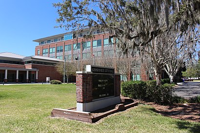
111 East Dakin Avenue, Kissimmee, FL, USA
This station serves Amtrak and Sunrail’s lines
Popular routes from Kissimmee station
- Pleasant St & Neptune Rd
Bus stop near Kissimmee stop
- Ohio St & Minnesota Ave,
- W Colonial Dr & Daniels Rd,
- N Mills Ave & E Colonial Dr,
- N John Young Pkwy & W Princeton St,
- S Obt & W Miller Ave,
- University Blvd & Rouse Rd,
- Lx10161 U.S 441 & Bealls,
- N Orange Ave & W Amelia St,
- T P C Dr & Hazeltine National Dr,
- Intl Dr & Hawaiian Ct (Rosen Centre Hotel),
- E Colonial Dr & Wingo St,
- W D Judge Dr & Ferguson Dr,
- Old Winter Garden Rd & Edgewood Ranch Rd,
- W Sand Lake Rd & Intl Dr,
- Kirkland Blvd & Mantilla Ave,
- Us Hwy 192 & Summer Bay Blvd,
- E Colonial Dr & N Bumby Ave,
- W Oak St & Oak Commons Blvd,
- Walnut St & Tiger Rd,
- Intl Dr & Carrier Dr (Titanic - the Artifact Exhibit)
Popular public transit stations in Kissimmee
Get around Kissimmee by public transit!
Traveling around Kissimmee has never been so easy. See step by step directions as you travel to any attraction, street or major public transit station. View bus and train schedules, arrival times, service alerts and detailed routes on a map, so you know exactly how to get to anywhere in Kissimmee.
When traveling to any destination around Kissimmee use Moovit's Live Directions with Get Off Notifications to know exactly where and how far to walk, how long to wait for your line, and how many stops are left. Moovit will alert you when it's time to get off — no need to constantly re-check whether yours is the next stop.
Wondering how to use public transit in Kissimmee or how to pay for public transit in Kissimmee? Moovit public transit app can help you navigate your way with public transit easily, and at minimum cost. It includes public transit fees, ticket prices, and costs. Looking for a map of Kissimmee public transit lines? Moovit public transit app shows all public transit maps in Kissimmee with all Bus and Train routes and stops on an interactive map.
Orlando has 2 transit type(s), including: Bus and Train, operated by several transit agencies, including LYNX Transit, Citrus Connection, Sunrail, I-Ride Trolley, Sanford Community Redevelopment Agency, Lake Xpress, Amtrak, FlixBus-us and Greyhound-us