How to get to Kit Bunker by bus?
Click on the bus route to see step by step directions with maps, line arrival times and updated time schedules.
From Webber Greens, Edmonton
67 minFrom Potters Green, Edmonton
57 minFrom M & M Food Market, Edmonton
50 minFrom Servus Credit Union Place, St. Albert
54 minFrom Tim Hortons, Edmonton
85 minFrom Elite Retreat, Edmonton
31 minFrom Pick-n-Pull, Edmonton
53 minFrom Argyll Casino, Edmonton
84 minFrom Warm Hearts & Wet Noses, Edmonton
51 minFrom Canada Steel Works, Edmonton
92 min
Bus stops near Kit Bunker in Edmonton
Light Rail stations near Kit Bunker in Edmonton
- Macewan Station, 14 min walk,VIEW
Bus lines to Kit Bunker in Edmonton
What are the closest stations to Kit Bunker?
The closest stations to Kit Bunker are:
- 119 Street & 111 Avenue is 517 meters away, 7 min walk.
- 124 Street & 111 Avenue is 649 meters away, 9 min walk.
- Macewan Station is 1035 meters away, 14 min walk.
Which bus lines stop near Kit Bunker?
These bus lines stop near Kit Bunker: 003, 007, 901.
What’s the nearest light rail station to Kit Bunker in Edmonton?
The nearest light rail station to Kit Bunker in Edmonton is Macewan Station. It’s a 14 min walk away.
What’s the nearest bus station to Kit Bunker in Edmonton?
The nearest bus station to Kit Bunker in Edmonton is 119 Street & 111 Avenue. It’s a 7 min walk away.
What time is the first light rail to Kit Bunker in Edmonton?
The METRO is the first light rail that goes to Kit Bunker in Edmonton. It stops nearby at 6:05 AM.
What time is the last light rail to Kit Bunker in Edmonton?
The METRO is the last light rail that goes to Kit Bunker in Edmonton. It stops nearby at 12:41 AM.
What time is the first bus to Kit Bunker in Edmonton?
The 005 is the first bus that goes to Kit Bunker in Edmonton. It stops nearby at 5:30 AM.
What time is the last bus to Kit Bunker in Edmonton?
The 005 is the last bus that goes to Kit Bunker in Edmonton. It stops nearby at 1:08 AM.
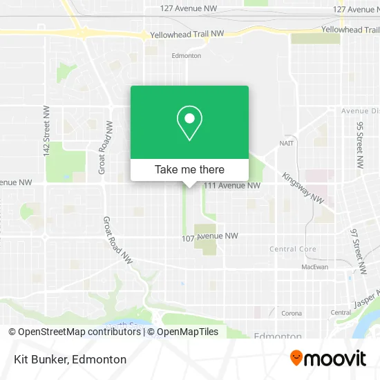
See Kit Bunker, Edmonton, on the map
Public Transit to Kit Bunker in Edmonton
Wondering how to get to Kit Bunker in Edmonton? Moovit helps you find the best way to get to Kit Bunker with step-by-step directions from the nearest public transit station.
Moovit provides free maps and live directions to help you navigate through your city. View schedules, routes, timetables, and find out how long does it take to get to Kit Bunker in real time.
Looking for the nearest stop or station to Kit Bunker? Check out this list of stops closest to your destination: 119 Street & 111 Avenue; 124 Street & 111 Avenue; Macewan Station.
Bus: 003, 007, 901, 111, 005.
Want to see if there’s another route that gets you there at an earlier time? Moovit helps you find alternative routes or times. Get directions from and directions to Kit Bunker easily from the Moovit App or Website.
We make riding to Kit Bunker easy, which is why over 1.5 million users, including users in Edmonton, trust Moovit as the best app for public transit. You don’t need to download an individual bus app or train app, Moovit is your all-in-one transit app that helps you find the best bus time or train time available.
For information on prices of bus and light rail, costs and ride fares to Kit Bunker, please check the Moovit app.
Use the app to navigate to popular places including to the airport, hospital, stadium, grocery store, mall, coffee shop, school, college, and university.
Kit Bunker Address: 12011 111 Ave NW Edmonton, AB T5H street in Edmonton
- Solid Steel Jewelry,
- Wheel and Deal Collectables,
- Moviesnacks Superflea Market D,
- High Top Blocks,
- Fatima's Discount Produce Market,
- Surf & Turf,
- Danny's Currency & Co.,
- Rendezvous Collectibles,
- Triple O's,
- Queen Mary's Market,
- Witches Inn Store,
- Mr D's,
- West Food Court,
- Zeek Footwear & Perfum,
- Thomp Apparel,
- Super Flea Market,
- Lebanese Pita Bakery,
- Massage,
- The City Of Edmonton,
- Primetime Computer Services
Places Near Kit Bunker (Edmonton)
- Kingsway Mall, Edmonton,
- Fort Edmonton Park, Edmonton,
- Grey Nuns Community Hospital, Edmonton,
- Edmonton VIA Rail Station, Edmonton,
- University of Alberta, Edmonton,
- Rogers Place, Edmonton,
- Edmonton Commonwealth Stadium, Edmonton,
- Alberta Legislature Building, Edmonton,
- MacEwan University, Edmonton,
- Edmonton EXPO Centre, Edmonton,
- Cross Cancer Institute, Edmonton,
- Borden Park, Edmonton,
- Whyte Avenue, Edmonton,
- West Edmonton Mall, Edmonton,
- Canada Place Service Canada Centre, Edmonton,
- Londonderry Mall, Edmonton,
- Royal Alexandra Hospital, Edmonton,
- Northgate Centre, Edmonton,
- Edmonton Valley Zoo, Edmonton,
- Kaye Edmonton Clinic, Edmonton
How to get to popular places in Edmonton with public transit
Get around Edmonton by public transit!
Traveling around Edmonton has never been so easy. See step by step directions as you travel to any attraction, street or major public transit station. View bus and train schedules, arrival times, service alerts and detailed routes on a map, so you know exactly how to get to anywhere in Edmonton.
When traveling to any destination around Edmonton use Moovit's Live Directions with Get Off Notifications to know exactly where and how far to walk, how long to wait for your line, and how many stops are left. Moovit will alert you when it's time to get off — no need to constantly re-check whether yours is the next stop.
Wondering how to use public transit in Edmonton or how to pay for public transit in Edmonton? Moovit public transit app can help you navigate your way with public transit easily, and at minimum cost. It includes public transit fees, ticket prices, and costs. Looking for a map of Edmonton public transit lines? Moovit public transit app shows all public transit maps in Edmonton with all Bus and Light Rail routes and stops on an interactive map.
Edmonton has 2 transit type(s), including: Bus and Light Rail, operated by several transit agencies, including ETS LRT, ETS, Strathcona County Transit, St. Albert Transit, Spruce Grove Transit, Fort Saskatchewan Transit, Beaumont Transit and Leduc Transit