Directions to Kitchen Solvers (Fairfax County) with public transportation
The following transit lines have routes that pass near Kitchen Solvers
 Bus: 306, F26, F29.
- Train: MANASSAS LINE.
How to get to Kitchen Solvers by bus?
Click on the bus route to see step by step directions with maps, line arrival times and updated time schedules.
From Defense Health Headquarters (DHHQ), Fairfax County
72 minFrom King's Dominion, Fairfax County
41 minFrom Mosaic District, Fairfax County
62 minFrom National Guard Bureau, Arlington County
68 minFrom Courtyard Alexandria Pentagon South, Alexandria
51 minFrom Fairfax County Courthouse, Fairfax County
71 minFrom Navy Federal Credit Union, Fairfax County
98 minFrom Springhill Suites Alexandria Old Town/Southwest, Alexandria
53 minFrom Falls Church Marriott Fairview Park, Fairfax County
61 minFrom Shirlington, Arlington County
50 min
Bus stops near Kitchen Solvers in Fairfax County
Train station near Kitchen Solvers in Fairfax County
- Backlick Road Station, 52 min walk,VIEW
Bus lines to Kitchen Solvers in Fairfax County
What are the closest stations to Kitchen Solvers?
The closest stations to Kitchen Solvers are:
- Braddock Rd & Blue Ridge Av is 147 yards away, 3 min walk.
- Ravensworth Rd+Heritage Dr is 1000 yards away, 13 min walk.
- Backlick Road Station is 4485 yards away, 52 min walk.
Which bus lines stop near Kitchen Solvers?
These bus lines stop near Kitchen Solvers: 306, F26.
What’s the nearest bus station to Kitchen Solvers in Fairfax County?
The nearest bus station to Kitchen Solvers in Fairfax County is Braddock Rd & Blue Ridge Av. It’s a 3 min walk away.
What time is the first train to Kitchen Solvers in Fairfax County?
The MANASSAS LINE is the first train that goes to Kitchen Solvers in Fairfax County. It stops nearby at 5:42 AM.
What time is the last train to Kitchen Solvers in Fairfax County?
The MANASSAS LINE is the last train that goes to Kitchen Solvers in Fairfax County. It stops nearby at 7:34 PM.
What time is the first bus to Kitchen Solvers in Fairfax County?
The F26 is the first bus that goes to Kitchen Solvers in Fairfax County. It stops nearby at 5:42 AM.
What time is the last bus to Kitchen Solvers in Fairfax County?
The F26 is the last bus that goes to Kitchen Solvers in Fairfax County. It stops nearby at 7:39 PM.
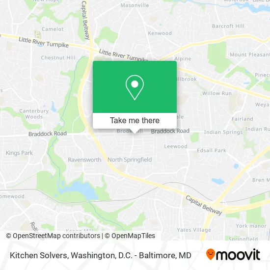
See Kitchen Solvers, Fairfax County, on the map
Public Transit to Kitchen Solvers in Fairfax County
Wondering how to get to Kitchen Solvers in Fairfax County? Moovit helps you find the best way to get to Kitchen Solvers with step-by-step directions from the nearest public transit station.
Moovit provides free maps and live directions to help you navigate through your city. View schedules, routes, timetables, and find out how long does it take to get to Kitchen Solvers in real time.
Looking for the nearest stop or station to Kitchen Solvers? Check out this list of stops closest to your destination: Braddock Rd & Blue Ridge Av; Ravensworth Rd+Heritage Dr; Backlick Road Station.
Bus: 306, F26, F29.Train: MANASSAS LINE.
Want to see if there’s another route that gets you there at an earlier time? Moovit helps you find alternative routes or times. Get directions from and directions to Kitchen Solvers easily from the Moovit App or Website.
We make riding to Kitchen Solvers easy, which is why over 1.5 million users, including users in Fairfax County, trust Moovit as the best app for public transit. You don’t need to download an individual bus app or train app, Moovit is your all-in-one transit app that helps you find the best bus time or train time available.
For information on prices of bus and metro, costs and ride fares to Kitchen Solvers, please check the Moovit app.
Use the app to navigate to popular places including to the airport, hospital, stadium, grocery store, mall, coffee shop, school, college, and university.
Kitchen Solvers Address: 7418 Jervis St Springfield, VA 22151 street in Fairfax County
- Kitchen Solvers of Springfield,
- Country Woodland School,
- George H Kresslein,
- Brook Hill,
- Ace of Space,
- Memfry,
- Electric HB,
- Qeip,
- Horizon Building,
- Steve's Mowing,
- Kubovcik,
- Appraise Metro DC,
- Flores Framing,
- Yummy,
- C.D. Shanahan's Heating, Cooling & Plumbing,
- Puppyk,
- MV Services,
- Love Thy Child Home Daycare,
- Nerio's Flooring,
- Yourmakeupbynh
Places Near Kitchen Solvers (Fairfax County)
- Amazon Hq2, Arlington County,
- Sibley Memorial Hospital, Washington,
- Warner Theatre, Washington,
- Capital One Arena, Washington,
- Washington DC VA Medical Center, Washington,
- M&T Bank Stadium, Baltimore,
- Basilica of the National Shrine, Washington,
- Georgetown, Washington,
- The Anthem, Washington,
- National Museum of African American History and Culture, Washington,
- Pennsylvania Ave NW (3rd st and pennsylvania), Washington,
- Camden Yards, Baltimore,
- Washington National Cathedral, Washington,
- National Zoo, Washington,
- Westfield Montgomery Mall, Montgomery County,
- Marriott Marquis Washington, DC, Washington,
- Rock Creek Tennis Center, Washington,
- PG Mall, Prince George's County,
- National Mall, Washington,
- Museum Of The Bible, Washington
How to get to popular places in Washington, D.C. - Baltimore, MD with public transit
Get around Fairfax County by public transit!
Traveling around Fairfax County has never been so easy. See step by step directions as you travel to any attraction, street or major public transit station. View bus and train schedules, arrival times, service alerts and detailed routes on a map, so you know exactly how to get to anywhere in Fairfax County.
When traveling to any destination around Fairfax County use Moovit's Live Directions with Get Off Notifications to know exactly where and how far to walk, how long to wait for your line, and how many stops are left. Moovit will alert you when it's time to get off — no need to constantly re-check whether yours is the next stop.
Wondering how to use public transit in Fairfax County or how to pay for public transit in Fairfax County? Moovit public transit app can help you navigate your way with public transit easily, and at minimum cost. It includes public transit fees, ticket prices, and costs. Looking for a map of Fairfax County public transit lines? Moovit public transit app shows all public transit maps in Fairfax County with all Bus, Train, Metro, Light Rail and Ferry routes and stops on an interactive map.
Washington, D.C. - Baltimore, MD has 5 transit type(s), including: Bus, Train, Metro, Light Rail and Ferry, operated by several transit agencies, including WMATA, Montgomery County Ride On, Fairfax Connector, TheBus, PRTC, DASH - Alexandria, Arlington Transit (ART), RTA of Central Maryland, MDOT MTA, MDOT MTA Light RailLink, MDOT MTA Commuter Bus, MDOT MTA Local Bus, FXBGO!, Virginia Railway Express (VRE) and MARC