How to get to Kitchen Stop by bus?
Click on the bus route to see step by step directions with maps, line arrival times and updated time schedules.
From Paramount, Huntington
145 minFrom Good Samaritan Hospital Medical Center, West Islip
71 minFrom Baxter Pavillion @ Good Sam, West Islip
56 minFrom Hauppauge ny, Hauppauge
75 minFrom Splish Splash Waterpark, Calverton
117 minFrom Tanger Outlets, Riverhead, Calverton
122 minFrom Jake's 58 Casino, Islandia
72 minFrom Brentwood, NY, Brentwood
81 minFrom Tanger Outlets, Deer Park
96 minFrom Tanger Outlets, Deer Park, Deer Park
94 min
How to get to Kitchen Stop by train?
Click on the train route to see step by step directions with maps, line arrival times and updated time schedules.
Bus stops near Kitchen Stop in Patchogue
Train station near Kitchen Stop in Patchogue
- Patchogue, 7 min walk,VIEW
Bus lines to Kitchen Stop in Patchogue
What are the closest stations to Kitchen Stop?
The closest stations to Kitchen Stop are:
- West Ave/South St is 331 yards away, 5 min walk.
- Patchogue is 564 yards away, 7 min walk.
- Holbrook Rd/Waverly Ave is 612 yards away, 8 min walk.
Which bus lines stop near Kitchen Stop?
These bus lines stop near Kitchen Stop: 2, 51.
Which train line stops near Kitchen Stop?
MONTAUK BRANCH (Montauk)
What’s the nearest train station to Kitchen Stop in Patchogue?
The nearest train station to Kitchen Stop in Patchogue is Patchogue. It’s a 7 min walk away.
What’s the nearest bus station to Kitchen Stop in Patchogue?
The nearest bus station to Kitchen Stop in Patchogue is West Ave/South St. It’s a 5 min walk away.
What time is the first train to Kitchen Stop in Patchogue?
The MONTAUK BRANCH is the first train that goes to Kitchen Stop in Patchogue. It stops nearby at 3:00 AM.
What time is the last train to Kitchen Stop in Patchogue?
The MONTAUK BRANCH is the last train that goes to Kitchen Stop in Patchogue. It stops nearby at 3:00 AM.
What time is the first bus to Kitchen Stop in Patchogue?
The 51 is the first bus that goes to Kitchen Stop in Patchogue. It stops nearby at 5:06 AM.
What time is the last bus to Kitchen Stop in Patchogue?
The 51 is the last bus that goes to Kitchen Stop in Patchogue. It stops nearby at 11:23 PM.
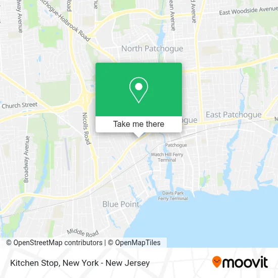
See Kitchen Stop, Patchogue, on the map
Public Transit to Kitchen Stop in Patchogue
Wondering how to get to Kitchen Stop in Patchogue? Moovit helps you find the best way to get to Kitchen Stop with step-by-step directions from the nearest public transit station.
Moovit provides free maps and live directions to help you navigate through your city. View schedules, routes, timetables, and find out how long does it take to get to Kitchen Stop in real time.
Looking for the nearest stop or station to Kitchen Stop? Check out this list of stops closest to your destination: West Ave/South St; Patchogue; Holbrook Rd/Waverly Ave.
Bus: 2, 51, 53, 55, 66, 6.Train: MONTAUK BRANCH.
Want to see if there’s another route that gets you there at an earlier time? Moovit helps you find alternative routes or times. Get directions from and directions to Kitchen Stop easily from the Moovit App or Website.
We make riding to Kitchen Stop easy, which is why over 1.5 million users, including users in Patchogue, trust Moovit as the best app for public transit. You don’t need to download an individual bus app or train app, Moovit is your all-in-one transit app that helps you find the best bus time or train time available.
For information on prices of bus and train, costs and ride fares to Kitchen Stop, please check the Moovit app.
Get to Kitchen Stop with public transit and pay for the ride in the Moovit app. In addition to all info you may need for your trip to Kitchen Stop, including live directions, real-time arrivals and fare prices, you can also buy public transit passes for your rides. No need for cash or paper tickets to get to Kitchen Stop - everything you need is accessible in the app with a click of the button.
Use the app to navigate to popular places including to the airport, hospital, stadium, grocery store, mall, coffee shop, school, college, and university.
Kitchen Stop Address: 427 W Main St street in Patchogue
- Infinitesol Llc,
- Li Web Guy Inc.,
- Firearms Tactics and Training,
- Rapid Restoration,
- Fleet Appliance Repair,
- Tiestos Restaurant,
- National Building & Roofing Supplies,
- Srs Building Products,
- Liv Esthetics & Salon,
- Rugen Realty,
- The Bearded Hoarder,
- Family Pet Clinic,
- Best Price Auto Repair,
- Roe Cardino-Dettling,
- Exxon & Mobil Stations,
- J. Signs Inc,
- Patchogue Ambulance Company,
- Cvs Beauty,
- Libertyx Bitcoin Atm,
- Cvs Pharmacy
Places Near Kitchen Stop (Patchogue)
- qqqq, Manhattan,
- San Gennaro Feast, Manhattan,
- Bellevue Hospital, Manhattan,
- Katz's Deli, Manhattan,
- 26 Federal Plaza, Manhattan,
- 3 Stone St, Manhattan,
- 111 Centre New York City Supreme Court, Manhattan,
- Times Square, Manhattan,
- 1 Police Plaza, Manhattan,
- Pier 83, Manhattan,
- Mountainside Hospital, Glen Ridge,
- 376 Hudson Street, Manhattan,
- Chinatown, Manhattan,
- Hudson Yards, Manhattan,
- Queens Center Mall, Queens,
- Wall Street, Manhattan,
- 911 Memorial, Manhattan,
- 66 John Street, Manhattan,
- SoHo, Manhattan,
- Rockefeller Center, Manhattan
How to get to popular places in New York - New Jersey with public transit
Get around Patchogue by public transit!
Traveling around Patchogue has never been so easy. See step by step directions as you travel to any attraction, street or major public transit station. View bus and train schedules, arrival times, service alerts and detailed routes on a map, so you know exactly how to get to anywhere in Patchogue.
When traveling to any destination around Patchogue use Moovit's Live Directions with Get Off Notifications to know exactly where and how far to walk, how long to wait for your line, and how many stops are left. Moovit will alert you when it's time to get off — no need to constantly re-check whether yours is the next stop.
Wondering how to use public transit in Patchogue or how to pay for public transit in Patchogue? Moovit public transit app can help you navigate your way with public transit easily, and at minimum cost. It includes public transit fees, ticket prices, and costs. Looking for a map of Patchogue public transit lines? Moovit public transit app shows all public transit maps in Patchogue with all Bus, Train, Subway, Light Rail, Ferry and Cable Car routes and stops on an interactive map.
New York - New Jersey has 6 transit type(s), including: Bus, Train, Subway, Light Rail, Ferry and Cable Car, operated by several transit agencies, including MTA Subway, Metro-North Railroad, LIRR, PATH, MTA New York City Transit - Express routes, MTA Bus, NJ Transit, NYC Ferry, NICE bus, Bee-Line Bus, NJ Transit Rail, Norwalk Transit District, Hartford Line, River Valley Transit and HART