How to get to Kitchencray - H Street by bus?
Click on the bus route to see step by step directions with maps, line arrival times and updated time schedules.
From Consulado General de El Salvador en El Dmv, Montgomery County
79 minFrom Lincoln Memorial Reflecting Pool, Washington
52 minFrom Georgetown Flea Market, Washington
49 minFrom College Park Marriott Hotel & Conference Center, Prince George's County
80 minFrom Del Ray, Alexandria
80 minFrom Arlington Central Library, Arlington County
84 minFrom Knollwood, Washington
85 minFrom Embassy Suites by Hilton Crystal City National Airport, Arlington County
68 minFrom Walmart Supercenter Fort Totten - Riggs Rd NE, Washington
49 minFrom Holy Cross Hospital, Montgomery County
62 min
How to get to Kitchencray - H Street by train?
Click on the train route to see step by step directions with maps, line arrival times and updated time schedules.
How to get to Kitchencray - H Street by metro?
Click on the metro route to see step by step directions with maps, line arrival times and updated time schedules.
From Consulado General de El Salvador en El Dmv, Montgomery County
48 minFrom Lincoln Memorial Reflecting Pool, Washington
53 minFrom Del Ray, Alexandria
69 minFrom Arlington Central Library, Arlington County
54 minFrom Embassy Suites by Hilton Crystal City National Airport, Arlington County
48 minFrom Walmart Supercenter Fort Totten - Riggs Rd NE, Washington
42 minFrom Holy Cross Hospital, Montgomery County
48 min
Bus stops near Kitchencray - H Street in Washington
Metro stations near Kitchencray - H Street in Washington
Train stations near Kitchencray - H Street in Washington
Bus lines to Kitchencray - H Street in Washington
What are the closest stations to Kitchencray - H Street?
The closest stations to Kitchencray - H Street are:
- H St Ne+12 St NE is 163 yards away, 3 min walk.
- Maryland Av Ne+13 St NE is 202 yards away, 3 min walk.
- H St Ne+14 St NE is 246 yards away, 3 min walk.
- Florida Av Ne+13 St NE is 268 yards away, 4 min walk.
- 14 St Ne+H St NE is 284 yards away, 4 min walk.
- Union Station is 1736 yards away, 21 min walk.
- Stadium-Armory is 2332 yards away, 28 min walk.
- Union Station Marc Washington is 4360 yards away, 52 min walk.
Which bus lines stop near Kitchencray - H Street?
These bus lines stop near Kitchencray - H Street: C41, C71, D20, D36.
Which train lines stop near Kitchencray - H Street?
These train lines stop near Kitchencray - H Street: MARC, NORTHEAST REGIONAL.
Which metro line stops near Kitchencray - H Street?
RED (Shady Grove)
What’s the nearest metro station to Kitchencray - H Street in Washington?
The nearest metro station to Kitchencray - H Street in Washington is Union Station. It’s a 21 min walk away.
What’s the nearest bus station to Kitchencray - H Street in Washington?
The nearest bus stations to Kitchencray - H Street in Washington are H St Ne+12 St NE, Maryland Av Ne+13 St NE and H St Ne+14 St NE. The closest one is a 3 min walk away.
What time is the first metro to Kitchencray - H Street in Washington?
The BLUE is the first metro that goes to Kitchencray - H Street in Washington. It stops nearby at 5:08 AM.
What time is the last metro to Kitchencray - H Street in Washington?
The ORANGE is the last metro that goes to Kitchencray - H Street in Washington. It stops nearby at 12:22 AM.
What time is the first train to Kitchencray - H Street in Washington?
The ACELA is the first train that goes to Kitchencray - H Street in Washington. It stops nearby at 5:00 AM.
What time is the last train to Kitchencray - H Street in Washington?
The SILVER METEOR is the last train that goes to Kitchencray - H Street in Washington. It stops nearby at 7:10 AM.
What time is the first bus to Kitchencray - H Street in Washington?
The D20 is the first bus that goes to Kitchencray - H Street in Washington. It stops nearby at 3:03 AM.
What time is the last bus to Kitchencray - H Street in Washington?
The D20 is the last bus that goes to Kitchencray - H Street in Washington. It stops nearby at 3:04 AM.
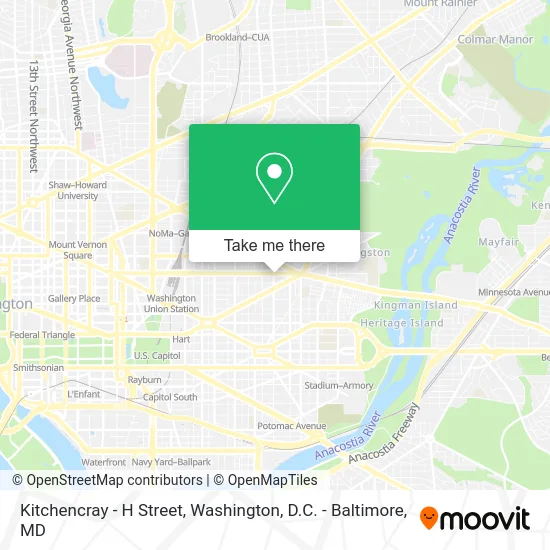
See Kitchencray - H Street, Washington, on the map
Public Transit to Kitchencray - H Street in Washington
Wondering how to get to Kitchencray - H Street in Washington? Moovit helps you find the best way to get to Kitchencray - H Street with step-by-step directions from the nearest public transit station.
Moovit provides free maps and live directions to help you navigate through your city. View schedules, routes, timetables, and find out how long does it take to get to Kitchencray - H Street in real time.
Looking for the nearest stop or station to Kitchencray - H Street? Check out this list of stops closest to your destination: H St Ne+12 St NE; Maryland Av Ne+13 St NE; H St Ne+14 St NE; Florida Av Ne+13 St NE; 14 St Ne+H St NE; Union Station; Stadium-Armory; Union Station Marc Washington.
Bus: C41, C71, D20, D36, C43.Train: MARC, NORTHEAST REGIONAL, ACELA, CARDINAL, CAROLINIAN, CRESCENT, FLORIDIAN.Metro: RED, BLUE, ORANGE, SILVER.
Want to see if there’s another route that gets you there at an earlier time? Moovit helps you find alternative routes or times. Get directions from and directions to Kitchencray - H Street easily from the Moovit App or Website.
We make riding to Kitchencray - H Street easy, which is why over 1.5 million users, including users in Washington, trust Moovit as the best app for public transit. You don’t need to download an individual bus app or train app, Moovit is your all-in-one transit app that helps you find the best bus time or train time available.
For information on prices of bus, metro and train, costs and ride fares to Kitchencray - H Street, please check the Moovit app.
Use the app to navigate to popular places including to the airport, hospital, stadium, grocery store, mall, coffee shop, school, college, and university.
Kitchencray - H Street Address: 1301 H St NE Washington, DC 20002 street in Washington
- DC Streetcar - 13th St/H St NE,
- H St NE (13th and h),
- District Daiquiri,
- Mozzeria,
- H Street Festival,
- Milk & Honey,
- H Street Corridor,
- Smith Commons,
- Atlas Performing Arts Center,
- Around the World Embassy Tour,
- H Street Country Club WC,
- The Magic Carwash,
- Toki Underground,
- Hill Prince,
- Boba Tea DC,
- Pie Shop,
- Dangerously Delicious Pies,
- Dangerous Pies DC,
- Crutchfield Insurance Agency,
- Gasaholics Smoke Shop
Places Near Kitchencray - H Street (Washington)
- Museum Of The Bible, Washington,
- Marriott Marquis Washington, DC, Washington,
- M&T Bank Stadium, Baltimore,
- National Theatre, Washington,
- National Zoo, Washington,
- Capital One Arena, Washington,
- PG Mall, Prince George's County,
- Rock Creek Tennis Center, Washington,
- Amazon Hq2, Arlington County,
- Camden Yards, Baltimore,
- Pennsylvania Ave NW (3rd st and pennsylvania), Washington,
- National Museum of African American History and Culture, Washington,
- Westfield Montgomery Mall, Montgomery County,
- Georgetown, Washington,
- The Anthem, Washington,
- Sibley Memorial Hospital, Washington,
- Washington DC VA Medical Center, Washington,
- Basilica of the National Shrine, Washington,
- Warner Theatre, Washington,
- Washington National Cathedral, Washington
How to get to popular places in Washington, D.C. - Baltimore, MD with public transit
Get around Washington by public transit!
Traveling around Washington has never been so easy. See step by step directions as you travel to any attraction, street or major public transit station. View bus and train schedules, arrival times, service alerts and detailed routes on a map, so you know exactly how to get to anywhere in Washington.
When traveling to any destination around Washington use Moovit's Live Directions with Get Off Notifications to know exactly where and how far to walk, how long to wait for your line, and how many stops are left. Moovit will alert you when it's time to get off — no need to constantly re-check whether yours is the next stop.
Wondering how to use public transit in Washington or how to pay for public transit in Washington? Moovit public transit app can help you navigate your way with public transit easily, and at minimum cost. It includes public transit fees, ticket prices, and costs. Looking for a map of Washington public transit lines? Moovit public transit app shows all public transit maps in Washington with all Bus, Train, Metro, Light Rail and Ferry routes and stops on an interactive map.
Washington, D.C. - Baltimore, MD has 5 transit type(s), including: Bus, Train, Metro, Light Rail and Ferry, operated by several transit agencies, including WMATA, Montgomery County Ride On, Fairfax Connector, TheBus, PRTC, DASH - Alexandria, Arlington Transit (ART), RTA of Central Maryland, MDOT MTA, MDOT MTA Light RailLink, MDOT MTA Commuter Bus, MDOT MTA Local Bus, FXBGO!, Virginia Railway Express (VRE) and MARC