How to get to Kronos Builders by bus?
Click on the bus route to see step by step directions with maps, line arrival times and updated time schedules.
From Pompano Citi Centre, Pompano Beach
82 minFrom Tri-Rail-Pompano Beach Station, Pompano Beach
90 minFrom Sample Rd, Deerfield Beach
95 minFrom Intersection : N Andrews Ave & Sample Rd., Pompano Beach
90 minFrom Tri-Rail-Deerfield Beach Station, Deerfield Beach
80 minFrom Pretty in Palm Beach, Boynton Beach-Delray Beach
74 minFrom Ollie's Bargain Outlet, Boynton Beach-Delray Beach
64 minFrom Brazzers, Boca Raton
39 min
How to get to Kronos Builders by train?
Click on the train route to see step by step directions with maps, line arrival times and updated time schedules.
Bus stops near Kronos Builders in Boca Raton
Train stations near Kronos Builders in Boca Raton
Bus lines to Kronos Builders in Boca Raton
What are the closest stations to Kronos Builders?
The closest stations to Kronos Builders are:
- NE 20TH ST at NE 4TH CT is 199 yards away, 3 min walk.
- FEDERAL HWY at NE 14TH ST is 534 yards away, 7 min walk.
- UNIVERSITY DR at GLADES RD is 890 yards away, 11 min walk.
- Boca Raton is 2381 yards away, 29 min walk.
- Boca Raton Station is 4787 yards away, 56 min walk.
Which bus lines stop near Kronos Builders?
These bus lines stop near Kronos Builders: 1, 91, 94.
Which train line stops near Kronos Builders?
TRIRAIL (Northbound To Mangonia Park)
What’s the nearest train station to Kronos Builders in Boca Raton?
The nearest train station to Kronos Builders in Boca Raton is Boca Raton. It’s a 29 min walk away.
What’s the nearest bus station to Kronos Builders in Boca Raton?
The nearest bus station to Kronos Builders in Boca Raton is NE 20TH ST at NE 4TH CT. It’s a 3 min walk away.
What time is the first train to Kronos Builders in Boca Raton?
The TRIRAIL is the first train that goes to Kronos Builders in Boca Raton. It stops nearby at 4:28 AM.
What time is the last train to Kronos Builders in Boca Raton?
The BLFM is the last train that goes to Kronos Builders in Boca Raton. It stops nearby at 11:53 PM.
What time is the first bus to Kronos Builders in Boca Raton?
The 1 is the first bus that goes to Kronos Builders in Boca Raton. It stops nearby at 6:10 AM.
What time is the last bus to Kronos Builders in Boca Raton?
The 1 is the last bus that goes to Kronos Builders in Boca Raton. It stops nearby at 9:46 PM.
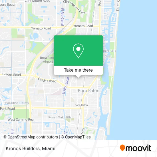
See Kronos Builders, Boca Raton, on the map
Public Transit to Kronos Builders in Boca Raton
Wondering how to get to Kronos Builders in Boca Raton? Moovit helps you find the best way to get to Kronos Builders with step-by-step directions from the nearest public transit station.
Moovit provides free maps and live directions to help you navigate through your city. View schedules, routes, timetables, and find out how long does it take to get to Kronos Builders in real time.
Looking for the nearest stop or station to Kronos Builders? Check out this list of stops closest to your destination: NE 20TH ST at NE 4TH CT; FEDERAL HWY at NE 14TH ST; UNIVERSITY DR at GLADES RD; Boca Raton; Boca Raton Station.
Bus: 1, 91, 94.Train: TRIRAIL, BLFM.
Want to see if there’s another route that gets you there at an earlier time? Moovit helps you find alternative routes or times. Get directions from and directions to Kronos Builders easily from the Moovit App or Website.
We make riding to Kronos Builders easy, which is why over 1.7 million users, including users in Boca Raton, trust Moovit as the best app for public transit. You don’t need to download an individual bus app or train app, Moovit is your all-in-one transit app that helps you find the best bus time or train time available.
For information on prices of bus and train, costs and ride fares to Kronos Builders, please check the Moovit app.
Use the app to navigate to popular places including to the airport, hospital, stadium, grocery store, mall, coffee shop, school, college, and university.
Kronos Builders Address: 1728 Costa del Sol street in Boca Raton
- NW 20th St & Dixie Highway,
- Glades Rd @ NW 4th Ave,
- The River Ya,
- - Boca,
- Boca Raton, FL,
- Baptist Health Vascula,
- Mizner Park Amphitheater,
- Customeraq,
- Wynwood,
- Brightline And Library Parking,
- Mizner Park,
- Lynn Cancer Institute,
- Bachir Berbari, MD,
- Boca Regional Hospital,
- Comcast Cable Sales,
- FAU Stadium,
- The Institute of Media Arts,
- Class Room GN 101 Florida Atlantic University,
- Florida Atlantic University,
- Funky Buddha Brewery And Lounge
Places Near Kronos Builders (Boca Raton)
- Miami-Dade County Courthouse, Miami,
- Keiser University Flagship Campus, West Palm Beach,
- Miami VA Hospital, Miami,
- Aventura Mall, Miami,
- Dolphin Mall Bus, Miami,
- Sawgrass Mall, Miami,
- Sawgrass mall ( FL ), Miami Beach,
- Marlins Park, Miami,
- Aventura Mall, Miami Beach,
- Wynwood, Miami,
- Zoo Miami, Miami,
- Miami Design District, Miami,
- Dolphin Mall, Miami,
- Hard Rock Stadium, Miami Gardens,
- Port of Miami Cruise Terminal, Miami,
- Richard E. Gerstein Justice Building, Miami,
- Brickell City Centre, Miami,
- Bayside Marketplace, Miami,
- Little Havana, Miami,
- Miami Freedom Park, Miami
How to get to popular places in Miami with public transit
Get around Boca Raton by public transit!
Traveling around Boca Raton has never been so easy. See step by step directions as you travel to any attraction, street or major public transit station. View bus and train schedules, arrival times, service alerts and detailed routes on a map, so you know exactly how to get to anywhere in Boca Raton.
When traveling to any destination around Boca Raton use Moovit's Live Directions with Get Off Notifications to know exactly where and how far to walk, how long to wait for your line, and how many stops are left. Moovit will alert you when it's time to get off — no need to constantly re-check whether yours is the next stop.
Wondering how to use public transit in Boca Raton or how to pay for public transit in Boca Raton? Moovit public transit app can help you navigate your way with public transit easily, and at minimum cost. It includes public transit fees, ticket prices, and costs. Looking for a map of Boca Raton public transit lines? Moovit public transit app shows all public transit maps in Boca Raton with all Bus, Train, Light Rail and Ferry routes and stops on an interactive map.
Miami has 4 transit type(s), including: Bus, Train, Light Rail and Ferry, operated by several transit agencies, including Broward County Transit, Miami-Dade Transit, Metrorail, Palm Tran, Tri-Rail, Brightline, MARTY, City of Homestead Trolley, Key West Transit, Treasure Coast Connector, GoLine IRT, Amtrak, Greyhound-us, FlixBus-us and Aventura Express Shuttle Bus