Directions to Kurye Net (Bursa) with public transportation
The following transit lines have routes that pass near Kurye Net
 Bus: 503, 624/K, BURSA TERMINALI - İNEGÖL TERMINALI, 612, 614.
How to get to Kurye Net by bus?
Click on the bus route to see step by step directions with maps, line arrival times and updated time schedules.
From Kazancı Köyü, Kestel
106 minFrom Erdoğan Köyü Kent Mezarlığı, Kestel
112 minFrom Bursa-İnegöl Yolu, İnegöl
47 minFrom BURSA BÜYÜKŞEHİR BELEDİYESİ ERDOĞAN KÖY KENT MEZARLIGI, Kestel
113 minFrom Sefa Tepesi - Alaçam, Kestel
131 minFrom Kazancı, Kestel
106 minFrom Tabiat Binicilik Kulübü, Kestel
109 minFrom Babasultan Köyü, İnegöl
57 minFrom Erdoğan köyü, Kestel
105 minFrom Aksu, Kestel
98 min
Bus stops near Kurye Net in Bursa
Bus lines to Kurye Net in Bursa
- 612, İnegöl Doğu Garajı-Ring,VIEW
- 614, Mesudiye-Ring,VIEW
- 618, Alanyurt - Ring,VIEW
- 619, Alanyurt - Ring,VIEW
- 610H, 610h - Alanyurt Ring,VIEW
- 615, İnegöl Terminal Ring,VIEW
- 620, Akhisar - Ring,VIEW
- 620K, Karalar - Ring,VIEW
- 621, İnegöl Toki - İnegöl Terminal,VIEW
- 613, Mesudiye-Ring,VIEW
- 616H, 616h - Alanyurt Ring,VIEW
- 617H, 617h - Alanyurt Ring,VIEW
- 623, 623 - Huzur Mah. Ring,VIEW
- 630, İnegöl Avm Durağı-Yenice Mah.,VIEW
- 631, İnegöl Avm Durağı-Yenice Mah.,VIEW
What are the closest stations to Kurye Net?
The closest stations to Kurye Net are:
- İstiklal Cd. 13 (İnegöl) is 247 meters away, 4 min walk.
- Altay Cd. 2 is 286 meters away, 5 min walk.
- Altay Cd. 5 is 316 meters away, 5 min walk.
- Yeşil Bursa Cd. 3 is 343 meters away, 5 min walk.
- Huzur Sk. 2 is 388 meters away, 6 min walk.
Which bus lines stop near Kurye Net?
These bus lines stop near Kurye Net: 503, 624/K, BURSA TERMINALI - İNEGÖL TERMINALI.
What’s the nearest bus station to Kurye Net in Bursa?
The nearest bus station to Kurye Net in Bursa is İstiklal Cd. 13 (İnegöl). It’s a 4 min walk away.
What time is the first bus to Kurye Net in Bursa?
The 630 is the first bus that goes to Kurye Net in Bursa. It stops nearby at 6:43 AM.
What time is the last bus to Kurye Net in Bursa?
The 630 is the last bus that goes to Kurye Net in Bursa. It stops nearby at 12:37 AM.
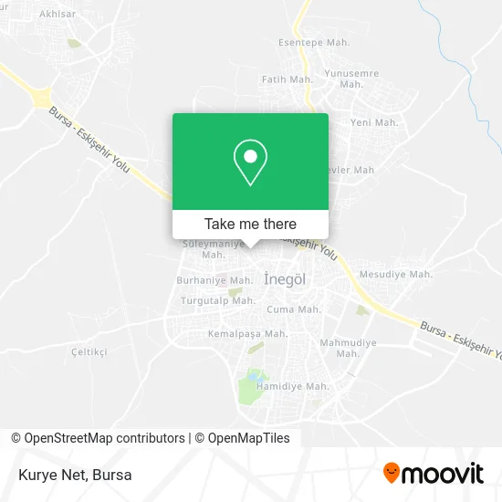
See Kurye Net, Bursa, on the map
Public Transit to Kurye Net in Bursa
Wondering how to get to Kurye Net in Bursa? Moovit helps you find the best way to get to Kurye Net with step-by-step directions from the nearest public transit station.
Moovit provides free maps and live directions to help you navigate through your city. View schedules, routes, timetables, and find out how long does it take to get to Kurye Net in real time.
Looking for the nearest stop or station to Kurye Net? Check out this list of stops closest to your destination: İstiklal Cd. 13 (İnegöl); Altay Cd. 2; Altay Cd. 5; Yeşil Bursa Cd. 3; Huzur Sk. 2.
Bus: 503, 624/K, BURSA TERMINALI - İNEGÖL TERMINALI, 612, 614, 618, 619, 610H, 615, 620, 620K, 621, 613, 616H, 617H, 623, 630, 631.
Want to see if there’s another route that gets you there at an earlier time? Moovit helps you find alternative routes or times. Get directions from and directions to Kurye Net easily from the Moovit App or Website.
We make riding to Kurye Net easy, which is why over 1.5 million users, including users in Bursa, trust Moovit as the best app for public transit. You don’t need to download an individual bus app or train app, Moovit is your all-in-one transit app that helps you find the best bus time or train time available.
For information on prices of bus and cable car, costs and ride fares to Kurye Net, please check the Moovit app.
Use the app to navigate to popular places including to the airport, hospital, stadium, grocery store, mall, coffee shop, school, college, and university.
Kurye Net Address: Yeşil Bursa Caddesi, 16400 Süleymaniye, İnegöl street in Bursa
- Market,
- Süleymaniye Mahallesi Cami,
- İsra Alışveriş Merkezi,
- İnegöl Isra Süleymaniye,
- Vakfıkebir Odun Ekmegi,
- Süleymaniye Camii,
- Süleymaniye Bilgi Kültür Evi,
- Korupark,
- Matıslı Pılıc Market,
- Çakır Fitness Center,
- Buragin Kuaförü,
- Cengiz Gıda,
- Hadiiim,
- Ciyan Abi'nin Kave,
- Masör Ergül,
- Faili Meçhul Bi Yerde,
- Hasta Bir Halde Evde Uyumakta,
- Gaziler Sokağı,
- Elegance Düğün Salonu,
- Inegöl Satranç Kulübü
Places Near Kurye Net (Bursa)
- Bursa Terminal, Nilüfer,
- Bursa Teleferik, Yıldırım,
- Ali Osman Sönmez Onkoloji Hastanesi, Osmangazi,
- Bursa Yüksek İhtisas Eğitim ve Araştırma Hastanesi Nilüfer Ek Binası, Nilüfer,
- Bursa Cumalıkızık Köyü, Osmangazi,
- Şehir Hastanesi, Nilüfer,
- Şevket Yılmaz Eğitim ve Araştırma Hastanesi, Yıldırım,
- Bursa, Osmangazi,
- Mustafakemalpaşa Karacabey Dolmuş Durağı, Mustafakemalpaşa,
- Sur Yapı Marka Avm, Osmangazi,
- FSM Bulvarı, Nilüfer,
- Millet Mahallesi,
- bursa mudanya, Mudanya,
- Podyum Park, Nilüfer,
- Sur Yapı Marka, Nilüfer,
- ÖzdilekPark Bursa Nilüfer, Nilüfer,
- Bursa Hayvanat Bahçesi, Osmangazi,
- Çekirge Devlet Hastanesi Otobüs Durağı, Osmangazi,
- Dörtçelik Çocuk Hastanesi, Nilüfer,
- Nilüfer Ağız ve Diş Sağlığı Merkezi, Nilüfer
How to get to popular places in Bursa with public transit
Get around Bursa by public transit!
Traveling around Bursa has never been so easy. See step by step directions as you travel to any attraction, street or major public transit station. View bus and train schedules, arrival times, service alerts and detailed routes on a map, so you know exactly how to get to anywhere in Bursa.
When traveling to any destination around Bursa use Moovit's Live Directions with Get Off Notifications to know exactly where and how far to walk, how long to wait for your line, and how many stops are left. Moovit will alert you when it's time to get off — no need to constantly re-check whether yours is the next stop.
Wondering how to use public transit in Bursa or how to pay for public transit in Bursa? Moovit public transit app can help you navigate your way with public transit easily, and at minimum cost. It includes public transit fees, ticket prices, and costs. Looking for a map of Bursa public transit lines? Moovit public transit app shows all public transit maps in Bursa with all Bus, Metro, Light Rail, Cable Car and Gondola routes and stops on an interactive map.
Bursa has 5 transit type(s), including: Bus, Metro, Light Rail, Cable Car and Gondola, operated by several transit agencies, including BursaRay, BurTram, BBBUS, Burulaş, Minibüs, İlçe Otobüsleri and Bursa Teleferik