How to get to Kuties Create by bus?
Click on the bus route to see step by step directions with maps, line arrival times and updated time schedules.
From Amazon Iad28, Fairfax County
49 minFrom Amazon Web Services - IAD21, Fairfax County
54 minFrom Northern Virginia Community College - Loudoun Campus, Loudoun County
38 minFrom Hookers & Blow, Fairfax County
45 minFrom Leesburg Corner Premium Outlet, Loudoun County
33 minFrom Dulles Discovery, Fairfax County
59 minFrom Sterling VA USA, Loudoun County
57 minFrom Reston Town Center, Fairfax County
75 min
Bus stops near Kuties Create in Loudoun County
Bus lines to Kuties Create in Loudoun County
- 70, Sterling/Nvcc,VIEW
- 321, Dulles Town Center P&R/Innovation Station,VIEW
- 62, Wingler/Ashby Ponds/Potomac Green/One Loudoun/Dtc,VIEW
- 331, Ashburn Metro Station/Quantum Park/One Loudoun,VIEW
- 332, Potomac Green/Ashby Ponds/Quantum Park/Ashburn Met,VIEW
- 581, Mt Zion Lot/Frederick Md,VIEW
- 181, Leesburg/Lansdowne/One Loudoun,VIEW
What are the closest stations to Kuties Create?
The closest stations to Kuties Create are:
- George Washington Blvd & Lakeview Overlook Plaza is 743 yards away, 9 min walk.
- George Washington Blvd & Exploration Hall is 1018 yards away, 13 min walk.
- Exchange Street at Brimfield Drive is 1705 yards away, 20 min walk.
- One Loudoun-Cb AM is 1725 yards away, 21 min walk.
Which bus lines stop near Kuties Create?
These bus lines stop near Kuties Create: 321, 70.
What’s the nearest bus station to Kuties Create in Loudoun County?
The nearest bus station to Kuties Create in Loudoun County is George Washington Blvd & Lakeview Overlook Plaza. It’s a 9 min walk away.
What time is the first bus to Kuties Create in Loudoun County?
The 332 is the first bus that goes to Kuties Create in Loudoun County. It stops nearby at 4:30 AM.
What time is the last bus to Kuties Create in Loudoun County?
The 331 is the last bus that goes to Kuties Create in Loudoun County. It stops nearby at 11:10 PM.
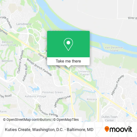
See Kuties Create, Loudoun County, on the map
Public Transit to Kuties Create in Loudoun County
Wondering how to get to Kuties Create in Loudoun County? Moovit helps you find the best way to get to Kuties Create with step-by-step directions from the nearest public transit station.
Moovit provides free maps and live directions to help you navigate through your city. View schedules, routes, timetables, and find out how long does it take to get to Kuties Create in real time.
Looking for the nearest stop or station to Kuties Create? Check out this list of stops closest to your destination: George Washington Blvd & Lakeview Overlook Plaza; George Washington Blvd & Exploration Hall; Exchange Street at Brimfield Drive; One Loudoun-Cb AM.
Bus: 321, 70, 62, 331, 332, 581, 181.
Want to see if there’s another route that gets you there at an earlier time? Moovit helps you find alternative routes or times. Get directions from and directions to Kuties Create easily from the Moovit App or Website.
We make riding to Kuties Create easy, which is why over 1.5 million users, including users in Loudoun County, trust Moovit as the best app for public transit. You don’t need to download an individual bus app or train app, Moovit is your all-in-one transit app that helps you find the best bus time or train time available.
For information on prices of bus and metro, costs and ride fares to Kuties Create, please check the Moovit app.
Use the app to navigate to popular places including to the airport, hospital, stadium, grocery store, mall, coffee shop, school, college, and university.
Kuties Create Address: 20130 Lakeview Center Plz Ashburn, VA 20147 street in Loudoun County
- JC Advertising Group,
- A Harmony Home Care Services, Inc.,
- Spear Realtykim,
- Jhai Victoria,
- Cleverspeck,
- Awesomecashbuyers,
- Virginia One Development,
- Protegus,
- The Wickwire Group,
- Dellcor Contracting,
- Fred Spurlock with Exp Realty,
- Matthew Lang - Financial Advisor Ameriprise Financial Services,
- Lakeview University Office Building,
- Defazio Industries,
- Resurge-USA,
- VTC Exchange,
- Gil Kall,
- Corporate Image Promotions Inc,
- Stimulating Media LLC,
- Moving Company
Places Near Kuties Create (Loudoun County)
- The Anthem, Washington,
- PG Mall, Prince George's County,
- Rock Creek Tennis Center, Washington,
- Basilica of the National Shrine, Washington,
- Warner Theatre, Washington,
- Marriott Marquis Washington, DC, Washington,
- Washington National Cathedral, Washington,
- M&T Bank Stadium, Baltimore,
- National Zoo, Washington,
- Westfield Montgomery Mall, Montgomery County,
- Capital One Arena, Washington,
- Pennsylvania Ave NW (3rd st and pennsylvania), Washington,
- Georgetown, Washington,
- Amazon Hq2, Arlington County,
- National Mall, Washington,
- Camden Yards, Baltimore,
- Washington DC VA Medical Center, Washington,
- Museum Of The Bible, Washington,
- National Museum of African American History and Culture, Washington,
- Sibley Memorial Hospital, Washington
How to get to popular places in Washington, D.C. - Baltimore, MD with public transit
Get around Loudoun County by public transit!
Traveling around Loudoun County has never been so easy. See step by step directions as you travel to any attraction, street or major public transit station. View bus and train schedules, arrival times, service alerts and detailed routes on a map, so you know exactly how to get to anywhere in Loudoun County.
When traveling to any destination around Loudoun County use Moovit's Live Directions with Get Off Notifications to know exactly where and how far to walk, how long to wait for your line, and how many stops are left. Moovit will alert you when it's time to get off — no need to constantly re-check whether yours is the next stop.
Wondering how to use public transit in Loudoun County or how to pay for public transit in Loudoun County? Moovit public transit app can help you navigate your way with public transit easily, and at minimum cost. It includes public transit fees, ticket prices, and costs. Looking for a map of Loudoun County public transit lines? Moovit public transit app shows all public transit maps in Loudoun County with all Bus, Train, Metro, Light Rail and Ferry routes and stops on an interactive map.
Washington, D.C. - Baltimore, MD has 5 transit type(s), including: Bus, Train, Metro, Light Rail and Ferry, operated by several transit agencies, including WMATA, Montgomery County Ride On, Fairfax Connector, TheBus, PRTC, DASH - Alexandria, Arlington Transit (ART), RTA of Central Maryland, MDOT MTA, MDOT MTA Light RailLink, MDOT MTA Commuter Bus, MDOT MTA Local Bus, FXBGO!, Virginia Railway Express (VRE) and MARC