How to get to Lúcia Modas by bus?
Click on the bus route to see step by step directions with maps, line arrival times and updated time schedules.
From Curia Metropolitana De Belem, Belém
36 minFrom Travessa 14 de Março, Belém
29 minFrom Rua Zacarias de Assunção, Ananindeua
31 minFrom Secon - Secretaria Municipal de Economia, Belém
44 minFrom Escola Municipal E.I.E.F Professor Francisco da Silva Nunes, Belém
36 minFrom Entre Alcindo Cacela e 14 de Março, Belém
30 minFrom Palacete Bolonha, Belém
41 minFrom Hospital Barros Barreto, Guama
42 minFrom abacatão, Icoaraci
36 minFrom Avenida Braz de Aguiar, Belém
40 min
Bus stops near Lúcia Modas in Bengui
Bus lines to Lúcia Modas in Bengui
- 795, Cabanagem - Pres. Vargas,VIEW
- 321, UFPA - Cidade Nova,VIEW
- 639, Pratinha - Castanheira (via Tapanã),VIEW
- 663, Benguí - Felipe Patroni,VIEW
- 664, Benguí - Ver-o-Peso,VIEW
- 666, Canarinho - Pres. Vargas,VIEW
- 669, Cordeiro de Farias - Castanheira,VIEW
- 755, Sideral - Pátio Belém,VIEW
- 758, Conj. Maguari - Ver-o-Peso,VIEW
- 768, Satélite - UFPA (Rio Guamá),VIEW
- 783 A, Tenoné - Presidente Vargas,VIEW
- 783 B, Tenoné - Pátio Belém,VIEW
- 785, Tenoné - Ver-o-Peso,VIEW
- 862, Tapanã - Felipe Patroni,VIEW
- 866, Tapanã - Ver-o-Peso,VIEW
- 869, Tapanã - Pres. Vargas,VIEW
- 872, Icoaraci - Almirante Barroso BRT,VIEW
- 883, Outeiro II - Terminal Mangueirão (Itaiteua),VIEW
- 884, Icoaraci - Marituba,VIEW
- 893, Tapanã - Castanheira (Socipe),VIEW
What are the closest stations to Lúcia Modas?
The closest stations to Lúcia Modas are:
- Panorama Com Augusto is 38 meters away, 1 min walk.
- Panorama XXI | Mangueirão is 132 meters away, 2 min walk.
- Mangueirão is 191 meters away, 3 min walk.
- Natália Lins | Sentido Norte is 364 meters away, 5 min walk.
- Terminal Mangueirão (Integração) is 368 meters away, 5 min walk.
Which bus lines stop near Lúcia Modas?
These bus lines stop near Lúcia Modas: 755, 768, 795, 872, 893, 942.
What’s the nearest bus station to Lúcia Modas in Bengui?
The nearest bus station to Lúcia Modas in Bengui is Panorama Com Augusto. It’s a 1 min walk away.
What time is the first bus to Lúcia Modas in Bengui?
The 664 is the first bus that goes to Lúcia Modas in Bengui. It stops nearby at 3:13 AM.
What time is the last bus to Lúcia Modas in Bengui?
The 869 is the last bus that goes to Lúcia Modas in Bengui. It stops nearby at 4:04 AM.
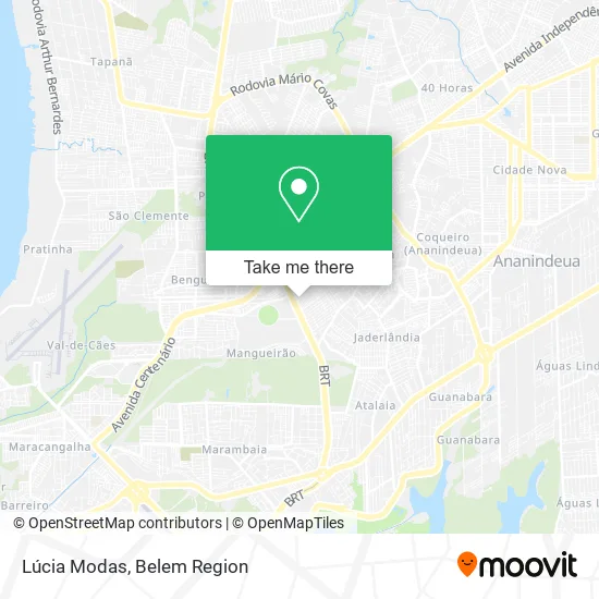
See Lúcia Modas, Bengui, on the map
Public Transit to Lúcia Modas in Bengui
Wondering how to get to Lúcia Modas in Bengui? Moovit helps you find the best way to get to Lúcia Modas with step-by-step directions from the nearest public transit station.
Moovit provides free maps and live directions to help you navigate through your city. View schedules, routes, timetables, and find out how long does it take to get to Lúcia Modas in real time.
Looking for the nearest stop or station to Lúcia Modas? Check out this list of stops closest to your destination: Panorama Com Augusto; Panorama XXI | Mangueirão; Mangueirão; Natália Lins | Sentido Norte; Terminal Mangueirão (Integração).
Bus: 755, 768, 795, 872, 893, 942, 321, 639, 663, 664, 666, 667, 996, 305, 879, 861, 888, 911.
Want to see if there’s another route that gets you there at an earlier time? Moovit helps you find alternative routes or times. Get directions from and directions to Lúcia Modas easily from the Moovit App or Website.
We make riding to Lúcia Modas easy, which is why over 1.5 million users, including users in Bengui, trust Moovit as the best app for public transit. You don’t need to download an individual bus app or train app, Moovit is your all-in-one transit app that helps you find the best bus time or train time available.
For information on prices of bus, costs and ride fares to Lúcia Modas, please check the Moovit app.
Use the app to navigate to popular places including to the airport, hospital, stadium, grocery store, mall, coffee shop, school, college, and university.
Lúcia Modas Address: Avenida Central, Mangueirão Belém-PA 66640-045 street in Bengui
- Mercadinho Bom de Preco Panorama XXI,
- Rabitto,
- Bira,
- Arte Delícia,
- Auto Escola Capital,
- Barraca do Zé,
- Iefp,
- Conjunto Panorama XXI,
- Volts Materiais Eletricos,
- Apil Panorama XXI,
- Auto Chaves,
- Stylu's Hair,
- Bar Sao Jorge,
- Papelaria Monteiro,
- Robson Silva,
- MS Calcados,
- Suzany Bolos Decorados,
- Estancia Bom Jesus,
- Bar dos Aposentados,
- Casa das Gaiolas
Places Near Lúcia Modas (Bengui)
- Bancrevea, Bengui,
- Mangal Das Garças, Belém,
- Parque Shopping Belém, Bengui,
- hospital Barros Barreto, Belém,
- Shopping Pátio Belém, Belém,
- Praça Brasil, Belém,
- Grão Pará, Belém,
- Linha 872: Icoaraci - Almirante Barroso (Presidente Vargas), Icoaraci,
- Av.Senador Lemos, Belém,
- Shopping Bosque Grão Pará, Entroncamento,
- Santa Casa De Misericórdia, Belém,
- Shopping Metrópole Ananindeua, Ananindeua,
- Boulevard Shopping, Belém,
- Aeroporto Internacional de Belém (BEL), Entroncamento,
- Hangar PA, Belém,
- Shopping Center Bosque Grão Pará, Entroncamento,
- Avenida Júlio Cesar, Belém,
- Avenida Augusto Montenegro, Belém,
- Centro Integrado de Inclusão e Reabilitação - CIIR, Entroncamento,
- Doca, Belém
How to get to popular places in Belem Region with public transit
Get around Bengui by public transit!
Traveling around Bengui has never been so easy. See step by step directions as you travel to any attraction, street or major public transit station. View bus and train schedules, arrival times, service alerts and detailed routes on a map, so you know exactly how to get to anywhere in Bengui.
When traveling to any destination around Bengui use Moovit's Live Directions with Get Off Notifications to know exactly where and how far to walk, how long to wait for your line, and how many stops are left. Moovit will alert you when it's time to get off — no need to constantly re-check whether yours is the next stop.
Wondering how to use public transit in Bengui or how to pay for public transit in Bengui? Moovit public transit app can help you navigate your way with public transit easily, and at minimum cost. It includes public transit fees, ticket prices, and costs. Looking for a map of Bengui public transit lines? Moovit public transit app shows all public transit maps in Bengui with all Bus and Ferry routes and stops on an interactive map.
Belem Region has 2 transit type(s), including: Bus and Ferry, operated by several transit agencies, including BRT Metropolitano, BRT Belém, SETRANSBEL, Coopcaban, Expresso Modelo, Voyage Transportes, Amazonat, Coopersati, Luane Transportes, Cooptarvc, Ruth Transportes, Mayara Transportes, Cooptauá, Expresso São José and Castanhal (Clara, Rosa's, Salve Maria)